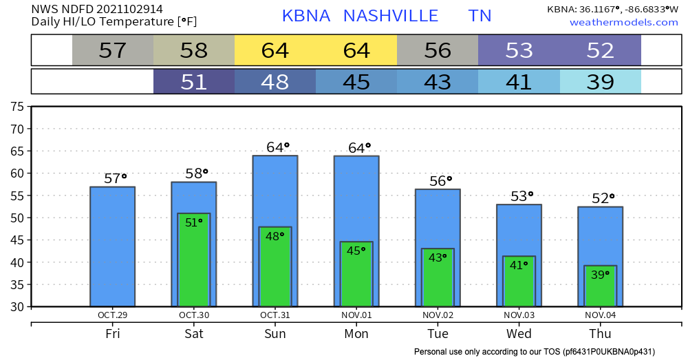
Our highs and lows are staying right around the monthly average, and steadily getting warmer throughout the next few days. As of now, there is no freeze warning in effect for tonight, but this could change as the day goes on.

Our highs and lows are staying right around the monthly average, and steadily getting warmer throughout the next few days. As of now, there is no freeze warning in effect for tonight, but this could change as the day goes on.
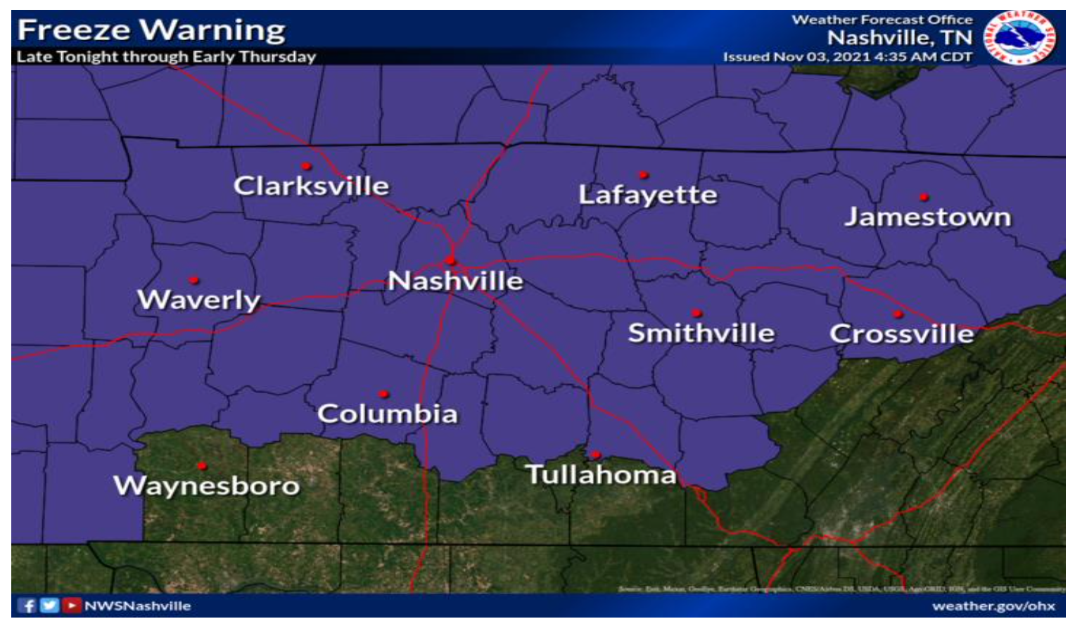
The wind will make it feel like we’re in the upper 20’s – low 30’s after midnight into Friday morning. A Freeze Warning is in effect for midnight to 9 AM. Keep those plants covered for at least one more night.
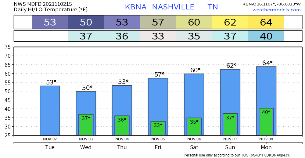
Whoever started listening to Christmas music on November 1st, don’t say you didn’t ask for this weather. Temps don’t get out of the low 50’s today. We’re in the low 30’s just in time for the start to your day tomorrow. The wind chill is going to make it feel like it’s in the upper 20’s, WHAT?!
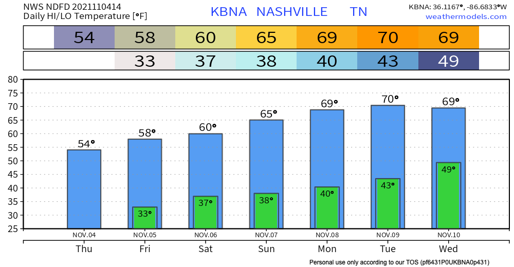
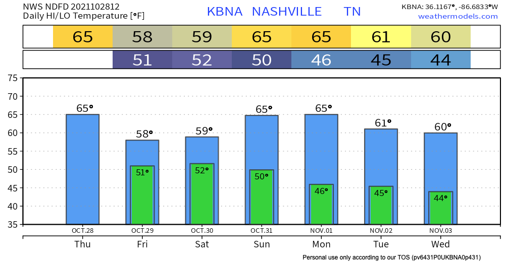
Well that was fast. Temps are way below average today and it’s going to stay that way for awhile. A whole ten degrees below average. Looking at highs in the mid 50s today, lows in the upper 30s by tomorrow morning. Wind chill is going to make it feel like near-freezing temps just in time for the morning commute tomorrow. Crank up the seat warmers!
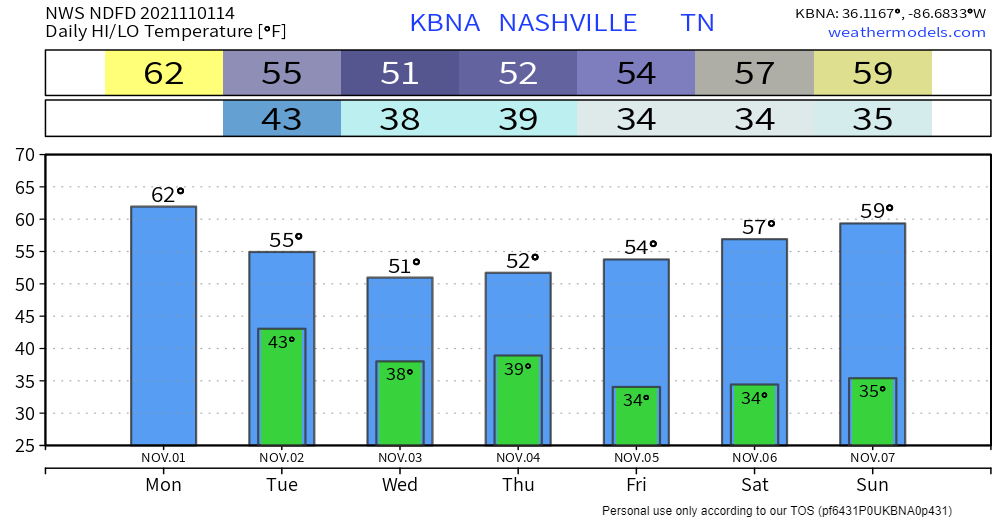
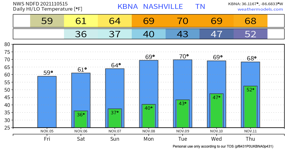
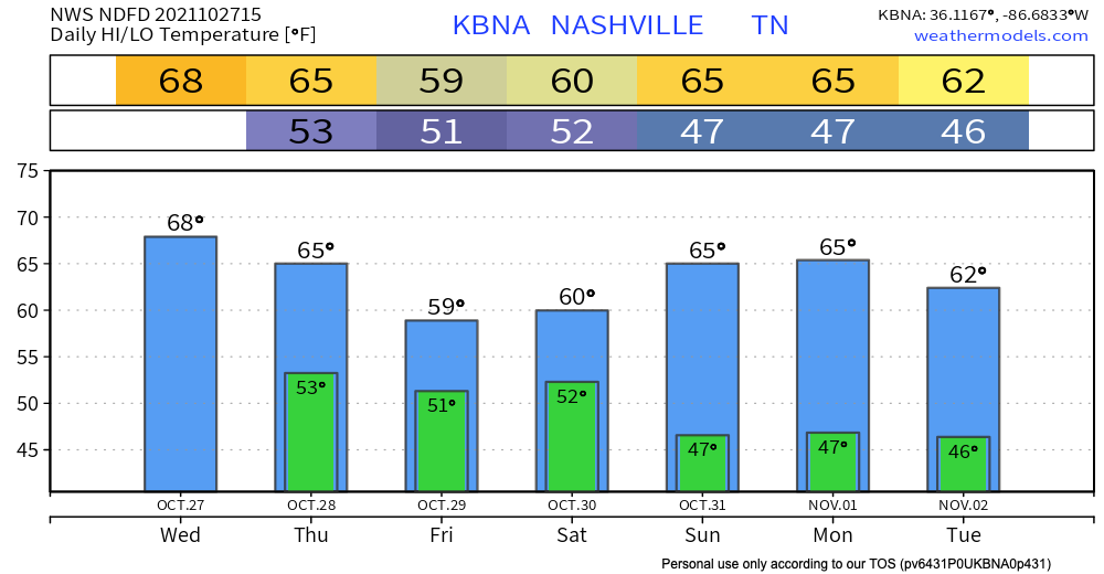
Now that Halloween’s come and gone…. next stop: Thanksgiving and cooler temps. Not much changing today. Highs in the low 60s and lows in the low 40s overnight. After that, brisk and overcast.
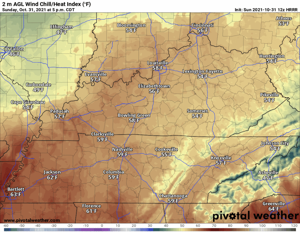
Nice weather tonight, but chilly.
Wind chill from 59° at 5 PM, dropping to 49° by 10 PM.
No rain Monday. Hint of rain possible Tuesday on the Euro model but the system dries as it approaches. Bet on dry.
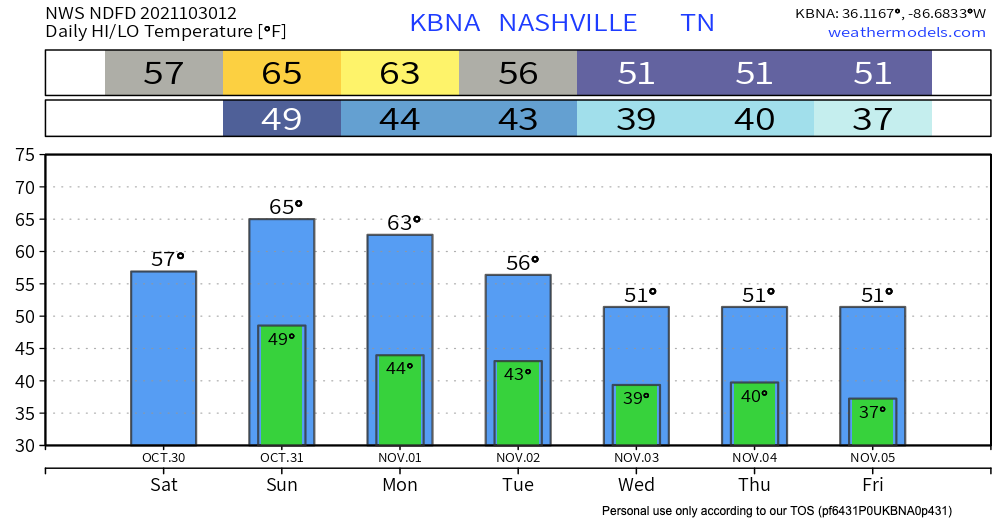
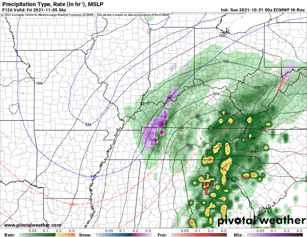
The generally dry weather we experience in the fall is taking a break as we deal with some cold gross rain behind the recent cold front.
While most of the rain for the day fell this morning, drizzle and mist will likely stick around for the rest of the afternoon. This will make the 57° high feel pretty chilly.
The upper low pressure system is going to keep hanging out with us in Middle Tennessee today, bringing us scattered showers all day and throughout the night.

For the most part, these storms won’t be strong, but some lightning and small hail is possible. This pattern will continue through Saturday, but we will dry out Sunday morning, just in time for Halloween. Here’s what the HRRR thinks about today/tonight.
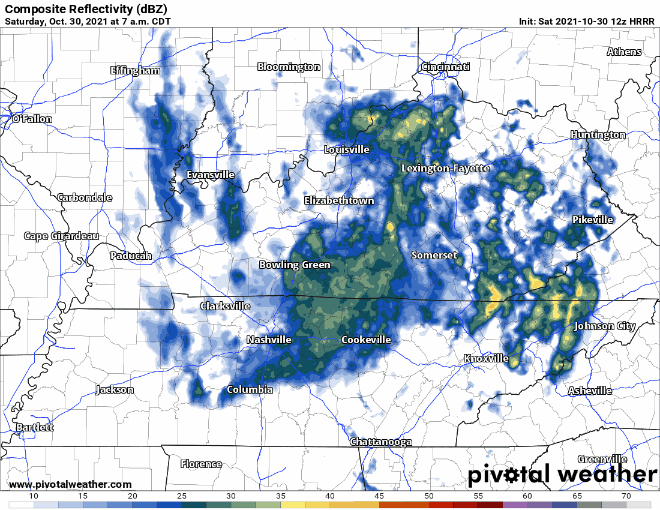
The heaviest rain today is on its way out. HRRR has scattered showers for the rest of today. A thunderstorm or two is possible mid-afternoon to evening. These will just bring wind gusts and quick downpours, no severe weather.
Today is the last dry day of the work week. A low pressure system is heading our way, bringing in showers and storms from overnight tonight, running off and on to Saturday.
HRRR loop below shows rain arriving just around midnight tonight with another round of heavier rain in the morning.
You must be logged in to post a comment.