
(If it is your birthday I got you “at least it’s not eleventy billion degrees today” and this birthday message).
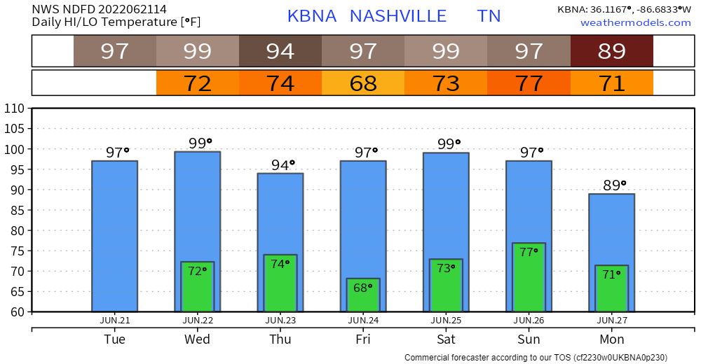
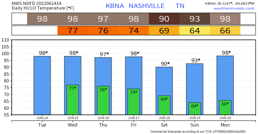
Temps today lower than yesterday’s streak snapping (almost ten years without hitting 100°) and June 22-record-breaking 101°.

(If it is your birthday I got you “at least it’s not eleventy billion degrees today” and this birthday message).
Temps today lower than yesterday’s streak snapping (almost ten years without hitting 100°) and June 22-record-breaking 101°.
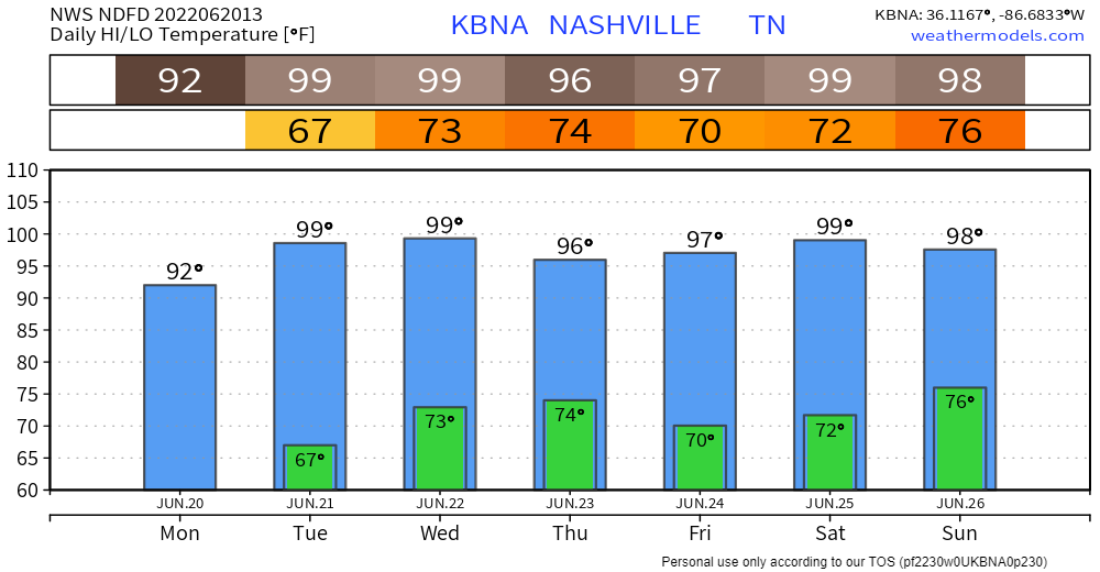
BNA last hit 100° July 8, 2012. We might hit 100° this afternoon. For several days forecasters have gone back and forth between 99° and 100° for the high. The latest data supports 99°, but 100° will be in reach. If we make it to 100° we would only tie the June 22 record set in 1988.
HEAT
Summer officially began early this morning.
This streak of near 100° temps will be a dry heat — not Vegas dry, Nashville dry — except for Wednesday when the dewpoint jumps up from the Comfortable to a Bit Sticky into the Uncomfortable area. That’ll send the heat index to 102°. Rest of the week the temp and heat index will be close together.
Heat will build just in time for Official Summer which starts tomorrow.
Models are beginning to agree that we won’t hit 100°, but it’s going to be very close. If we do make it to a hundo it’ll be nice to stop talking about the almost 10 year streak of sub 100° days that started on July 8, 2012.

Yes there are people out there rooting for the temp to reach one hundred degrees. They like extremes. It’s how they’re wired. If are one of them, you are loved. You be you.
Record Heat Incoming?

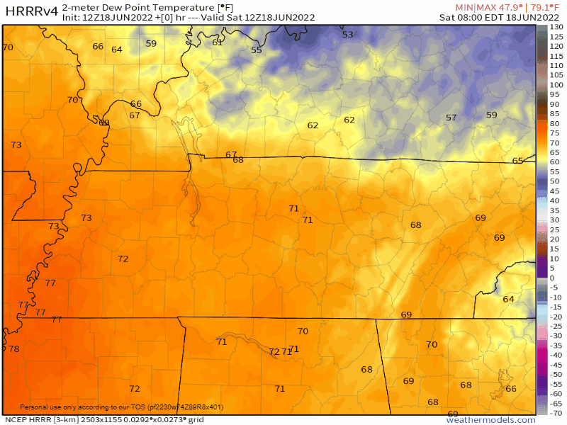
Dry air started spilling over us this morning.
It’ll get even drier tonight and tomorrow. Red at the end of the below dewpoint GIF is super-dry air: dewpoints in the 20°s!:
A north breeze will blow through the weekend, a gift from the notorious D.A.M.
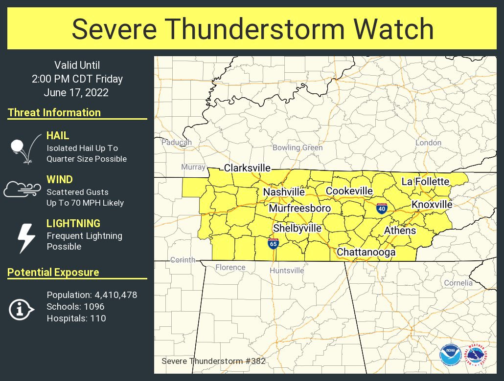

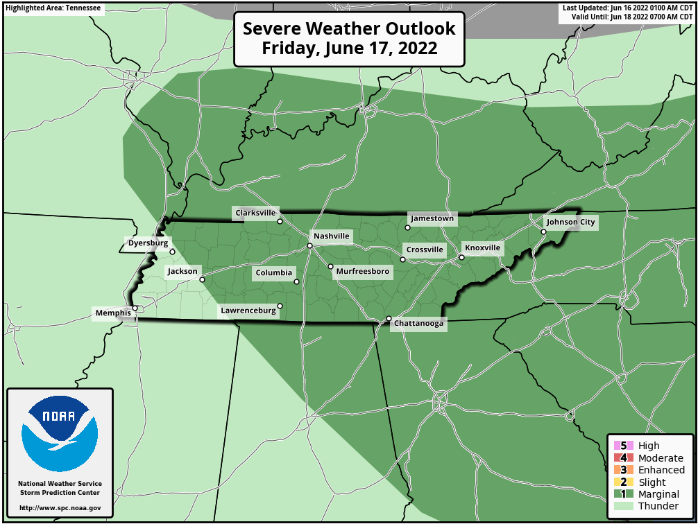
The Storm Prediction Center has issued a Severe Thunderstorm Watch until 2pm for both of our counties. SPC has outlooked our area for a 15% chance of damaging straight-line winds and a 5% chance of severe hail. We are not outlooked for any tornado threat.
Looking for 98° today. Heat index up to 104°. The record temp is 100° from 1952. Doubt we’ll make it there today.
Rain is unlikely but the HRRR consistently shows a few non-severe thunderstorms popping up around 6-8 PM.
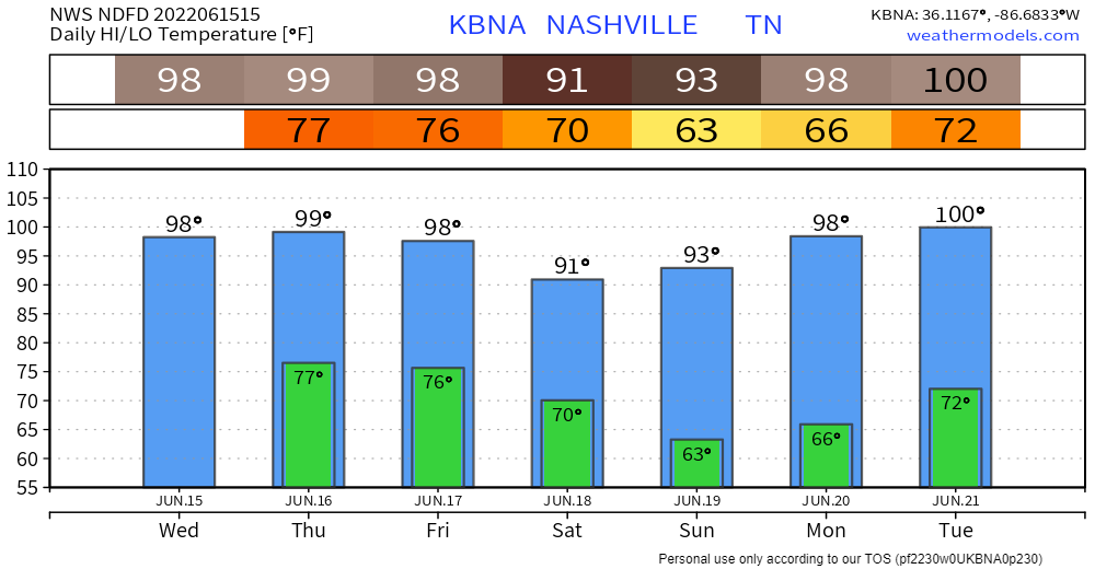
Oppressive humidity will combine with 98° today and 99° Thursday to send our “feels like” heat index well over 100°, maybe as high as 105°+.
Humidity drops a category (low 70°s to upper 60°s) by Friday.
This brutal heat is continuing to be a total vibe killer.
High of 98° (which would break the daily high record by 2°) combined with a dewpoint of 72-73° will be lead a heat index of 106-108 (in the shade). For that reason, NWS Nashville has issued another Heat Advisory for us today from 11AM – 7PM. Wednesday will have nearly the same temp/dewps combo, so they went ahead and issued another Heat Advisory for us tomorrow.
You must be logged in to post a comment.