
Heat will build just in time for Official Summer which starts tomorrow.
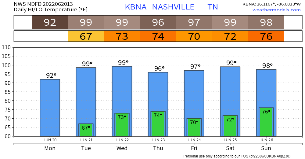
Models are beginning to agree that we won’t hit 100°, but it’s going to be very close. If we do make it to a hundo it’ll be nice to stop talking about the almost 10 year streak of sub 100° days that started on July 8, 2012.
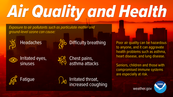
Meanwhile there’s an Air Quality Alert in effect today and there’s reason to think this may be extended through the week.
Humidity won’t be nearly as bad as last week when dewpoints were in the 70°s. Dewpoints today in the low 50°s, rising to upper 50°s tonight, then settling into the low 60°s through the week. As usual, humidity will be highest in the morning (mid to upper 60°s) when temps are coolest, then the two trade places: in the afternoon temps rise, but dewpoints drop.
Wednesday will have the worst heat/humidity combo, with heat index expected to max out around 101°. That’s five degrees less than max readings we got last week.
By our standards it’s a dry heat.
SPC thinks non-thunderstorms are possible Wednesday but don’t bet on that. Possible doesn’t mean probable. NWS-Nashville put a big ole zero on the probability of precipitation, and a 1 in 10 chance of seeing a rain drop before sunrise Thursday morning. Looks like the rain chances will be just north of us on the south side of a cold front.
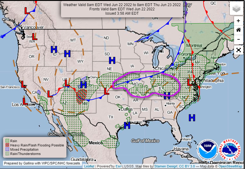
So for us looks like the dry streak lives.
Next rain chance Sunday with a low probability of precip. Around then, the grip high pressure will have on us should slowly start to fade away. This may allow a few downpours to pop up somewhere in Middle TN.
Quick References:
Weather changes constantly.
Follow @NashSevereWx on Twitter for any changes to this forecast.
Live coverage during tornado and severe thunderstorm warnings.

Look good.
Support the mission.

We are 100% community supported. No ads. No subscription fees. Keep it free for everyone.


Categories: Forecast Blogs (Legacy)
You must be logged in to post a comment.