

(If it is your birthday I got you “at least it’s not eleventy billion degrees today” and this birthday message).
Temps today lower than yesterday’s streak snapping (almost ten years without hitting 100°) and June 22-record-breaking 101°.
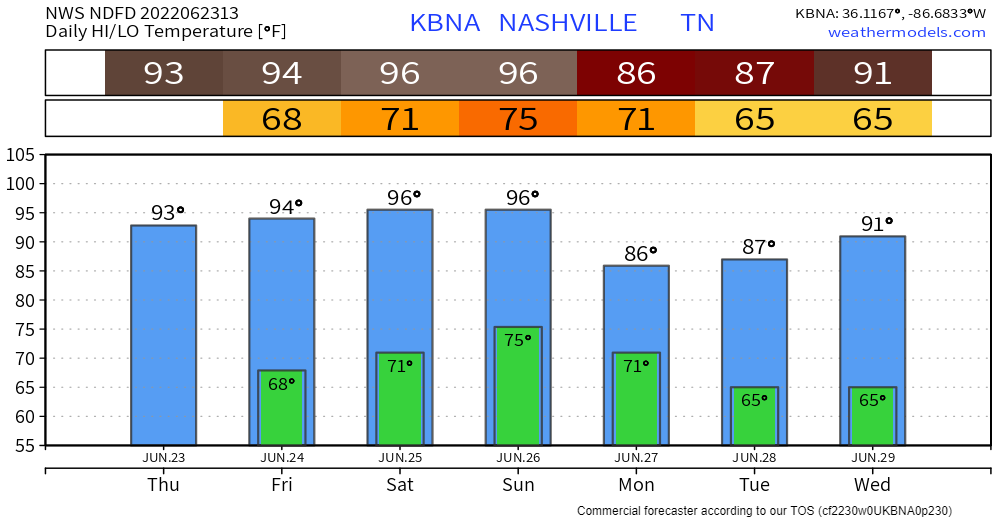
Temps are above normal for late June.
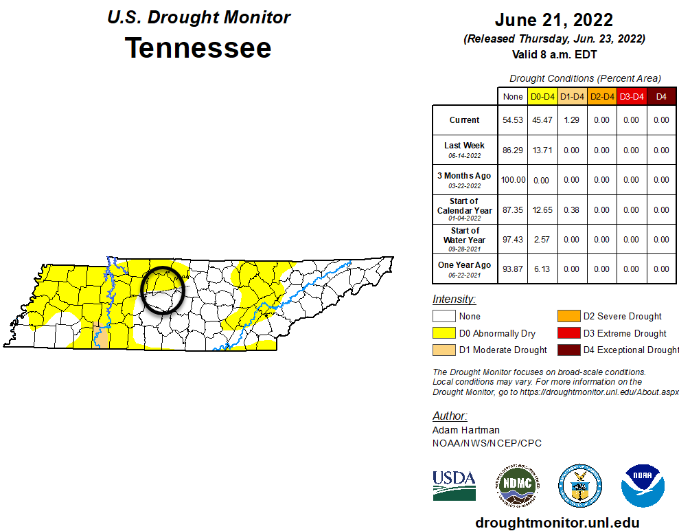
Everyone’s grass is crunchy. New drought monitor arrived today painting those along and north of I-40 “abnormally dry.”
Rain is expected Sunday/Monday. It could arrive as early as Sunday afternoon but the most likely ETA range is Sunday night overnight into Monday morning. However, note the 6z Euro model has big soak and a few storms in here late Sunday afternoon, so have a plan if you’re planning something.
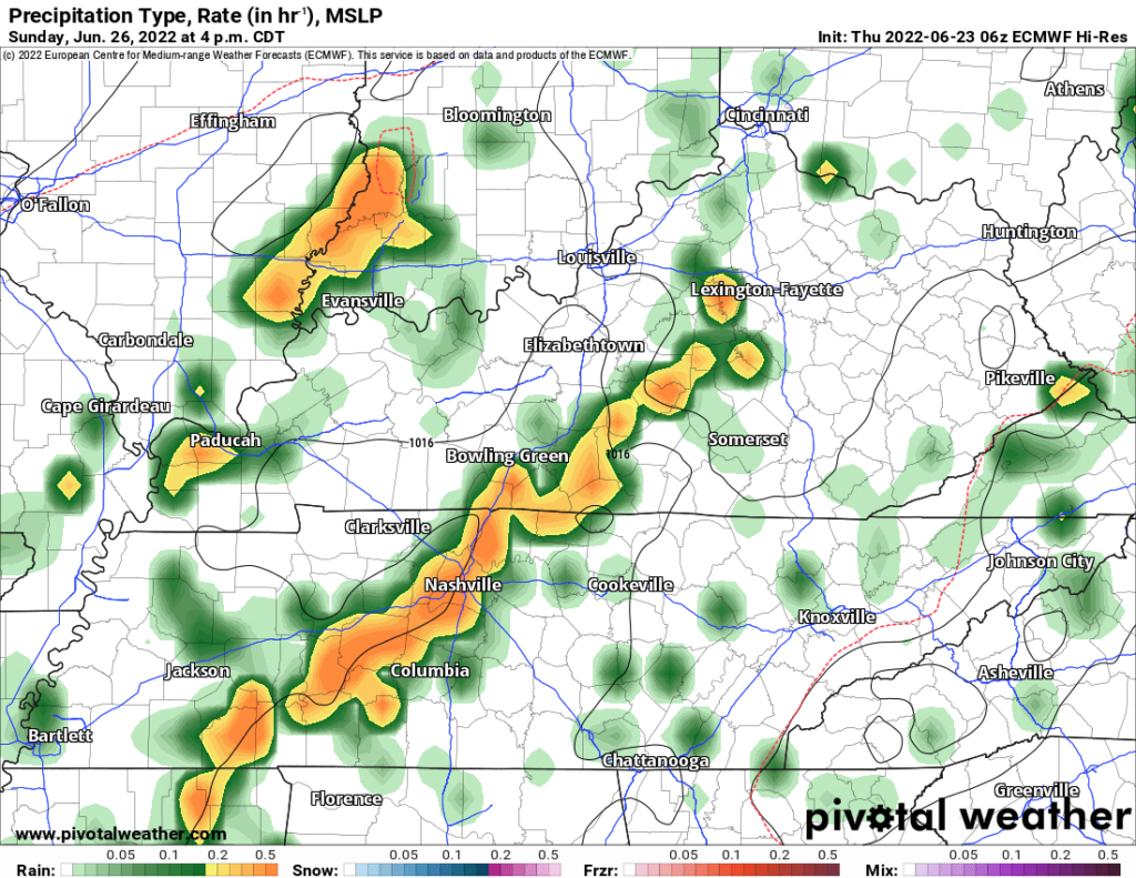
A few showers may linger into the day Monday. Models haven’t worked out the timing — they never do at this range anyway.
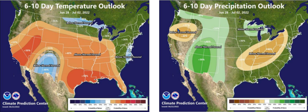
Data suggests this will be a minor rain event. We need rain because next week looks dry. The side by side below shows hotter and drier than normal as we move into July.
Quick References:
Weather changes constantly.
Follow @NashSevereWx on Twitter for any changes to this forecast.
Live coverage during tornado and severe thunderstorm warnings.

Look good.
Support the mission.

We are 100% community supported. No ads. No subscription fees. Keep it free for everyone.


Categories: Forecast Blogs (Legacy)
You must be logged in to post a comment.