Current Radar
Happy Fourth!
Today’s weather concern is potential for flash flooding, frequent lightning, and maybe severe weather (damaging straight-line winds).
Last night, a weak line of storms sank down from the KY/TN border, and dumped a lot of rain on Montgomery County (Clarksville), getting as far south as northern Davidson County. It quickly lifted north, and that’s where the rain will be for most of the morning.
Scattered showers and storms should develop before noon to our northwest, then move east. As the day progresses, showers and storms are expected to scatter throughout most of Middle Tennessee, including us. Exactly when/where they will scatter is unknown, but as you go through the day, your chance of rain will increase.
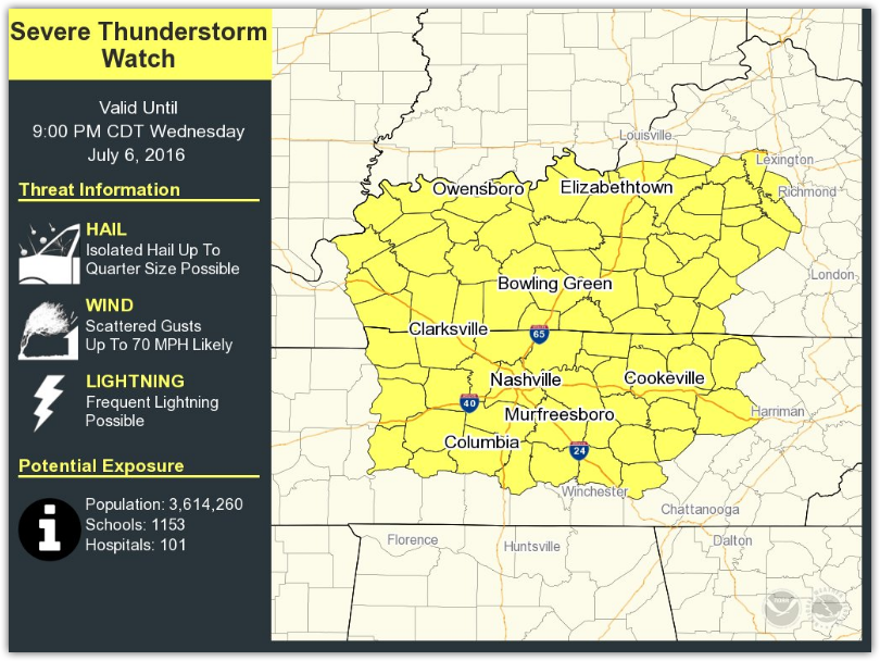
From NWS-Nashville:
The bulk of rainfall and severe wx potential will be located just north of TN, but there will be enough dynamic support, along with deep moisture and instability, to bring a few strong to severe storms to the Mid State. read more


You must be logged in to post a comment.