
Current Radar
Severe Thunderstorm Watch for Davidson County until 8 PM
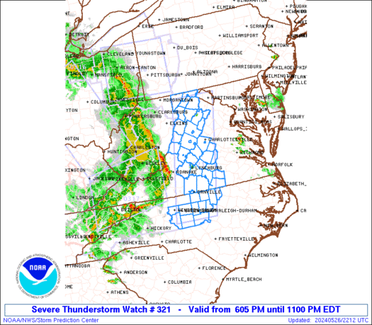
Watch says "primary threats include scattered damaging wind gusts to 70 MPH, isolated large hail events to 1 inch diameter possible."
— NashSevereWx (@NashSevereWx) July 4, 2016
Here is the text of the Watch:
Williamson County’s exclusion from the Watch does not mean it won’t rain or storm in Williamson County. This does, however, track the earlier forecast thinking that says the larger threat is north of I-40.
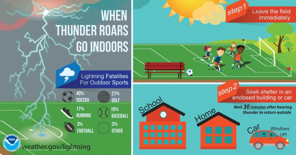
NWS thinks we will see a weaker, short lived wave this afternoon, “with a secondary wave this evening.” When they say “wave,” they mean rain/storms. Yes, right now, it doesn’t look good for fireworks.
It’s time to start watching radar. We’ll be tweeting all day/night on this @NashSevereWx.
Rest of the Week
This website supplements @NashSevereWx on Twitter, which you can find here.
Categories: Forecast Blogs (Legacy)