Category: Forecast Blogs (Legacy)

Sitting Pretty Through Wednesday, Cooler Than Normal

Editor’s Note: What Happened Yesterday?

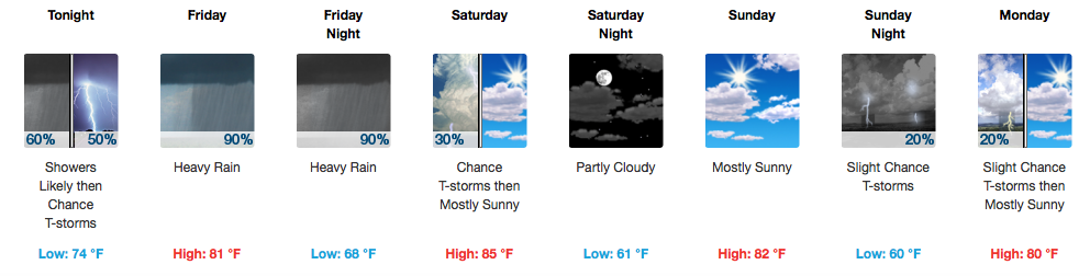
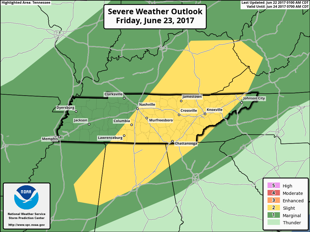
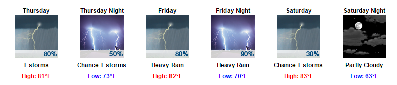
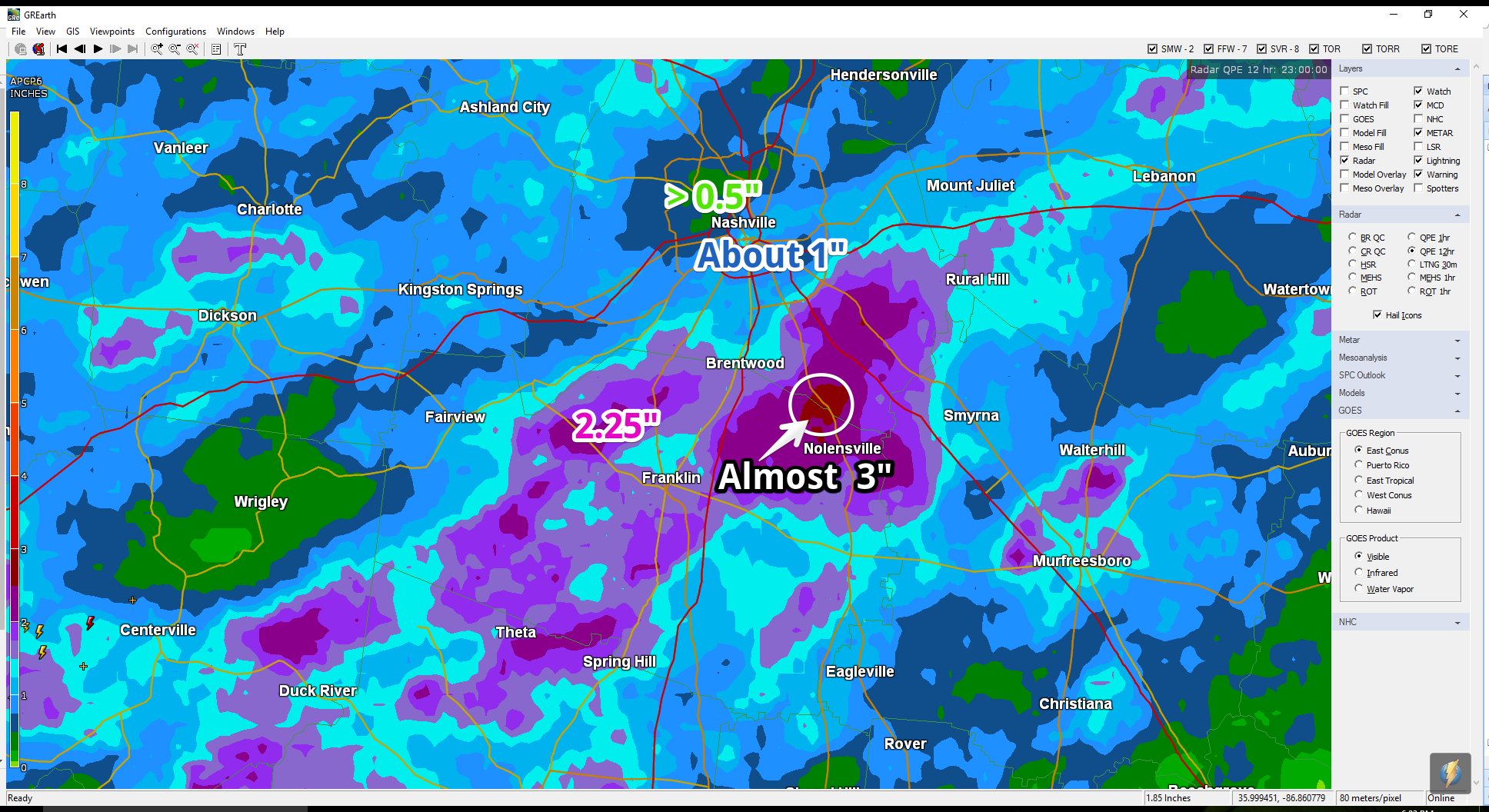
Friday’s forecast came from a pretty unified prediction by the weather models. The models thought Tropical Storm/Depression Cindy was going to move north along the Louisiana/Texas border, then turn northeast, then east, and move into Middle Tennessee right as a cold front was going to sweep through. This combo was gonna make it rain and maybe even produce damaging winds and few isolated tornadoes.Hence the Flash Flood Watch and probabilities of tornado (5%) and damaging winds (15%).   read more

Slight Risk of Severe Weather Today. Main Concerns: Flash Flooding, Damaging Winds, & an Isolated Tornado.

More Rain & Severe Weather Potential For Today

Showers and some strong to severe thunderstorms are possible. Today will be one of those if you absolutely must do something/drive somewhere today, do it early rather than later. 

Timing: After Lunch into the Evening

This morning, we do have a chance of seeing a few scattered showers. However, the main bulk of showers and thunderstorms should arrive sometime around or after lunchtime. read more

Flash Flood Watch in Effect; Turn Around, Don’t Drown

More rain, with maybe a little lightning, is on the way tonight.

Flash flooding (a flood that happens almost suddenly, due to heavy rain and run off) is tonight’s primary weather concern.

A lot of rain has fallen. The below map is a radar estimate as of 6 PM. The purple indicates radar estimates of 1.5″ to 2″ or more, and are especially vulnerable to flash flooding tonight/overnight. read more

Father’s Day Storms

Today’s Father’s Day forecast is kinda like this.

Expect thunderstorms.

At 8:45 AM, weak storms near Paducah, KY, are moving slowly our way down I-24. Those storms should strengthen as they approach and encounter a hotter, more destabilized airmass here in Davidson & Williamson Counties. read more