
More rain, with maybe a little lightning, is on the way tonight.
Flash flooding (a flood that happens almost suddenly, due to heavy rain and run off) is tonight’s primary weather concern.
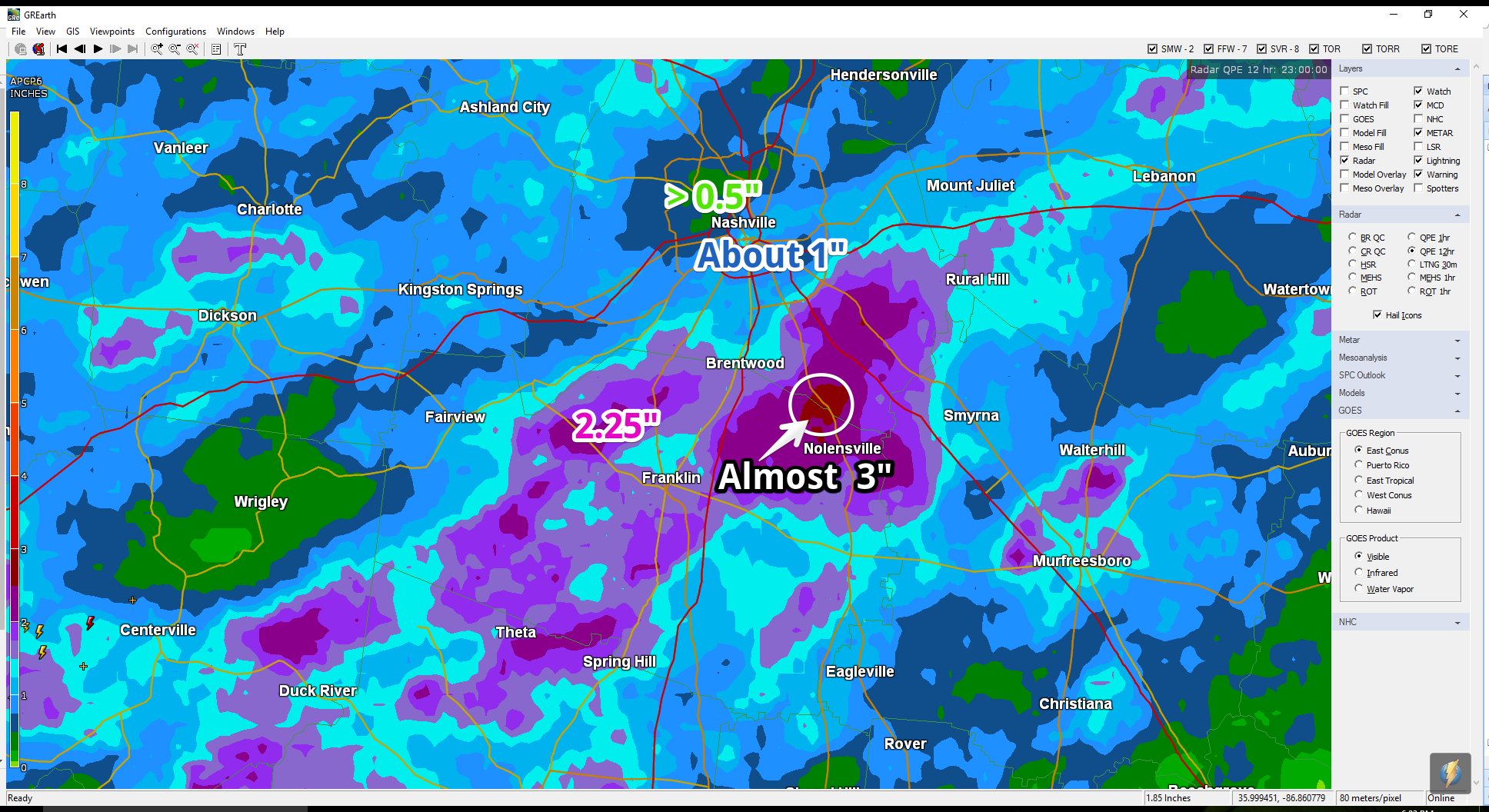
A lot of rain has fallen. The below map is a radar estimate as of 6 PM. The purple indicates radar estimates of 1.5″ to 2″ or more, and are especially vulnerable to flash flooding tonight/overnight.
Rain should continue tonight, overnight, and into the wee hours Monday morning.
At 547 PM, NWS-Nashville issued a Flash Flood Watch because “heavy rainfall from a slow moving front this evening, tonight, and Monday could cause flash flooding issues.”
NWS has issued a Flash Flood Watch effective tonight, overnight, Monday morning, and into Monday afternoon. pic.twitter.com/KkevwbACcV
— NashSevereWx (@NashSevereWx) June 18, 2017
Don’t expect that rain to continue through Monday afternoon; in fact, I expect rain to start to let up before sunrise, with a mostly rain-free Monday morning.
12 to 24 inches of water can carry away your vehicle. Even your tough-guy truck. Respect water, especially at night.
Monday thru Wednesday: Less Humid
A cold front arrives Monday, and will scour away the humidity. It’ll still be hot, but you’ll love Monday – Wednesday, with no rain forecast.
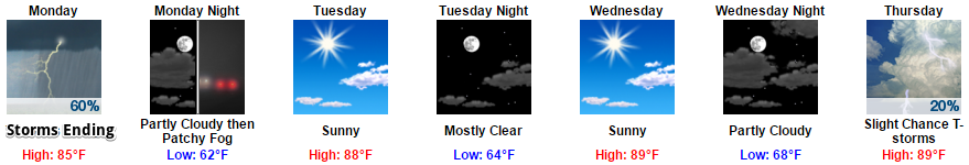
Humidity returns Thursday through the weekend, and with it, another chance of typical-summery afternoon rain/thunderstorms, with maybe another cold front to create another rain/storm event next weekend.

Categories: Forecast Blogs (Legacy)
You must be logged in to post a comment.