Tonight
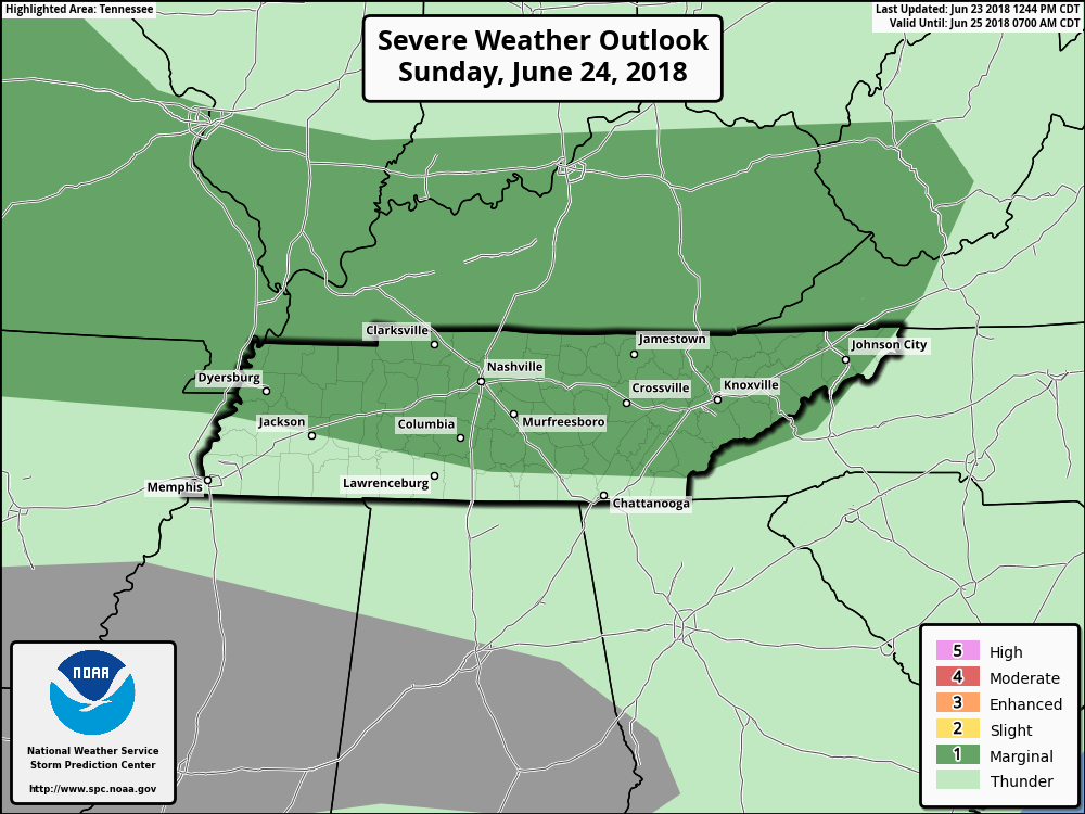
We have some storms moving into middle Tennessee. These will hang around late tonight into early Sunday morning.
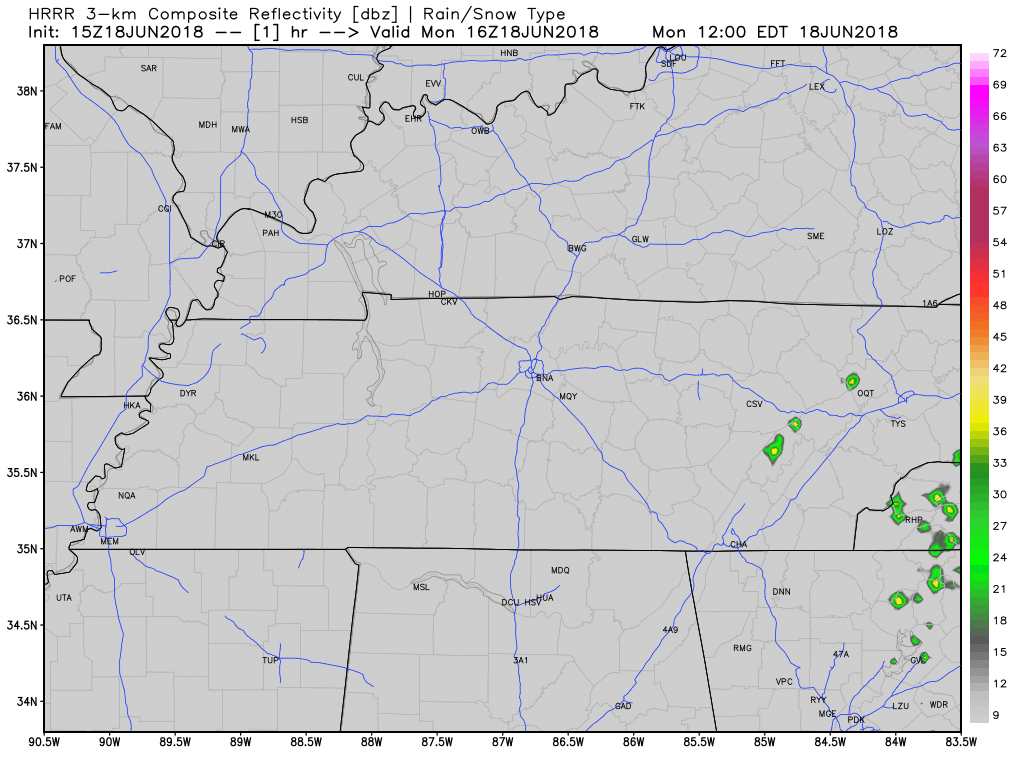
Both our HRRR and NAM 3-km models are in disagreement – lending to uncertainty for tomorrow.

We have some storms moving into middle Tennessee. These will hang around late tonight into early Sunday morning.
Both our HRRR and NAM 3-km models are in disagreement – lending to uncertainty for tomorrow.
After some strong, damaging storms to our south today, HRRR suggests we are done with the rain for tonight. More storms expected tomorrow.
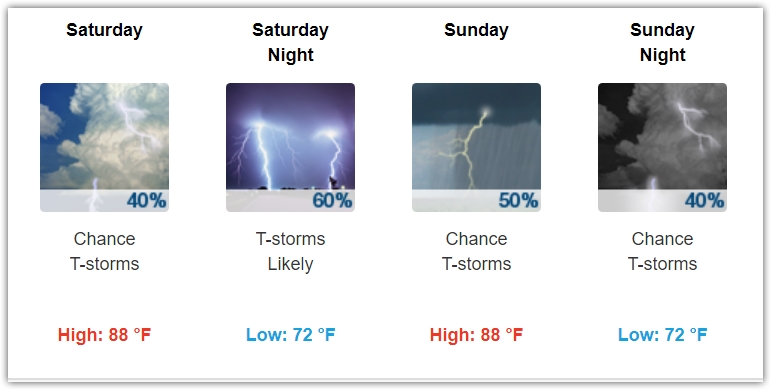
The typical summertime status quo remains intact for this weekend. Storms look like they could be severe again on Sunday as the atmosphere recharges following possible rain/storms Saturday night. Highs will be in the upper 80s with the muggy-meter in the uncomfortable range.
We’re expecting a high of 84° today. You can thank the clouds and rain-cooled air for that. Dewpoints will remain in the upper 60s and low 70s from tropical moisture funneled into Middle Tennessee. Cooler temps, but uncomfortable humidity.

Who is ready for some rain?! It’s coming. Tropical moisture is arriving.
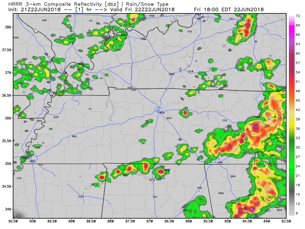
The HRRR model below shows off and on showers this afternoon, then a lot of light arriving arriving after midnight.

We are expecting the high temperature to be right around 90º today with dew point temperatures in the upper 60s (uncomfortable range).
We’ve got sunny skies across Williamson and Davidson Counties to start off our morning. Lack of clouds will let temps soar pretty quickly. Our high today could reach 93, and with dewpoints in the upper 60s, you can expect that real-feel to be a few degrees warmer.
The Intern assigned to write today texted to say he cannot connect to his only available WiFi connection. For no good reason, I blame Memphis.
The good news is no real change to the forecast. It’s hot and humid and of course you already knew that.
Below is an update from what we wrote this morning. It’s new information. But the same. Hot, Humid, Chance of Rain/Storms.
Hot every day this week. Lower high temps mean more clouds and more humidity. That’s not comforting.

The forecast is essentially the same every day this week.
Hot every day this week. At least 90°. More clouds, and the temp will get closer to 90°; fewer clouds and it’ll get closer to 95°. Today looks like a “fewer clouds” day.

Large hail was the big hazard yesterday, from Nashville to East Nashville, and Franklin to Thompson’s Station.
And I think we had a microburst.
Southwest of Franklin, winds likely 60+ MPH resulted when a tremendous amount of water dropped quickly from the sky. Residents said it wasn’t raining, then suddenly a massive amount of water and wind came all at once. The water flooded a garage as strong winds swept through in a straight line, dropping these very large branches on cars (note this was after the bigger trees limbs had been removed)…

Sooooo hot today through this weekend. Mid 90°s temps. Heat index 97° today, 98° Saturday, and up to 100° Sunday. This heat index rise is due to higher temps and slightly lower dewpoints, but let’s not pretend it’s “dry.” It’s not. Still humid. Still hot.
You must be logged in to post a comment.