
The Intern assigned to write today texted to say he cannot connect to his only available WiFi connection. For no good reason, I blame Memphis.
The good news is no real change to the forecast. It’s hot and humid and of course you already knew that.
I’m waiting for a heat advisory before I redo the “too hot or too cold” poll question we tweeted last winter. I’m curious how recency bias impacts poll results.
Today
From NWS-Nashville:
around noon [we should] see more cumulus clouds develop with some scattered thunderstorm activity as the afternoon progresses. Similar to the last few days, some storms may become strong with heavy rainfall, gusty winds, and hail, before they die down near sunset.
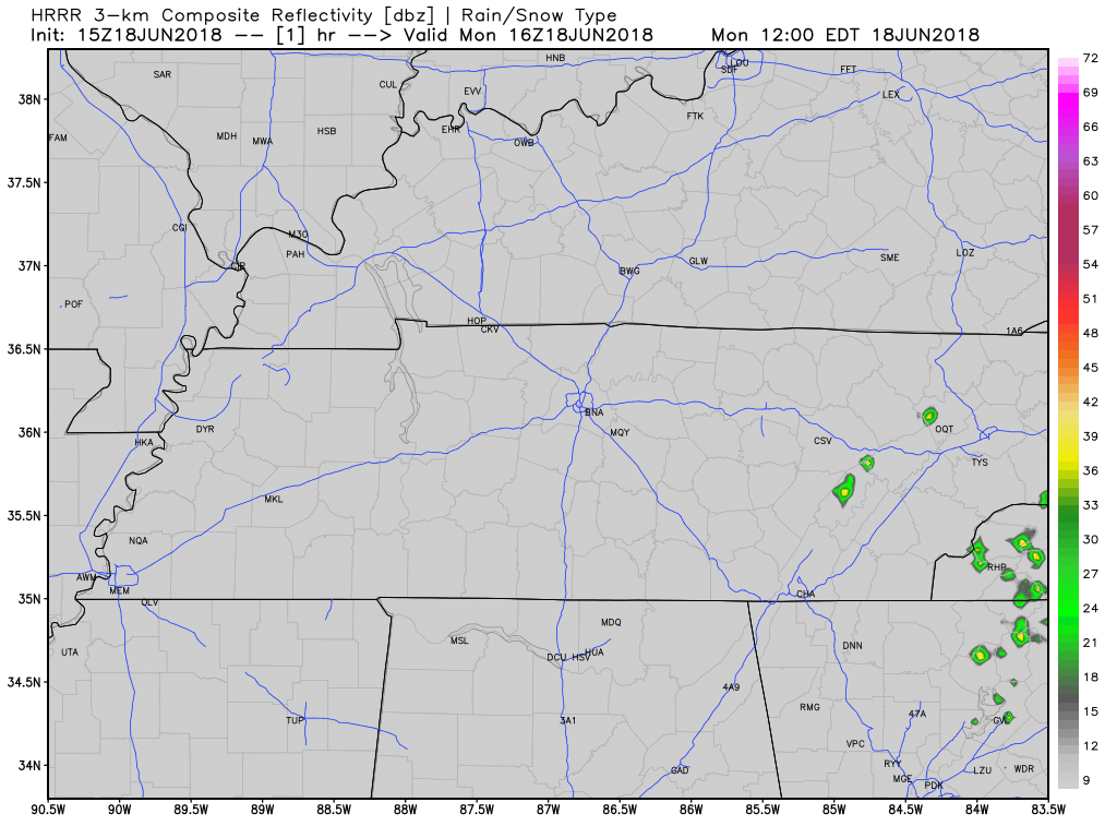
Latest HRRR model pops up usual afternoon storms, mostly along and east of I-65, but don’t read much into their exact locations. I think your chance of rain and a storm today is as good as anyone else’s in Middle Tennessee:
Hot & Humid Week Ahead
Temps under 90° Thursday and Friday do not reflect a cool down.

Instead, rain chances are a bit better Thursday and Friday than they are Tuesday and Wednesday. Therefore more clouds, more shade, and not as hot.
Rain chances go up Thursday through at least Saturday because a low pressure system in the midwest will bump away the storm-limiting high pressure currently trying (and failing) to keep all our showers away. Thus outdoor activities today through Wednesday are more likely to escape rain than anything else you have planned Thursday into the weekend.
Humidity will remain oppressive in the morning, then on the upper end of Uncomfortable in the afternoon.

Remember: Things We Don’t Know
We don’t know exactly where the storms will be. Your outdoor activity decisions should be guided by your risk tolerance and proximity to safety should a storm pop up. I think it’s more likely than not, each day, that the storms will miss you, but we can’t really tell you for sure.
We don’t know exactly when. Generally, though, storms are most likely during the hottest part of the day, ending after dark
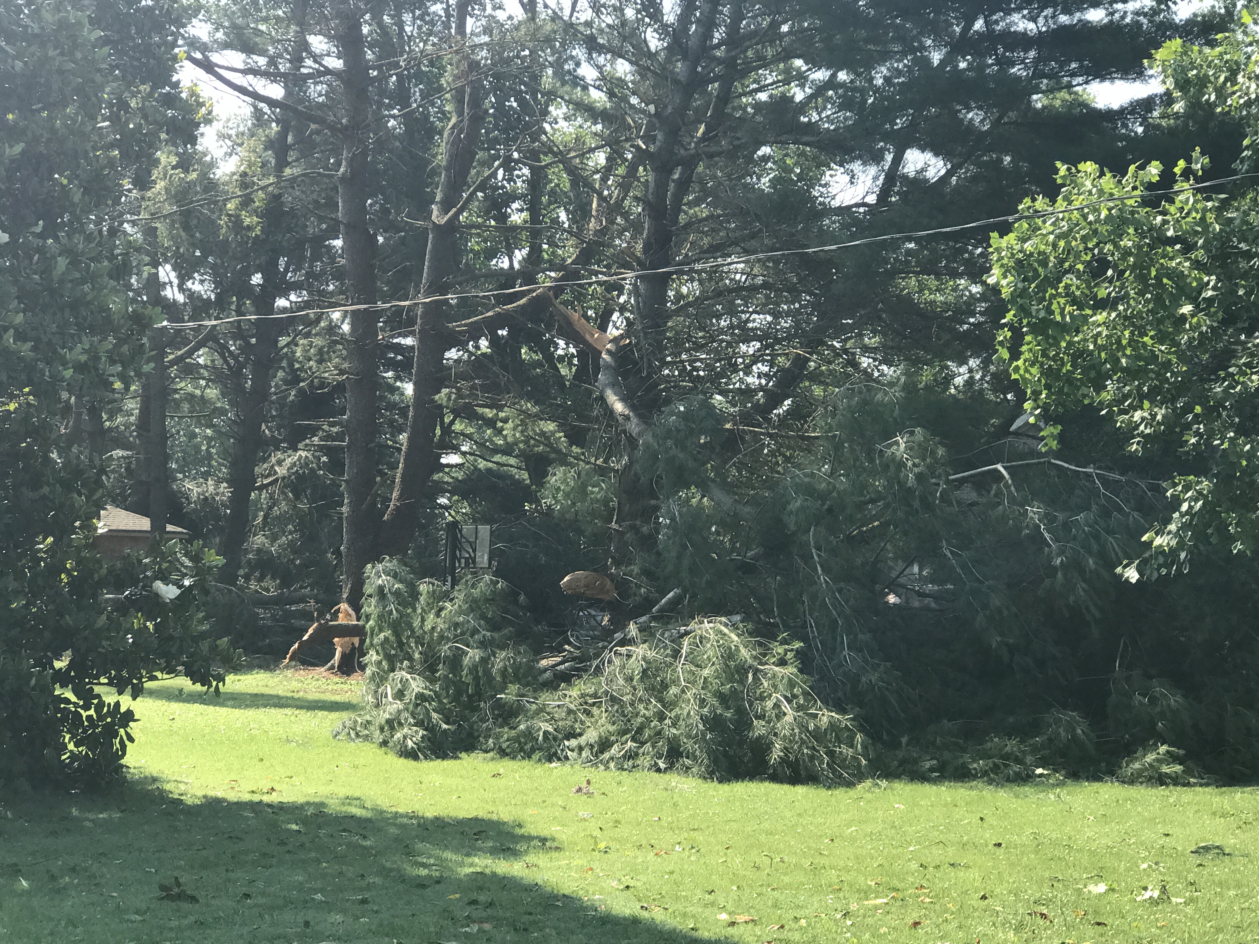
We don’t know how bad storms will be. Sometimes, they’re just rain. Most of the time there’s some lightning. Some storms can produce 30 MPH to 60+ MPH winds, with hail.
Recent examples include:
Sunday:
#tSpotter downtown franklin…..heavy hail for about 2 minutes pic.twitter.com/I03LhgZb1m
— Ryan (@MeMyselfandRyan) June 17, 2018
@NashSevereWx This just happened at my neighbors house here in Bellevue!😳 pic.twitter.com/EDa7CHv7nt
— Tracy (@CrazyCatLady70) June 17, 2018
Saturday:
Time lapse of the hail/wind damage storm a bit ago over Woodmont Blvd. Looks microbursty. ^al pic.twitter.com/uSndf8cdCw
— NashSevereWx (@NashSevereWx) June 17, 2018
@NashSevereWx Hail on the West Side near Vandy. pic.twitter.com/rRk1233V1u
— Bernie (@Hey_Bernstein) June 17, 2018
Friday:
Just SW of Franklin
#tspotter @NashSevereWx 25-centers here near Trinity and Dickerson pic.twitter.com/AQygUygR39
— Joseph Hudak (@JosephHudak3) June 15, 2018
We will update the forecast as needed @NashSevereWx on Twitter. Not on Twitter? We have you covered.

Categories: Forecast Blogs (Legacy)
You must be logged in to post a comment.