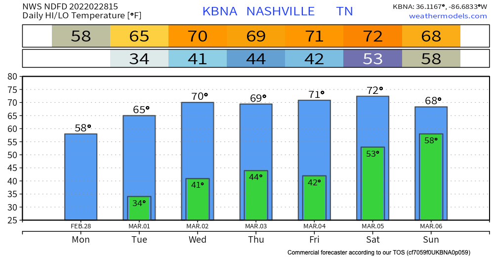
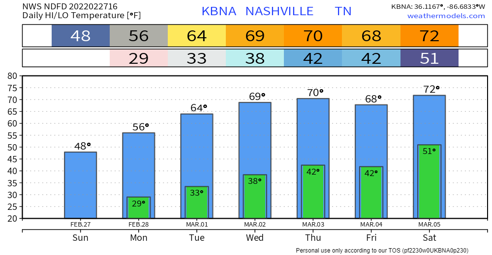
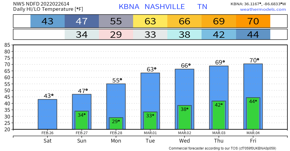
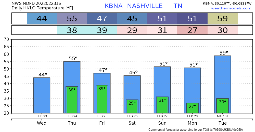
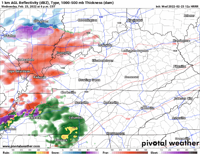
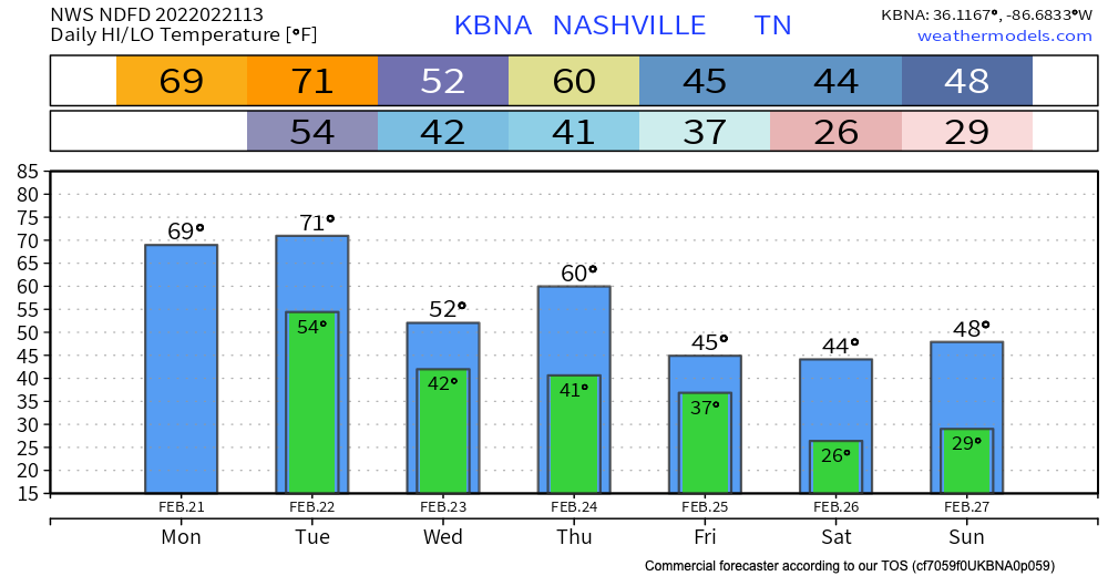
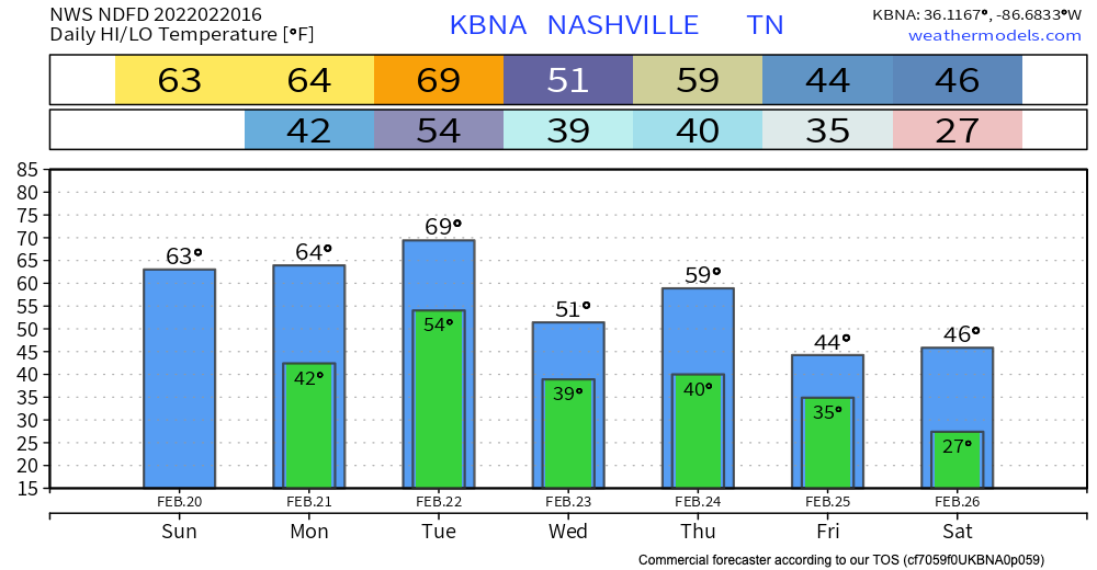
This week will definitely feel like springtime has arrived! Temps heat up to the low 70’s by Saturday. Overnight lows are still chilly during the work week dancing around the lower 40’s. A dry pattern sets in and stays until Saturday(ish). The pollen count rises to 7(medium) this week. This weather may have you feeling like this:
Category: Forecast Blogs (Legacy)
Warmer, Dry Week Ahead
The overnight rain is long gone.
Temps won’t break 50 today, so after all this rain it may feel pretty chilly. Clouds will clear. See cloud cover gif below:

After today it is sun, sun, and more sun. No rain is expected during the weekdays. Temps climb throughout the week, with highs peaking around 70 this Thursday. Those warm temps should continue into the weekend.
Stadium Series Forecast Chilly But Mostly Good, Next Week We Warm Up and Dry Out

This morning light wintry precip has been coming in from the southwest. It’s of no consequence. BNA and all other personal weather stations scattered around are above freezing, so no problems.
More showers (liquid variety, not frozen) might slide in here around lunch, but the majority of them are expected to stay to our south.
Chilly Friday
Now that the cold front has pushed through – we are left with some chilly air.

Highs today will be in the low 40s, and overnight temps will be in the 20s.
The good news is, we’re only going to warm up from here, and we’ll be feeling some spring temperatures early next week. Any residual moisture on bridges and overpasses will freeze tonight. However, most roads will be totally dry by then.
Heavy Rain Winding Down, Flooding Still Possible
The heaviest of the rainfall is past us. Hit or miss showers rest of today. Under a half inch of rain between now and the wee hours tomorrow morning. Everything should be mostly out by then.


Good news is the ground has more time to accommodate this new rain. But flooding is still possible. Anything that falls is going to easily runoff to already flooded areas. Especially north of I-40 where more rain is expected. We remain under a flood watch until 6AM tomorrow morning.
Round Two Starting Tonight, More Flooding Possible
Shortlived break from the rain today. Chilly temps today and tonight. Most of the frozen precip expected to fall NW of us. HRRR thinks a little sleet could mix in early on… nothing impactful.

On and off rain showers start tonight and continue throughout the day tomorrow. Heaviest rainfall overnight tonight:
Flooding and Severe Weather Possible Today
Storm & Flood Threat Tuesday.
Tonight’s 0z run of the HRRR model thinks beginning Tuesday after lunch an atmosphere somewhat capable of producing a tornado or two, damaging straight line winds, and maybe even hail will settle in. The severe storm capability should linger into the evening and end before bedtime if current model data has it right.