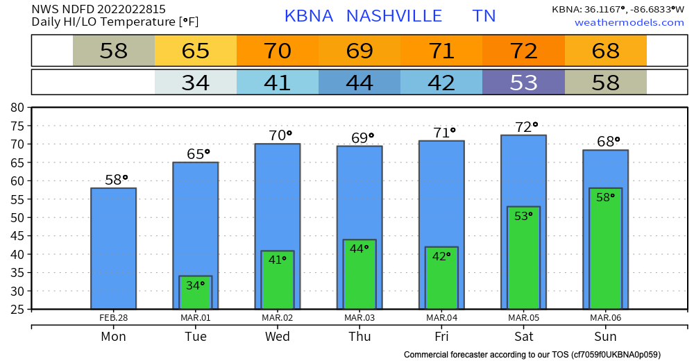
This week will definitely feel like springtime has arrived! Temps heat up to the low 70’s by Saturday. Overnight lows are still chilly during the work week dancing around the lower 40’s. A dry pattern sets in and stays until Saturday(ish). The pollen count rises to 7(medium) this week. This weather may have you feeling like this:

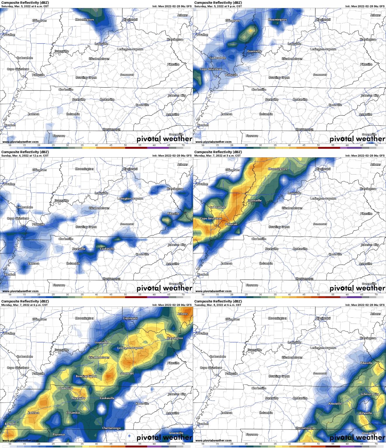
Our next chance for rain comes this weekend. GFS below shows Saturday being pretty clear with a sprinkle for some of us. The Sunday morning rain comes in then leaving us dry until midday Monday.
Euro model has scattered showers Saturday and Sunday with heaviest rain Monday.
A cold front is set to pass through our area Monday bringing showers. As of now no severe weather is expected but a thunderstorm or two could be possible as that line moves through. All the weekend data is suss and timing is subject to change.

This event still is a bit out so keep posted throughout this week for any changes on ETAs and intensity.
Quick References:
Weather changes constantly.
Follow @NashSevereWx on Twitter for any changes to this forecast.
Live coverage during tornado and severe thunderstorm warnings:
Look good.
Support the mission.
We are 100% community supported. No ads. No subscription fees. Keep it free for everyone.
Categories: Forecast Blogs (Legacy)


You must be logged in to post a comment.