Flash flooding is a low probability threat today (5% to 15%).
→MRMS radar estimates 1.5″ to almost 2″ fell over the past 24 hours in parts of Will Co and Nashville. CoCoRahs data shows measured precip, it shows around 0.5″ to 1.5″:

Flash flooding is a low probability threat today (5% to 15%).
→MRMS radar estimates 1.5″ to almost 2″ fell over the past 24 hours in parts of Will Co and Nashville. CoCoRahs data shows measured precip, it shows around 0.5″ to 1.5″:

→ No reliable information tells anyone exactly when or where (Halsey concert, baseball games, whatever) it is going to rain or storm tonight. It may not storm at any one location.
→ You should be prepared for rain and storms. Most of us will be probably be fine, or slightly inconvenienced by weather. No data suggests a total washout/stormout for us tonight.
Much cooler today. Tuesday, a warm front lifts in making things warmer and more humid.
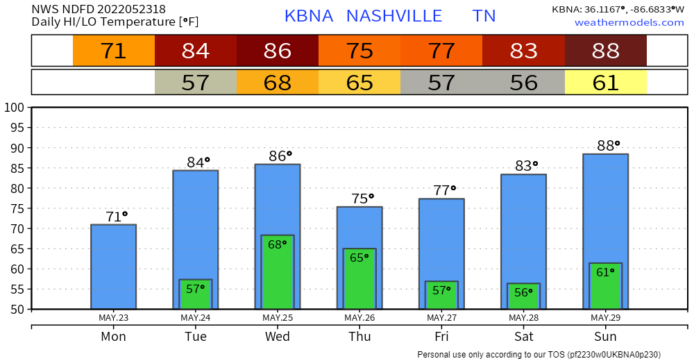
Next rain and/or storm event is Wednesday – Thursday.
Timing. A few models put in rain/storms here Weds morning. But I think the most likely ETA for rain is Weds afternoon and night. ETD Thursday after lunch or so, tho we may see drizzlers linger into Thu late afternoon/evening.

NWS Nashville said in their morning AFD.
This is a true "cold" front for early summer
and afternoon high temperatures today will be noticeable cooler
as only in the 70s to around 80.
This is a good thing. It’s been super hot lately. This cool change will do us some good. From hot and dust to cool and musty.

Highest heat and humidity combo of the spring expected today. High temps in the shade 93° with dewpoints 66° to 68°.
The May 21 record high is 94° (1941). We may tie it.
Rain/Storms are unlikely. A few model runs had storms popping up late this afternoon / early tonight, but most models think not. It’s totally possible tho so keep an eye on it.
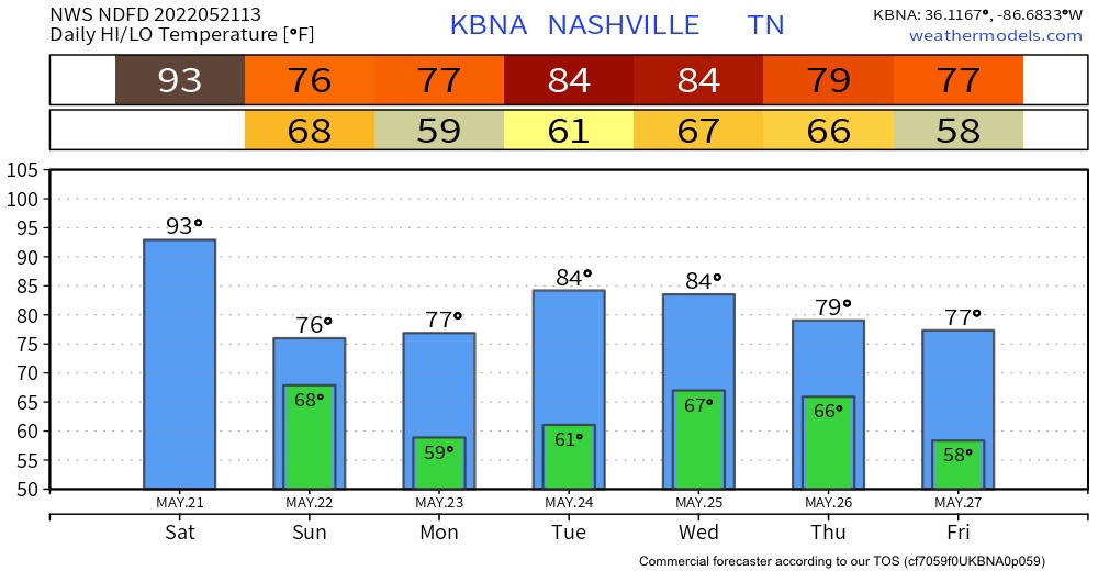
Today is going to be a muggy one. The high today is going to be 93. The record high was set back in 1941 with a high of 94 degrees. I don’t believe that we are going reach 94 today but there is still a chance.
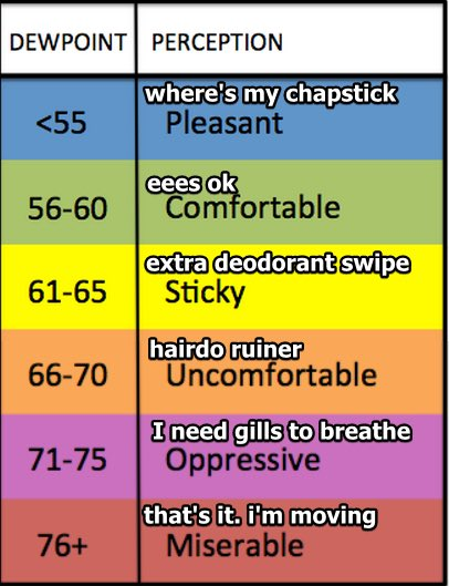
Winds up to 30 MPH today. Humidity May-typical, Sticky/Extra Deodorant Swipe range today and Saturday:
Sweaty / Boaty today and Saturday, hot under that cap and gown:
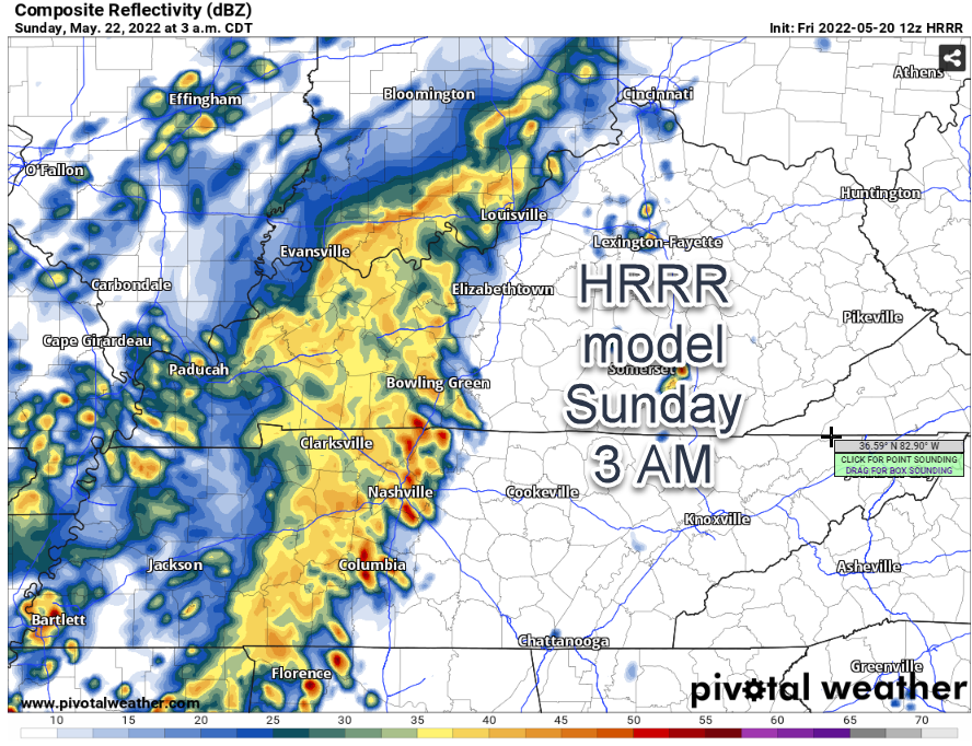
Rain/Storms may sneak in here Saturday late afternoon – early evening. 12z HRRR thinks so:

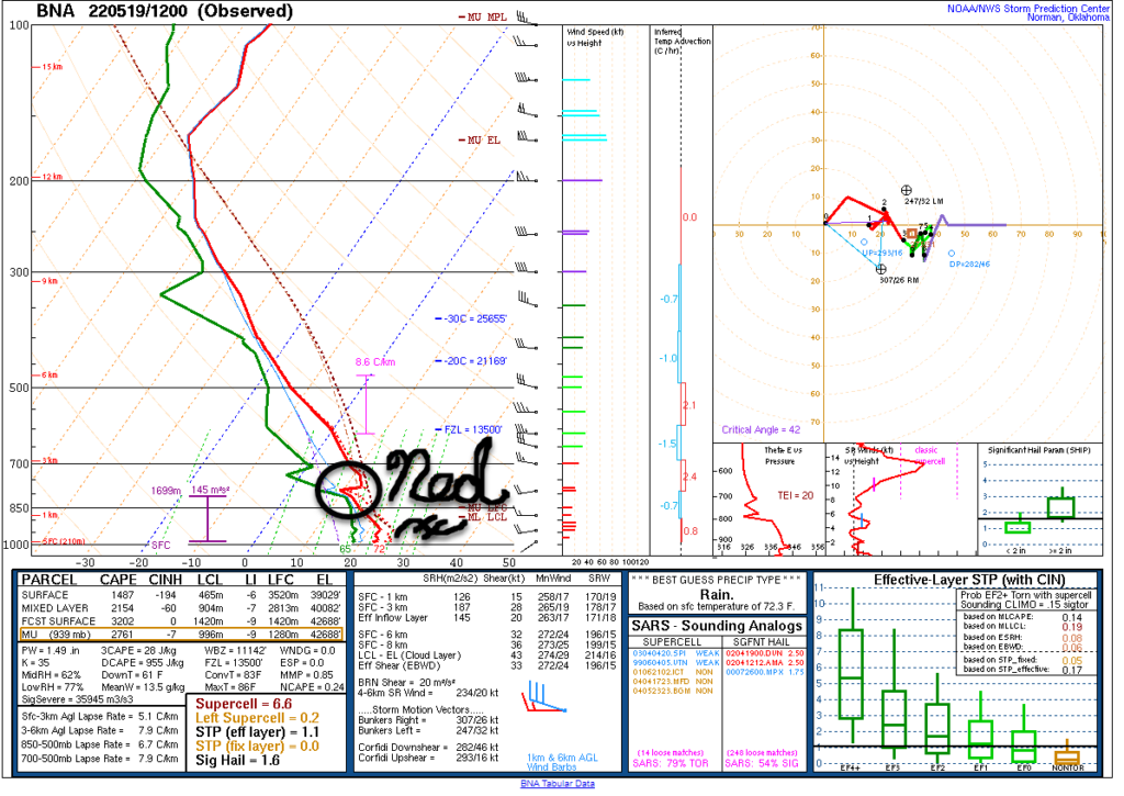
The morning weather balloon showed our atmosphere r-e-a-d-y to storm but our hero Ned is there, capping us off, preventing it all from happening. Hold on, Ned!
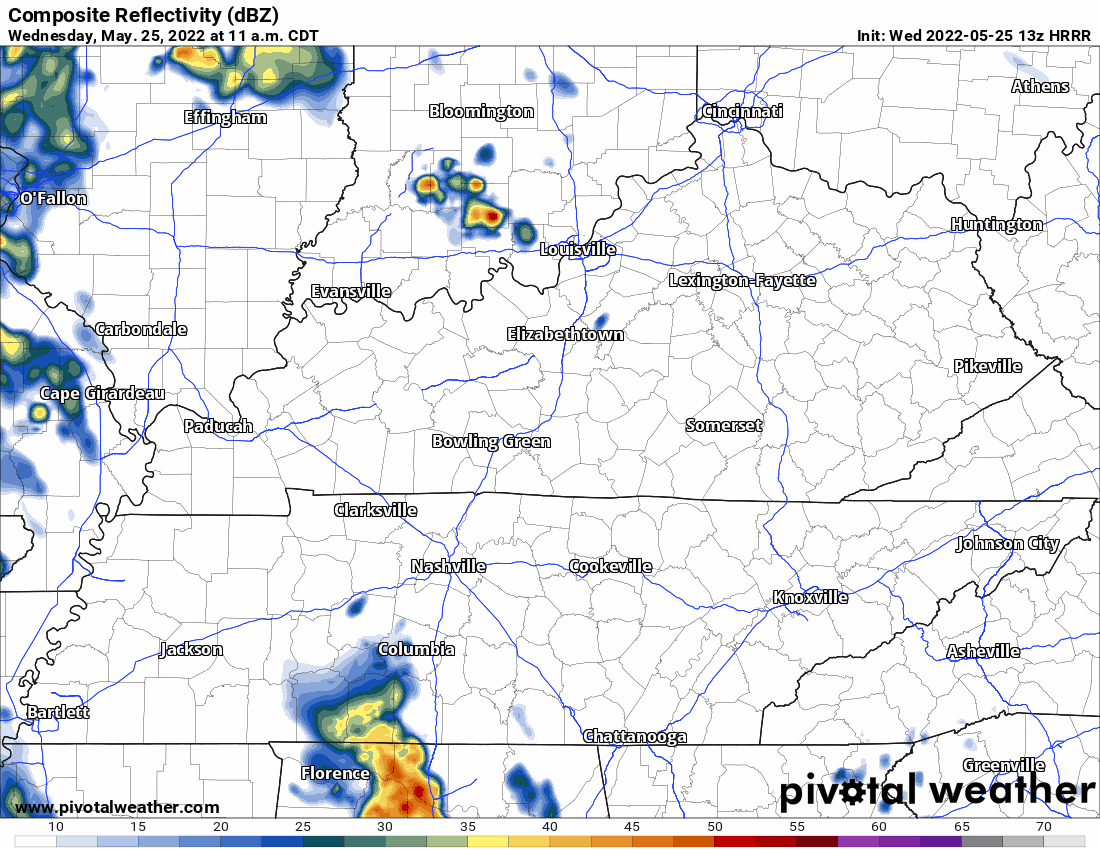
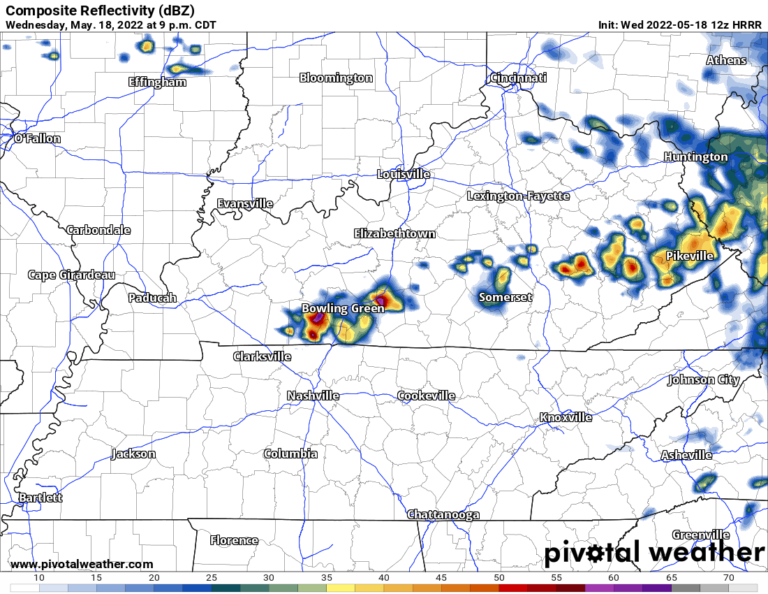
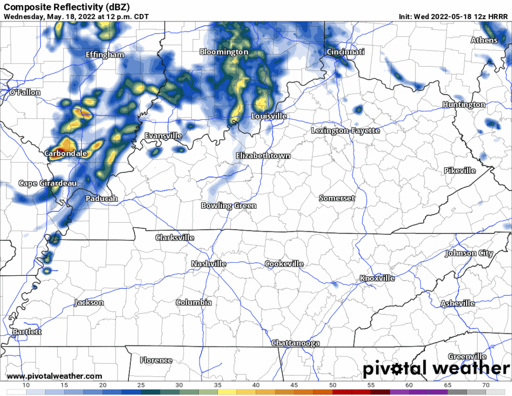
Models think it won’t storm today. HRRR shows a storm complex running north of us right along the Ohio River today:
Models disagree about today. It’s causing forecast headaches.
The HRRR model has storms missing you today and tonight.
The Euro has storms coming in here late afternoon/early tonight.
Which is “right?” Great question! Who knows? When “reliable” tools contradict the lesson isn’t “pick one,” it’s “we don’t really know.”

Hot with low humidity (under 55°!) today. Fantastic!
Let’s talk Wednesday.
Dewpoint up to the mid 60°s by late Weds afternoon and staying there through Thursday. #schweddy
More moisture and yeah, we’ll be set up for storms. But will they actually happen, maybe/probably not.
You must be logged in to post a comment.