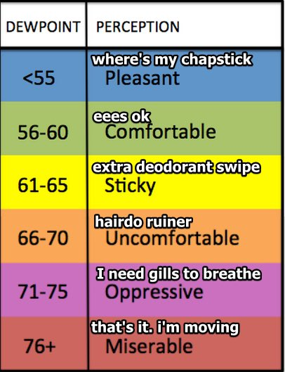
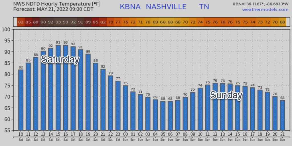
Highest heat and humidity combo of the spring expected today. High temps in the shade 93° with dewpoints 66° to 68°.

The May 21 record high is 94° (1941). We may tie it.
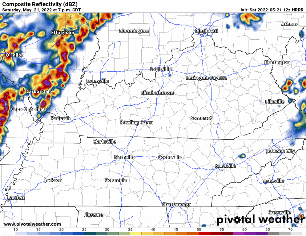
Rain/Storms are unlikely. A few model runs had storms popping up late this afternoon / early tonight, but most models think not. It’s totally possible tho so keep an eye on it.
Weak storms are likely after midnight. Lightning the most likely of potential hazards. Storms may stay organized long enough for a low probability hail/wind threat but think we’re too far east for that. CAPE will fall off and shear near zero. No tornado worries.

Rainfall will vary. HRRR has between 0.2″ and 1.2″, the average total will be 0.6″ or so.
HRRR thinks rain will be mostly done by sunrise. Most other high resolution models agree. Hang on to your Sunday plans, but maybe grab a jacket in case of a drizzle. A cold front will sweep in during the day Sunday, reducing/eliminating rain chances during the day.
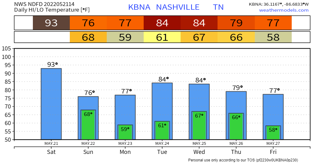
Check out the temp drop Saturday vs Sunday, high Sunday only 76°!

Next week temps are niiiice.

NWS-Nashville threw down this prose about next week:
Several waves of rain and thunderstorms are in the cards Tuesday through Thursday before a cold front sweeps through Thursday afternoon and evening. With sufficient instability around each day, strong storms seem plausible…especially on Thursday ahead of the cold front. Rain and clouds will exit later in the day Friday, leaving behind cooler and drier conditions. An early look at next weekend would suggest near to slightly above normal temperatures and dry conditions with high pressure in place.
NWS-Nashville, Morning Forecast Discussion, 5/21/22
Quick References:
Weather changes constantly.
Follow @NashSevereWx on Twitter for any changes to this forecast.
Live coverage during tornado and severe thunderstorm warnings:
Look good.
Support the mission.
We are 100% community supported. No ads. No subscription fees. Keep it free for everyone.
Categories: Forecast Blogs (Legacy)


You must be logged in to post a comment.