

Much cooler today. Tuesday, a warm front lifts in making things warmer and more humid.
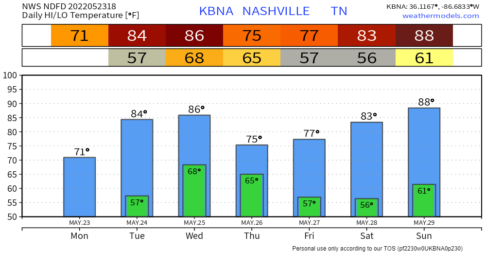
Next rain and/or storm event is Wednesday – Thursday.
Timing. A few models put in rain/storms here Weds morning. But I think the most likely ETA for rain is Weds afternoon and night. ETD Thursday after lunch or so, tho we may see drizzlers linger into Thu late afternoon/evening.
The Euro model agrees with all this, not a steady/continuous rain, but also not a one and done:
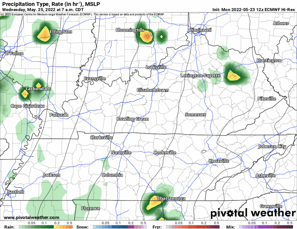
ETA and ETD are estimated, check back for timing adjustments.
Rainfall Totals. Rain heaviest Weds night overnight into Thursday morning. This is a soaker, 1″ to 2″.
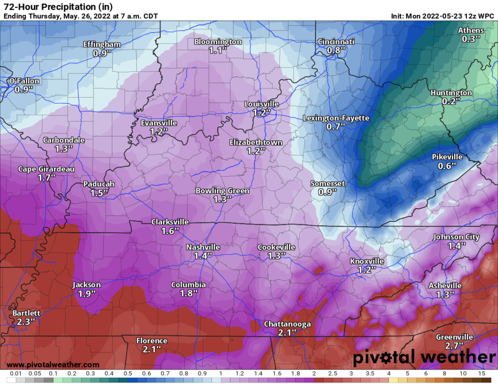
Rainfall rates do not appear to be heavy enough for flooding, but if this verifies expect rollyball field rainouts Weds and probably also Thursday.
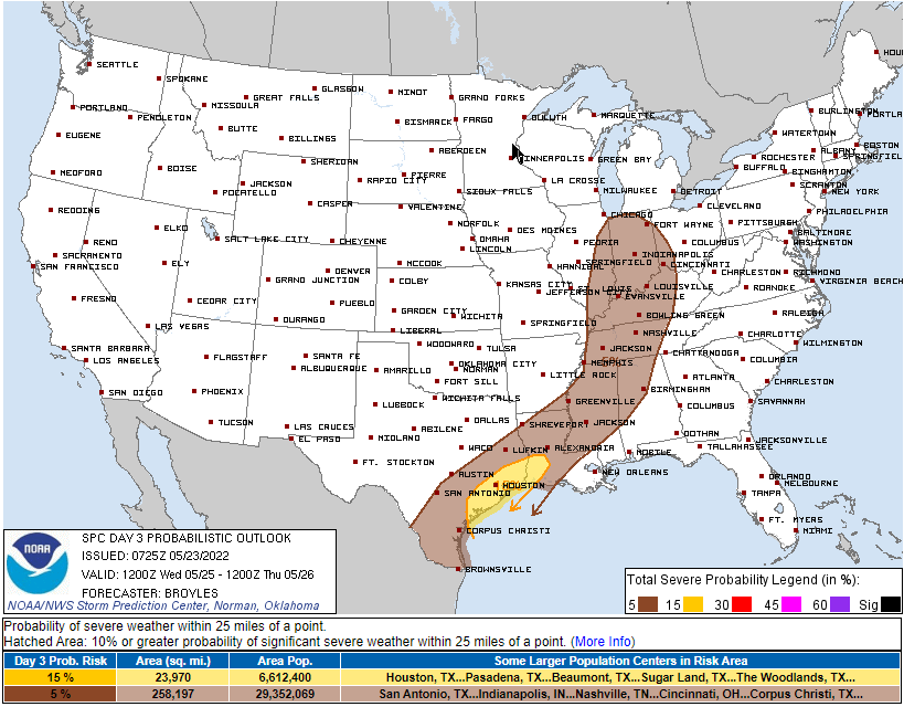
Bad Storms? Strong/Severe storms are possible during the Weds afternoon/evening main event — damaging winds and hail are the hazards. This hazard is conditional with low probability. SPC has us in its 5% probability for a severe event within 25 miles of us. Tornado? Meh/nah.
A cold front comes in Thursday and whacks the temps and humidity back down.
“Memorial Day weekend looks to be rain-free and increasingly warmer, with highs returning to around 90 degrees by Monday.” –NWS-Nashville.
Quick References:
Weather changes constantly.
Follow @NashSevereWx on Twitter for any changes to this forecast.
Live coverage during tornado and severe thunderstorm warnings:
Look good.
Support the mission.
We are 100% community supported. No ads. No subscription fees. Keep it free for everyone.
Categories: Forecast Blogs (Legacy)
You must be logged in to post a comment.