
Winds up to 30 MPH today. Humidity May-typical, Sticky/Extra Deodorant Swipe range today and Saturday:
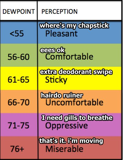
Sweaty / Boaty today and Saturday, hot under that cap and gown:
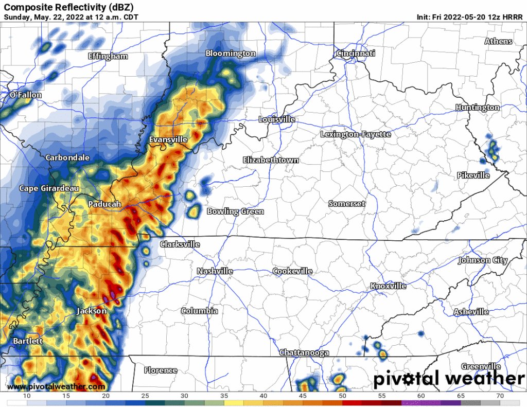
Rain/Storms may sneak in here Saturday late afternoon – early evening. 12z HRRR thinks so:
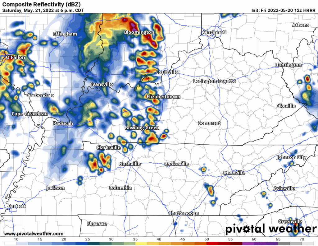
These should be thunderstorms, not expecting anything that bad, but lightning would be featured. Models don’t agree on this happening (the HRRR could be wrong!) but with the high heat, humidity, and other conditions it won’t take much to pop off these storms late Saturday afternoon/early evening.
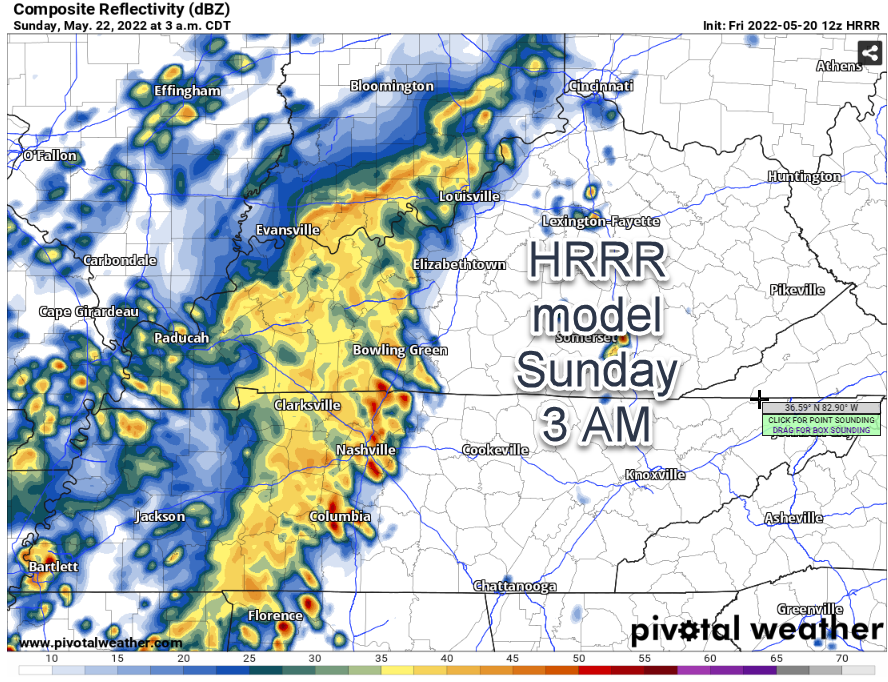
Main event is expected in the middle of the night Saturday night, technically Sunday morning. This is around 2-3 AM Sunday. Date, do not marry, this ETA.
Before sunrise Sunday is the ideal time for a cold front to shove storms through Middle Tennessee. CAPEs will be relatively low, there’s a huge Ned capping off the storm’s ability to tap that powerful surface based fuel, and shear is kinda meh.
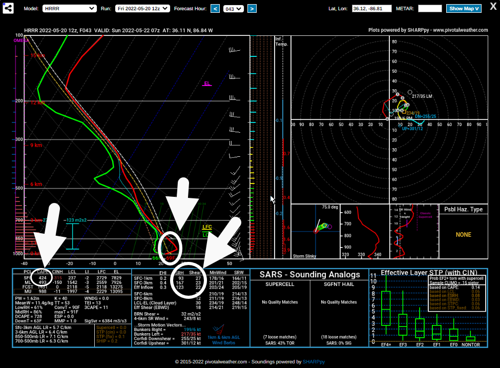
Still think we could get some lightning from this but severe storms are unlikely. Tornado is not a concern at the moment.
Sunday during the day is up in the air. The HRRR isn’t fully in range. The lower res Euro shows a boundary stalling right over us, causing off and on showers and storms Sunday afternoon and night – enough to ruin plans. But the NAM3 doesn’t, keeps us dry, but the NAM is *cough* not great. The GFS doesn’t have much rain after noon Sunday. WPC only tacks on another 0.2″. Sorry party planners, we’re in a weird spot forecastwise right now — the good high res models are just out of range (they start coming into range tonight) — and the demand for good data for weekend Sunday party planners is high. Think rain is a decent bet Sunday; NWS-Nashville has it “likely” for us Sunday afternoon and evening. But I think it’s just too soon to start making definite plans. I could see the heaviest rain coming in before sunrise with just a few spotty showers during the day. I would not trash my Sunday afternoon plans right now. More on this tonight as models get in range.
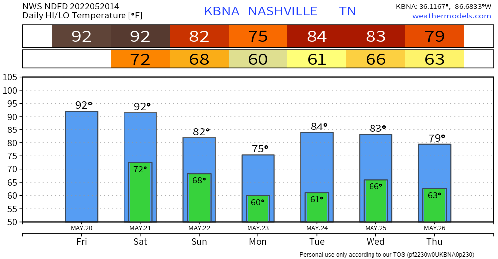
The good news is humidity and temps drop Sunday.
More rain likely Wednesday. We may end up with around 2″ total by Thursday. We kinda need it.
Quick References:
Weather changes constantly.
Follow @NashSevereWx on Twitter for any changes to this forecast.
Live coverage during tornado and severe thunderstorm warnings:
Look good.
Support the mission.
We are 100% community supported. No ads. No subscription fees. Keep it free for everyone.
Categories: Forecast Blogs (Legacy)
You must be logged in to post a comment.