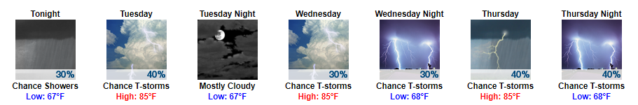
Periscope from 4 pm Detailing Latest Thinking on Rain/Storms
Harvey's Rain and Storm (low tornado) Potential Tonight. Review and discussion. https://t.co/Fo8v6jqeu2
— NashSevereWx (@NashSevereWx) August 31, 2017

Periscope from 4 pm Detailing Latest Thinking on Rain/Storms
Harvey's Rain and Storm (low tornado) Potential Tonight. Review and discussion. https://t.co/Fo8v6jqeu2
— NashSevereWx (@NashSevereWx) August 31, 2017
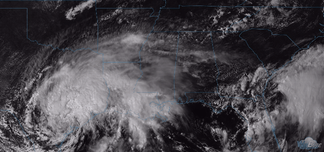
Harvey’s rain is arriving.
Current rain is just the beginning. Most of it (the "bulk" of it) will begin late tonight, heaviest rain for entire event ETA Thurs night. pic.twitter.com/dEr31qhoKP
Latest HRRR Model Loop
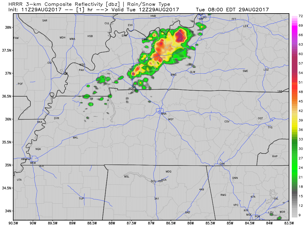
A weak upper level impulse will slide further south today, sparking showers and an isolated storm in Kentucky and along the KY/TN border. One or two of these may meander far enough south into Davidson County, but the chances are low. Temperatures will stay in the mid 80s for afternoon highs. Otherwise, expect some cloud cover around…as already evidenced by GOES this morning (also, note the fog around Nashville):
Majority of the rainfall has moved out over the course of this afternoon. We do have a few lingering showers around the area, but nothing that an umbrella won’t fix. For those with plans to head out to the Nashville Sounds game tonight, rain should clear by then. We may see a stray shower but nothing to worry about.
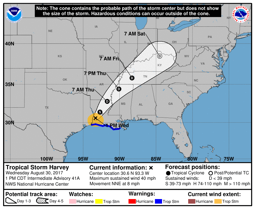
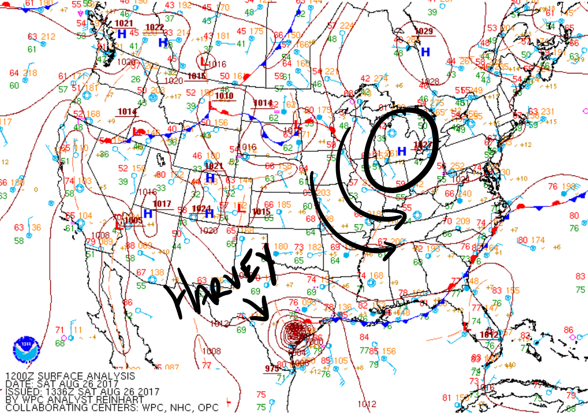
Harvey is sitting and spinning in Texas. It’s so large, high cirrus clouds are spinning off into Middle Tennessee.
Harvey is flooding Houston, rivaling and exceeding our May 2010 flood.
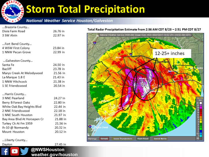
By comparison, here were our totals in 2010:
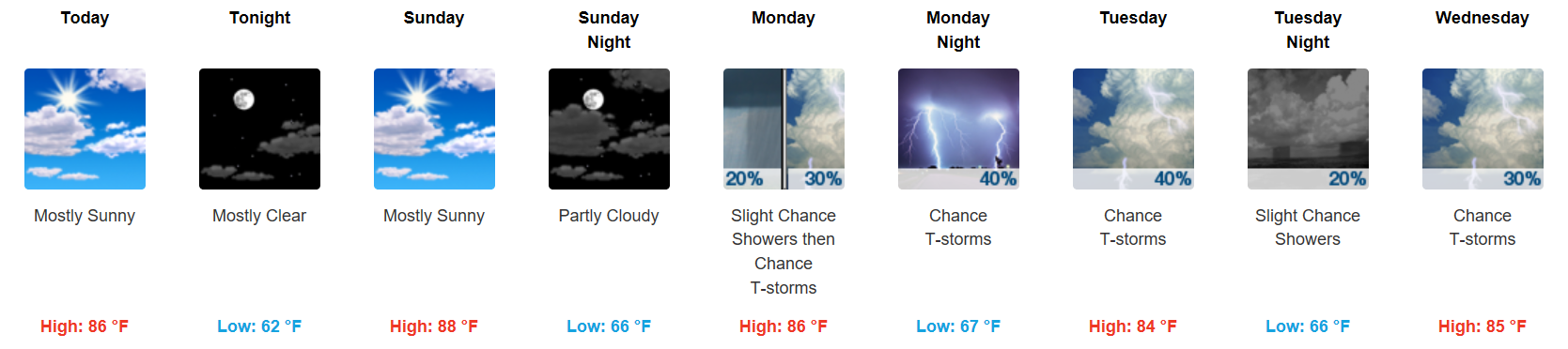
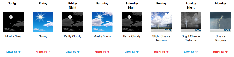
Sunday, humidity will rise a bit (not too bad). Mid-level moisture blowing off the top of Harvey (centered now in Victoria, Texas) may sneak in some clouds and shower, but no model really thinks it’ll rain enough to bother outdoor plans. It probably won’t rain at all, but don’t be surprised if we get a little.
Canada is good for bacon, hockey, and lots of other things…including high pressure!
West-northwesterly flow, thanks to the Canadian high, will continue to filter in through the remainder of this weekend. Dry conditions will prevail, with sunshine bumping afternoon temperatures Sunday into the upper 80s. Overnight lows will be a bit cool, hovering in the low to mid 60s.
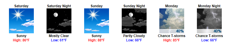
Things really can’t get any better than this for Middle Tennessee as we near the end of August. Highs in the mid 80s, dew point temps in the mid to upper 50s, and no rain chances over the next few days.
What more could you ask for in late August? We can thank northwesterly flow aloft for this drier, cooler pattern. The GFS, among most other models, agree that this great weather stretch will last through a portion of Sunday:
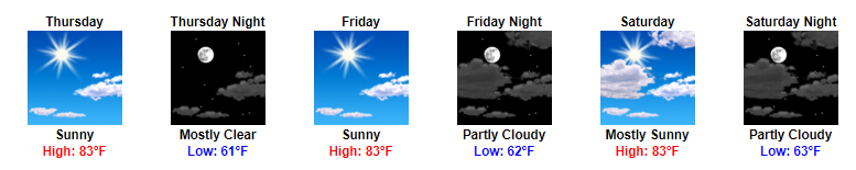
Say goodbye to those highs in the 90s and say hello to cooler and drier temps over the next several days. Following yesterday’s cold front, expect for highs to only reach the low to mid 80s now through the weekend.
You must be logged in to post a comment.