Nice Friday Ahead, Warmer and A Few Storms This Weekend

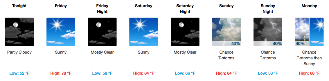
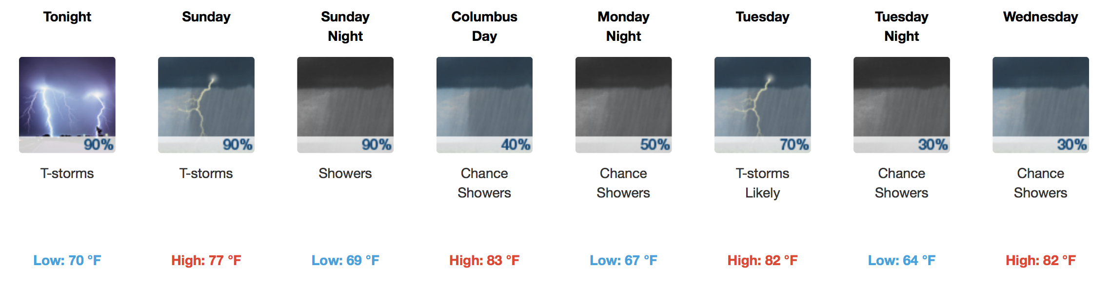
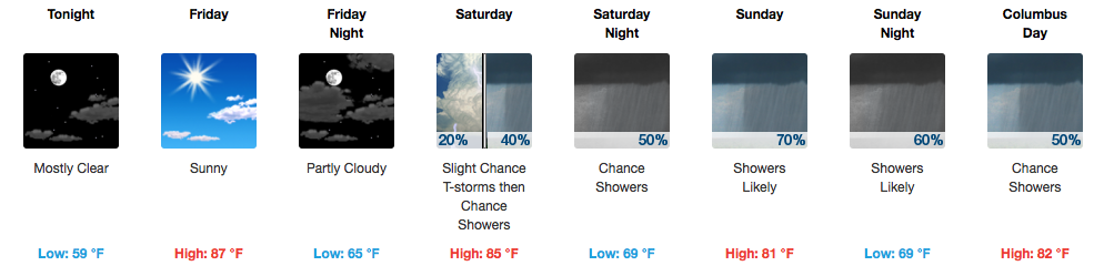
NOTE: Barring a partly/mostly clear nighttime, fog could develop and be around for tomorrow’s morning commute.

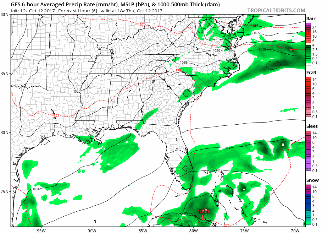
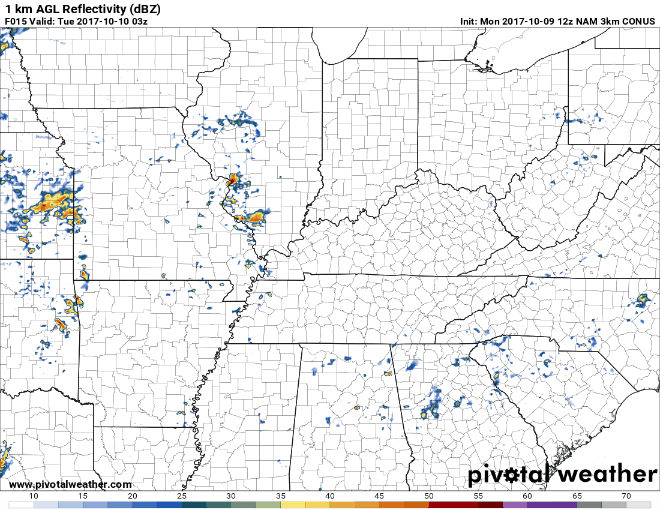
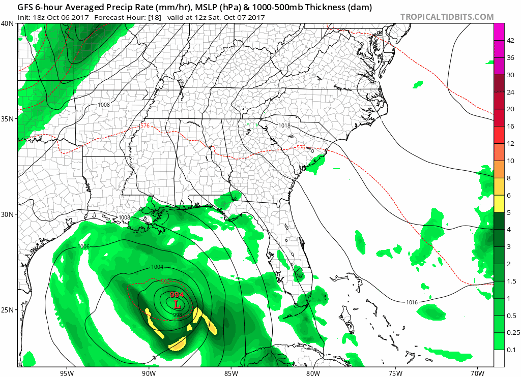
GFS Model Loop through Sunday Morning

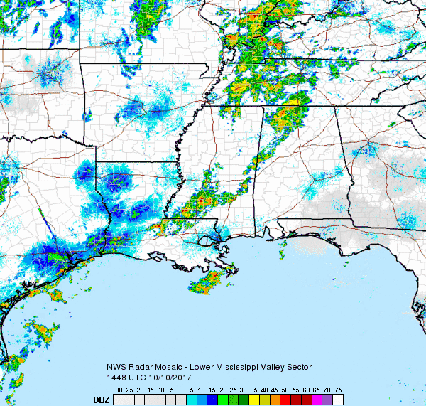
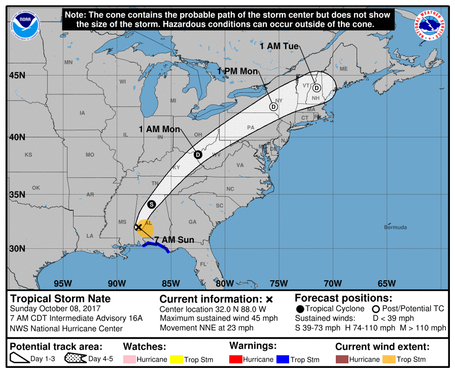
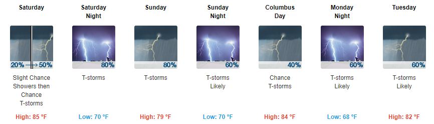
We will remain dry through Saturday as high pressure continues to hold in place through then. Flow will become southerly on Saturday, so expect temperatures about 10-12 degrees warmer than they are today (middle 80s). read more

Cooler Temps for Now, Warmer Temps Return Friday

No Measurable Rainfall Through the Rest of the Week

Temperatures will remain near normal into tomorrow. Unfortunately, these cooler temps won’t last that long.

https://giphy.com/gifs/diorandi-the-orchard-dior-and-i-3o6ZtifZvaatBm2hMI

Just like that, temps will jump back into the 80s on Friday and stay in the 80s through the weekend. Sunny skies look to hang around through at least the first half of the weekend, with no measurable rainfall in the forecast through Saturday. read more

Stormy Today, Great Looking Week and Weekend Ahead

Gloomy and Rain-Filled Tuesday

Regional Radar 11:30AM CDT

Rain has encompassed much of Middle Tennessee this morning and another heavier batch is moving in from the west for the lunch hour. Plus or minus a few more showers after this next rain swath, we will be largely done with measurable precipitation by late afternoon/evening. The HRRR is in good agreement with this scenario. read more

Showers Return Late Tonight/Tomorrow, Dry for the Rest of the Week

Showers Possible Starting Late Tonight, a Few Strong Thunderstorms Possible Tomorrow Afternoon

Scattered showers look to start sometime late tonight and last throughout the day tomorrow.

NAM3 Loop 10PM Tonight Through 7 AM Wednesday 

You may want to keep the umbrella handy throughout the day. read more

Later Nate. Storms Possible Tuesday.

As sunset sped west (the sunset is the white stuff coming in from the right), what’s left of tropical depression Nate was speeding just southeast of us.

Nate’s hurrying toward Pennsylvania tonight and tomorrow morning, taking its rain with it. The HRRR model illustrates: read more

Off & On Rain from Nate Today; Storms Tuesday

Hurricane Nate made landfall on the northern Gulf Coast.

Nate’s now a tropical storm, speeding northeast into Middle and Eastern Tennessee. The center of Nate should pass east of us.

Rain

Off and on all day. read more

Hurricane Nate To Make Presence Felt In Middle Tennessee

Soggy Weekend and Start To the Work Week

Some fast moving showers have popped up over Middle Tennessee this morning, in addition to extra cloud cover. A gradual increase in rain coverage is expected today as moisture pumping in from the Gulf of Mexico and Hurricane Nate aid in shower development. Additionally, a frontal boundary will spark off a few storms after dark tonight. read more

Last Bit of Sunshine Today, Monitoring Showers Starting Tomorrow

Scattered Showers Starting Tomorrow, Keeping an Eye on Tropical Storm Nate

Let me start by saying that there are still a lot of uncertainties surrounding Nate’s track and how the remnants will eventually impact Middle Tennessee. Ultimately, we will see showers, and sometimes showers will be heavier than others. read more

Quiet to End the Week, Tropical Remnants Bring Rain For the Weekend

Two More Days of Nice, A Weekend Spent With Nate

Sunny skies and mid-upper 80s are two phrases you’ll only find in the late spring and early fall, but to have 5-6 days of it in a row has been quite the gift. Unfortunately, the sunshine and “relaxed” weather pattern will come to a screeching halt this weekend, thanks to an active Gulf of Mexico. Southerly flow is expected to return in full force tomorrow, ushering in added moisture and warmth…consequentially leading to increased cloud cover and a small chance for an afternoon thunderstorm. read more

Sunshine Continues, Keeping an Eye on Showers for the Weekend

Highs in the 80s, Dry & Sunshine

High pressure remains well in control of our area and looks to stay that way through at least Friday. This will keep our temps above-average in the mid 80s with overnight temps falling into the upper 50s. read more