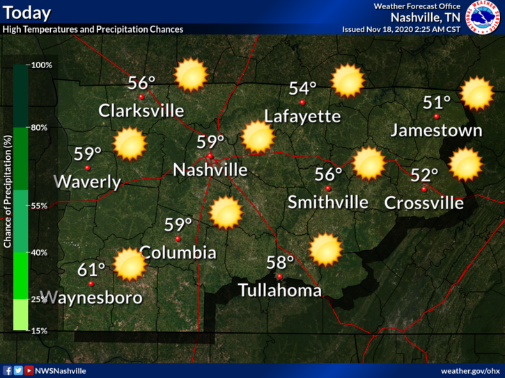
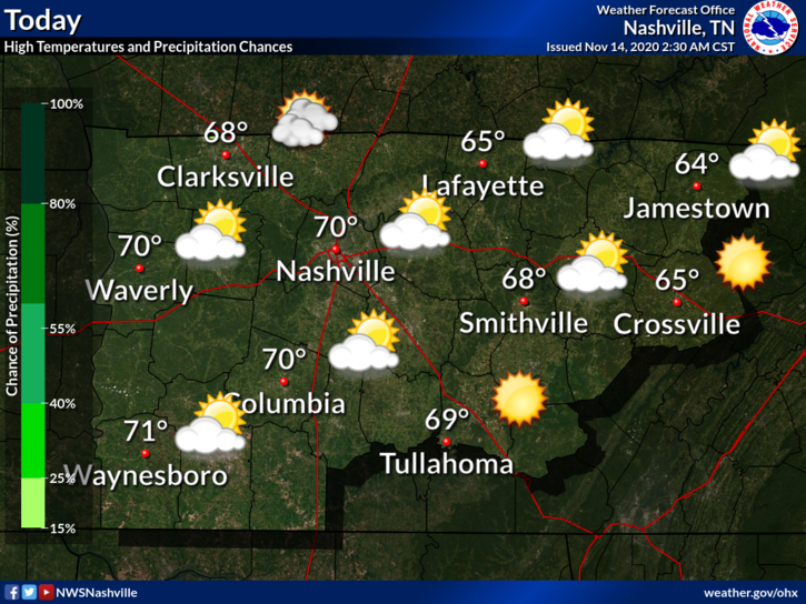
We’ll hit 36° at BNA early Tuesday morning, many of us will be colder so expect frost and a few hours of freezing Tuesday morning. Clouds and a south wind will warm us up Tuesday as we watch the next storm system expected Wednesday.

We’ll hit 36° at BNA early Tuesday morning, many of us will be colder so expect frost and a few hours of freezing Tuesday morning. Clouds and a south wind will warm us up Tuesday as we watch the next storm system expected Wednesday.
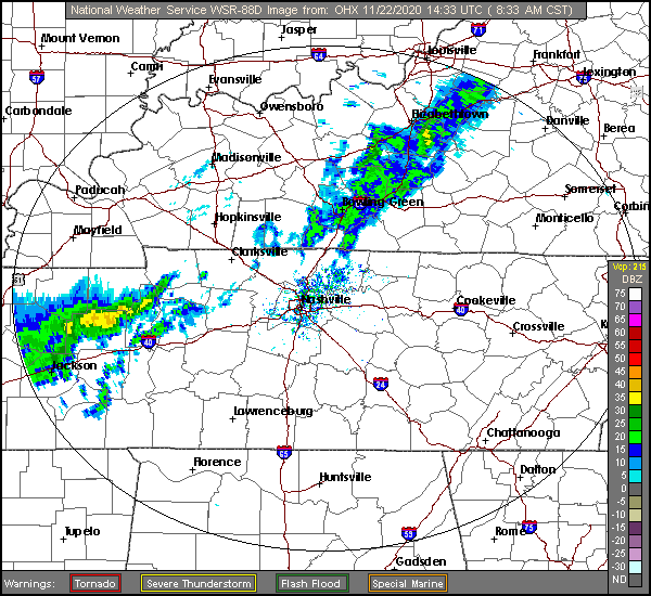
Radar as of 10:22 AM:
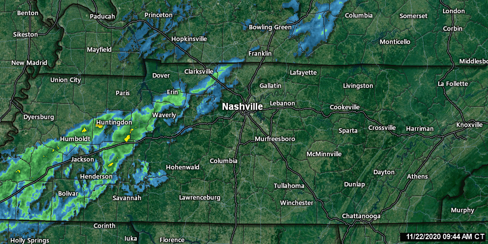
You can check updated radar scans here.
The HRRR model predicts rain this afternoon. It looks like it’s predicting more rain than we see coming on radar:
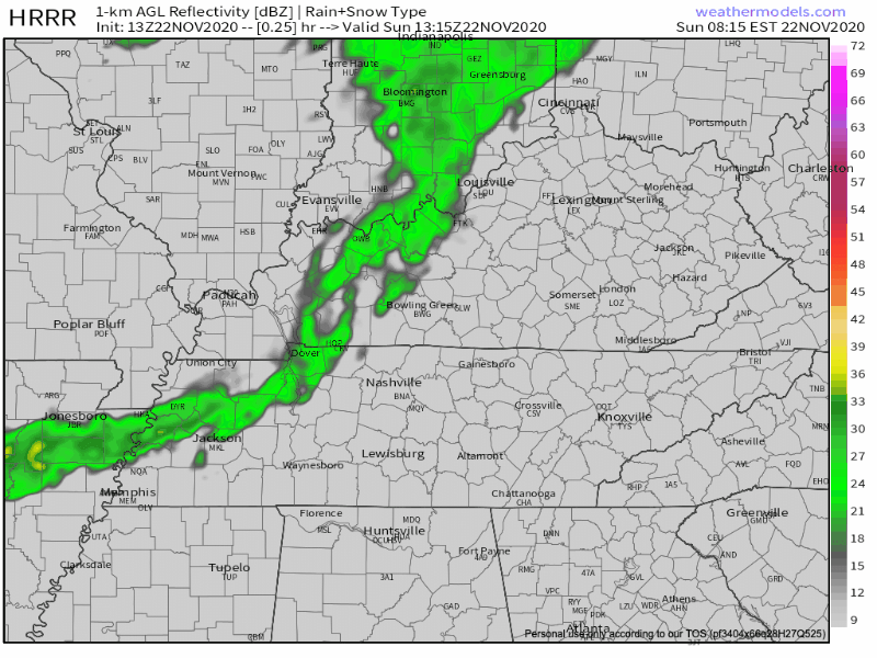
The rain should end around dark. HRRR model is showing about 0.4″ or so (below), but expect less than that. NWS-Nashville expects about 0.25″.
Clouds will begin to make their way into the area this morning.
We should be looking at dry conditions through this afternoon, but can’t rule out a stray shower popping up in your backyard. High of 70. Saturday is forecasted to be the nicest of the weekend.
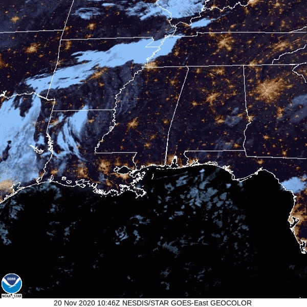
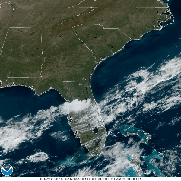
Sun will prevail this morning before some clouds move in this afternoon. You can see them hanging out over West Tennessee in this morning’s satellite imagery:
Winds may pick up to 10-15 mph today.
High temperatures will approach 70º. This will be closer to the record (78º) than it will be to the average:
It’s Friday Eve! We’re warming up today with a high 69 degrees and clear, sunny skies.
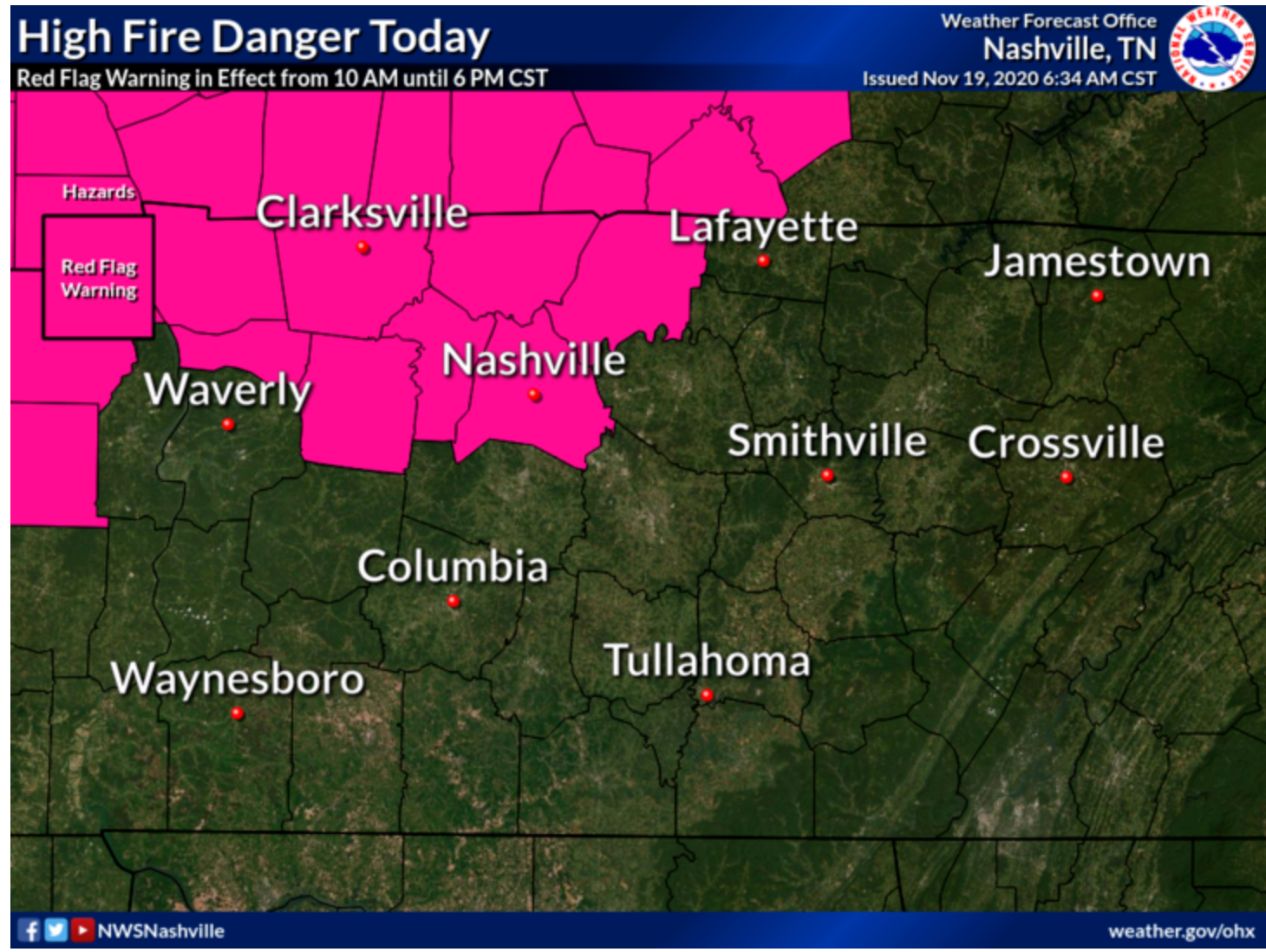
It’s quite windy today due to a south wind at 10-15mph gusting as high as 35mph.
Due to these dry and windy conditions today, fire danger is high putting Davidson County in a Red Flag warning from 10am-6pm.
Few degrees warmer than Tuesday with a high approaching 60 and bright sunshine.
Notice the “Blue H” over Kentucky.
If you’re a dry weather fan, that “H” is your friend. It prevents air from rising, which is how showers and thunderstorms form.
“Our best guess is that Jordan is in the area immediately near his home in Joelton, but the reality is he could be anywhere….Search your property….Even if you see something that looks out of place and you think this isn’t significant, it might very well be significant.” See the video below. They think he may be in a shed, outbuilding and they’re asking Joeltonians to search your property, look under a car.
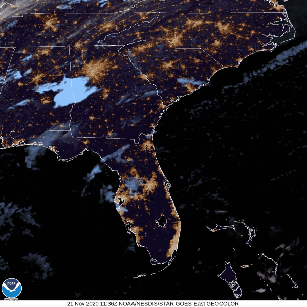
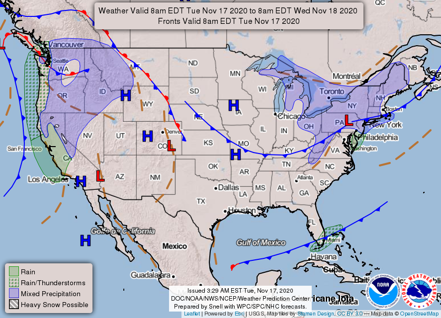
The cold front that brought us strong wind and rain Sunday morning is down in Florida.
The big blue H is high pressure. It’s in charge, causing sunshine and cold mornings this week.

Lows will flirt with freezing in the mornings this week but then we’ll start warming into the weekend.

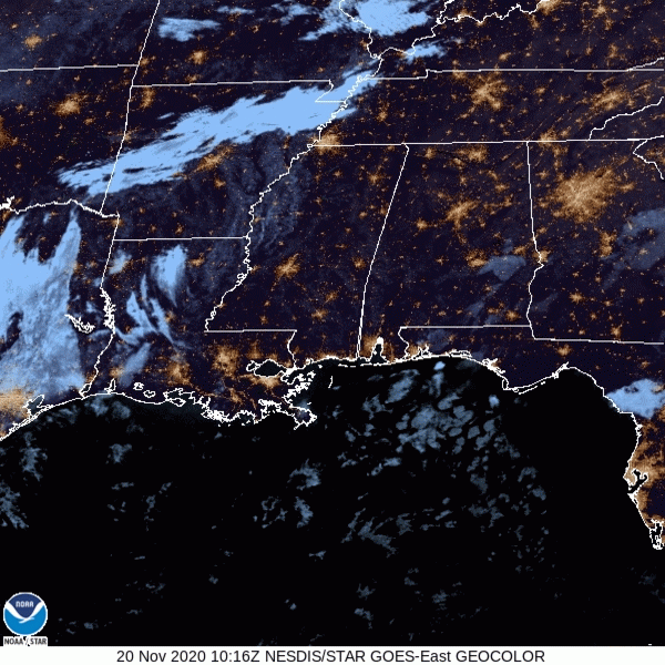
You may have heard some rain and wind this morning when you woke up.
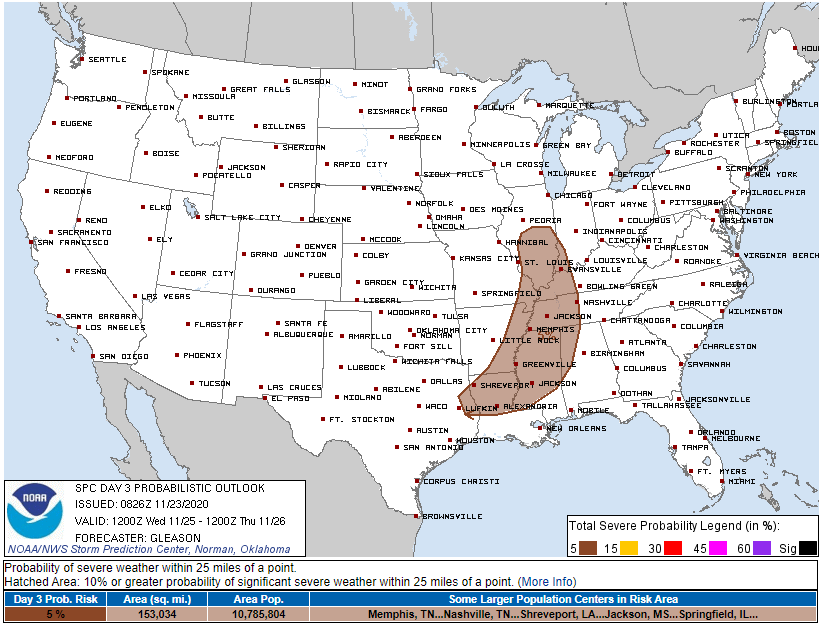
That came from a cold front moving through the area, which will give us a cool down this week. November cold fronts like the one we just had often cause severe weather. Not this time, because moisture and instability was lacking.
No rain during the day. Mostly sunny and 70!
A wind advisory has been issued for the overnight hours.
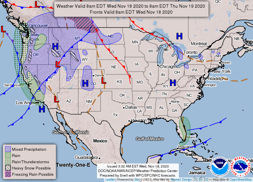
A cold front will swing through overnight. Showers and possibly a thunderstorm will accompany it.
ETA? HRRR Model predicts a broken line of showers between 2AM-7AM, although a stray shower before then is possible.
You must be logged in to post a comment.