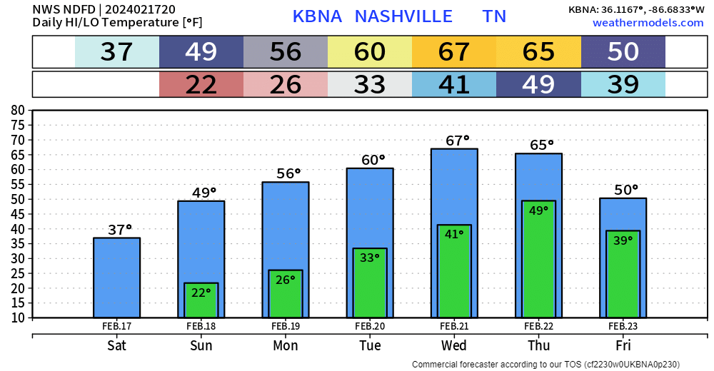
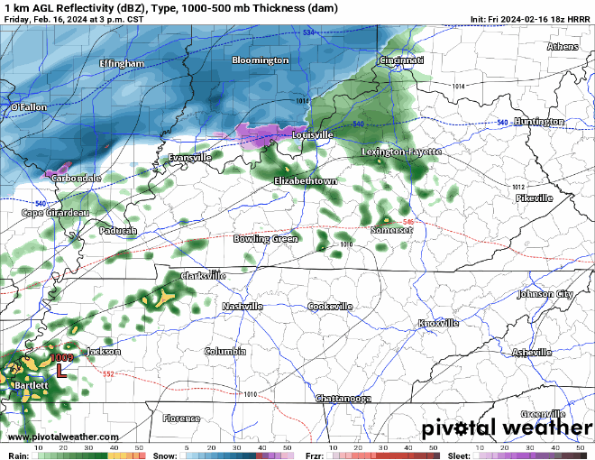
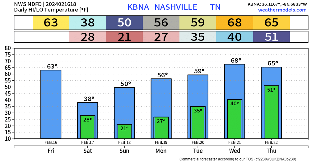
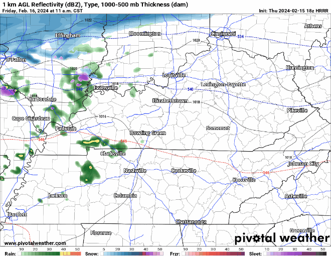
High temps again in the upper 90’s today, with heat index values pushing 🥵109°🥵 = Heat Advisory from 11am – 7pm.
If you have to be outside, take it easy with frequent hydration breaks. Or pool.
We have three consecutive days of severe weather chances and/or dangerous heat. Let’s discuss.
Both counties are under a Severe Thunderstorm Watch until 4pm today. Main concerns are damaging straight-line winds and hail. Not concerned with tornadoes. Updates are constantly flowing, stay connected to our Twitter for frequent updates.
If you have yard work, (crunchy) grass to mow, today and tomorrow are the days. No rain chances.
Thursday thru Saturday high temps will be flirting with the century mark.
An Excessive Heat Watch has already been issued for Thursday. I imagine one will be issued for Friday and Saturday. “Dangerously hot conditions with heat index values up to 113° possible.”
Majority of morning round of showers/storms missed us to the east. Still can’t rule out a couple stray showers/storms.
The absence of rain this morning will allow our temperatures to get into the low to mid 90’s this afternoon, paired with dewpoints in the low 70’s = heat index values around 100°. Take breaks if you have to be outside.
Today and Friday will be similar. Low Wattery chances, temps slightly below average. Not too shabby for late June.
Saturday our weather pattern shifts. Rain chances clear out and it’ll start to feel like summer. Heat index values will start to push the upper 90’s. These numbers will relax a bit as we get to Tuesday and Wednesday, as the dewpoints will go from the low 70’s to the mid 60’s.