
Splendid day today, unfortunately the same cannot be said about the forecast for tomorrow.
The HRRR model, displays what it thinks the radar *could* look like tomorrow.
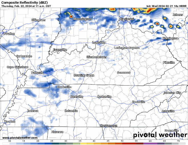
- scattered showers begin late Thursday morning and continue thru the afternoon, NBD
- heavier rain, and maybe a few storms push in later, current ETA ~7 – 9 pm (subject to change)
- at the time, our severe threat remains very low, however…
- “So maybe a strong thunderstorm here or there producing small hail and gusty winds below severe thresholds, but do not expect an organized strong convective event as of this time.” – NWS Nashville
- weather can change, so we’ll keep an eye on it and keep you updated
- rainfall totals look around 0.2 – 0.3″
We’ll dry out Friday and should get away with a dry weekend except maybeee some light, quick showers Saturday morning.
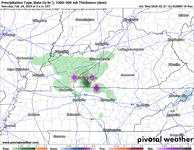
Euro model (above) shows the possibility of light showers Saturday morning. These will be no big deal and get on outta here quickly. The plateau is the only place that could see some wintry mix, we will be above freezing in our neck of the woods.
Speaking of Saturday…that’s the big day for SWAD. Should be a hoot. More info below.
Saturday will be cooler than what we’ve been dealing with, but we’ll quickly warm up.
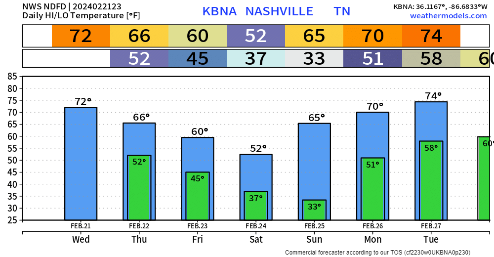
We even reach the low to mid 70s by early next week. End of February looks like it could get a little stormy…still wayyy far out, things will likely change.
Categories: Featured Blog