
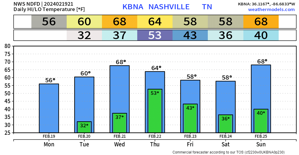
Warm + dry weather expected the next two days. High temps get into the low 60s tomorrow, and even surge into the upper 60s Wednesday.
Our relative humidity values will be in the low to mid 20% range Tuesday and Wednesday, but thanks to recent rains and light winds (besides Wednesday), our fire danger will remain very low.
Breezy conditions will come around Wednesday afternoon and continue Thursday (before the rain arrives), gusts up to 25 – 35 mph are possible.
Thursday rain returns, with maybe a few storms.

Euro model (above) shows:
- rain moving in Thursday mid-morning or so
- heavier rain and maybe a storm Thursday evening
- as of right now, no severe weather is expected due to limited moisture and CAPE (storm fuel)
- however, some small hail (below severe limits) may be possible
Things can always change, so we’ll keep an eye on it.
We’ll “cool” down a bit Friday and Saturday, and quickly warm back up Sunday. Looks like a dry weekend ahead.
Above average temperatures will likely stick around thru the end of the month, including the extra day we get.

Categories: Featured Blog