
A bit chilly today, but it could be worse. Lows will dip into the upper 20s tonight, brr.
Good news is that we will quickly warm up to start off the week.
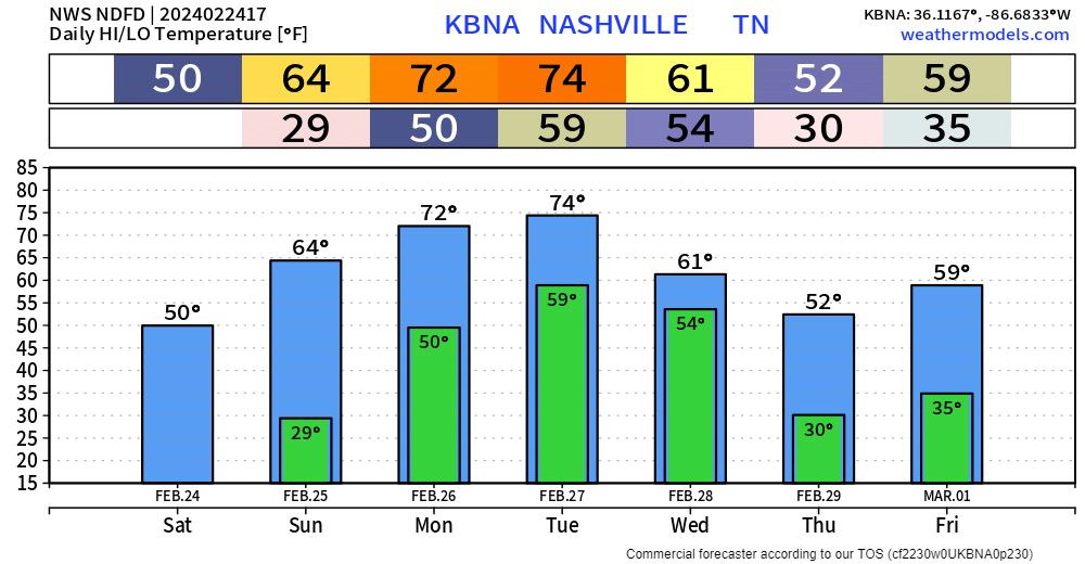
Mid 60s on Sunday, getting into the low to mid 70s on Monday and Tuesday.
A few light, quick showers are possible Sunday morning – most of us will stay dry.
Showers are also possible throughout the day Tuesday – but want to focus in on the possibility for severe weather on Wednesday.

The Storm Prediction Center has outlooked both of our counties with a 15% chance of severe weather within 25 miles.
This is 5 days out, so there is quite a bit of uncertainty with this system.
Per usual, this far out, the two big global models, the GFS and Euro, agree on a few things, but disagree about a lot.
The timing of this system is still up in the air. The EURO model thinks a line of storms arrives Wednesday morning, the GFS thinks the line holds off until the afternoon. Wayyy too far out to know which one is right, if either of them are – they could both be wrong.
Timing, threats, info may change as we get closer to the event. More models will come into range in the coming days and we’ll get a better idea of what this system will bring us. For now, keep checking back up for updates, stay informed – help other people who may be unaware become informed.

Remainder of the week looks calm and cool.
Categories: Featured Blog