
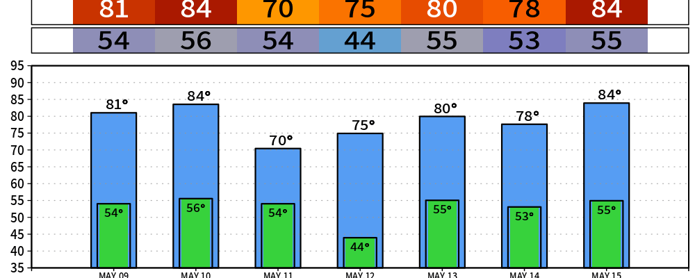
Beautiful weather coming this weekend.
The only wrinkle is a round of showers and a few thunderstorms Sunday afternoon into Monday morning, and even that looks pretty tame.
NWS-Nashville’s key messages back this up:
Warming this weekend with highs mostly upper 70s and lower 80s. Medium to high rain chances Sunday afternoon into early Monday. No hazardous weather through the next 7 days.
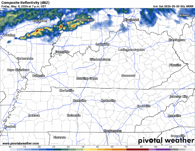
On Saturday, there might be an rogue cluster of showers that comes in early morning. You can see that in the first few frames of the HRRR above. Likely you won’t notice anything.
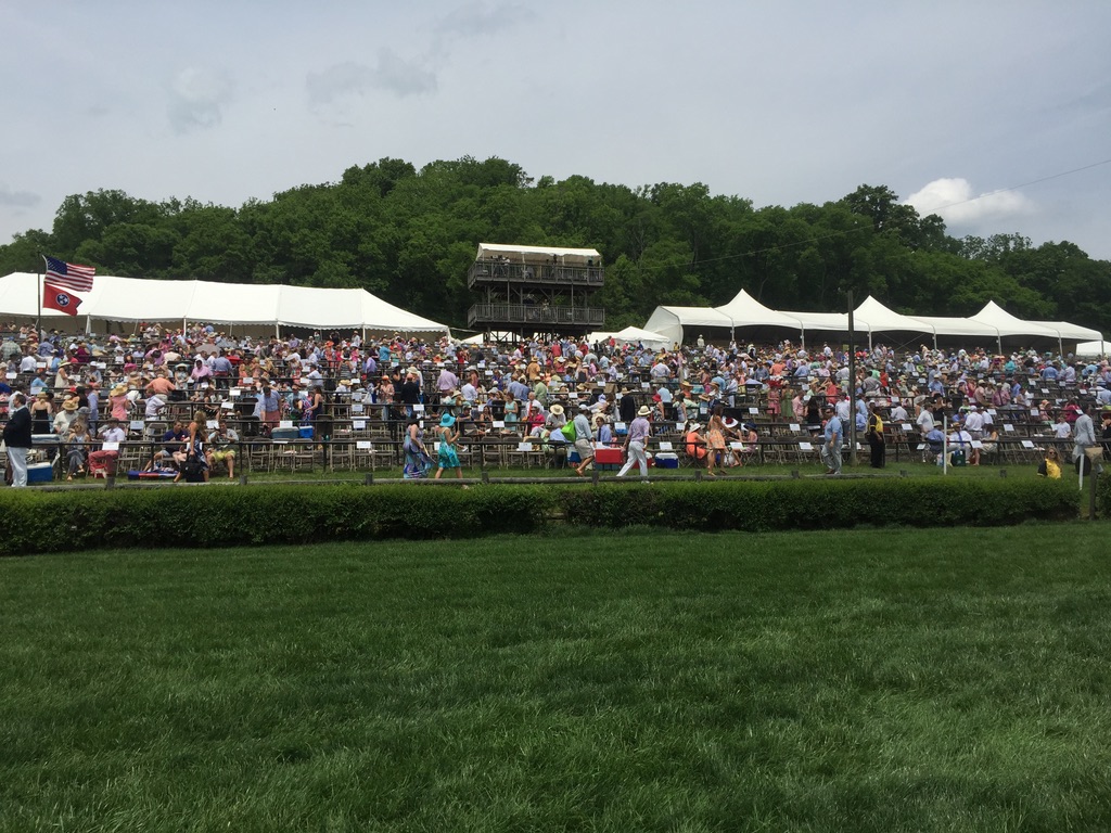
If you’re heading to the Iroquois Steeplechase at Warner Park, pack your sunscreen. UV will be around 8 at it’s peak. It will be a beautiful day at the races. Hydrate!
Mother’s Day
Expect patchy fog early Sunday, then a chance of showers and storms developing Sunday afternoon and becoming more likely Sunday evening into the overnight. High Sunday near 84 before the front, low around 55 behind it. Not the best weather day for Mom but the heaviest rain will likely wait until the afternoon. Below the HRRR is looping from 1pm-7pm. Not awesome.
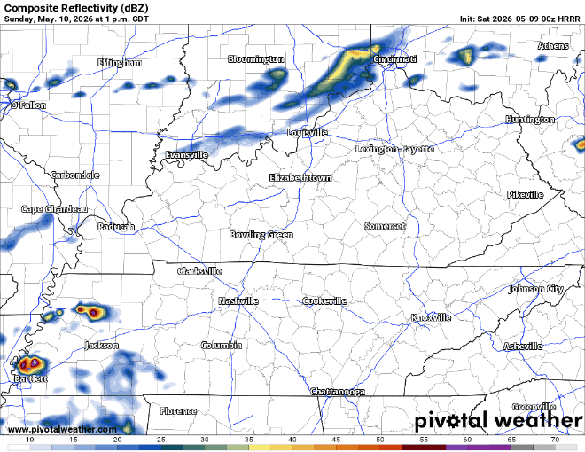
This is not a severe setup — moisture and other parameters are unimpressive, and most spots end up with less than a quarter inch of rain. So: bring the umbrella for evening plans Sunday, but you do not need to rearrange your weekend around it.
The Rest of the Week
A leftover shower is possible before about 7 a.m. Monday, then we clear out. Monday turns breezy and noticeably cooler behind the front: mostly sunny, high near 71, north wind 10 to 15 mph with gusts to 25. Then another front sliding through late Tuesday into Wednesday with a low rain chance, then seasonable 70s for the rest of the week before temps creep back into the 80s heading into next weekend.
Categories: Featured Blog