
Current Temps and Radar

First, a PSA:
Observe the top of the car following you. If you’re not sure it’s clear, it is a good idea not to follow too closely.
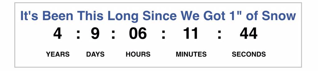
Is the Snowdome Dead?We thought so this morning. We stopped the #Snowdome clock this morning at . . .


You must be logged in to post a comment.