
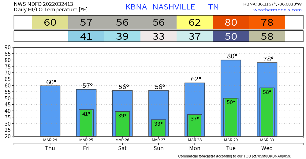
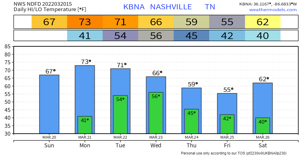
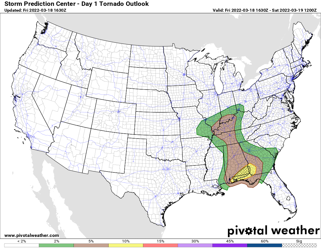
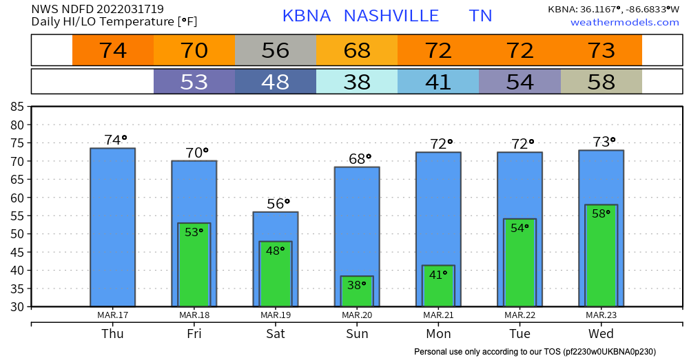
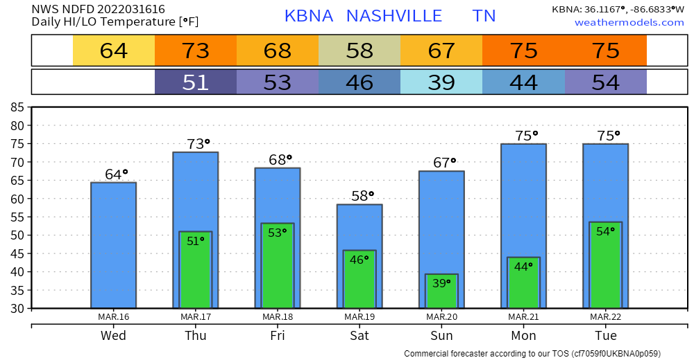
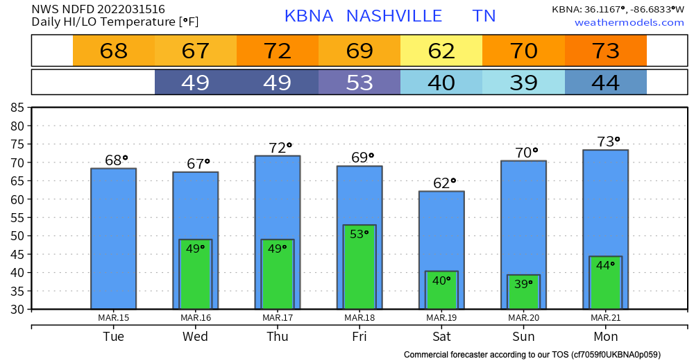
A slight cooldown from yesterday to today. Likely won’t break into the 60s again until next week. The same goes for rain.
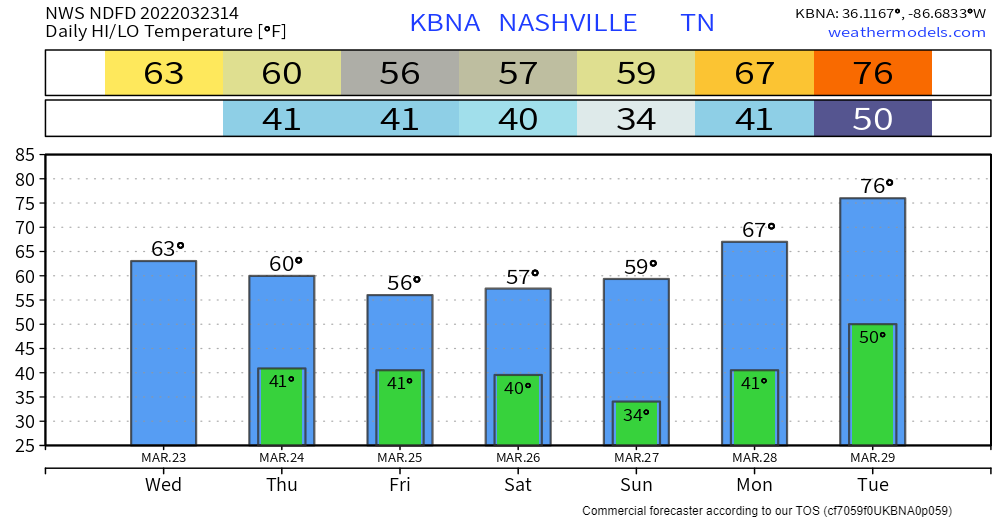
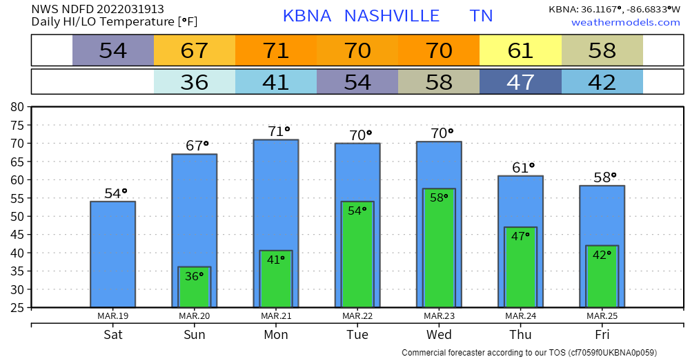
Most interesting thing about today is the wind… could see gusts up to 35 mph! That’s about as unsettled as our current weather pattern gets for awhile.


You must be logged in to post a comment.