
Happy first day of Spring!
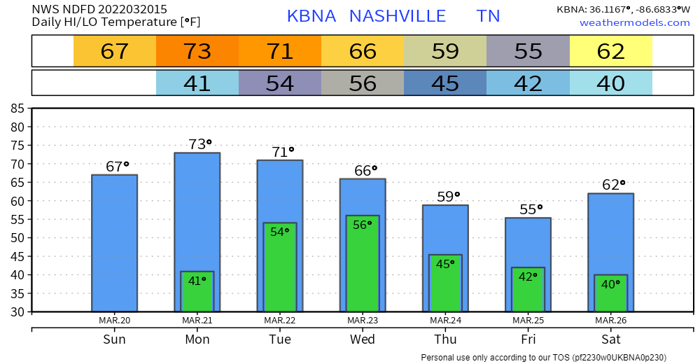
The dry weekend will continue into today. Lots of sun, no rain, temps in the 60’s. Tomorrow is a repeat of today with slightly warmer temps.

Rain returns Tuesday. A powerful storm system to our southwest will move south of us and eventually bring us not severe weather, but heavy rain.
WPC has us in the 15% chance of flash flooding within 25 miles of us zone.
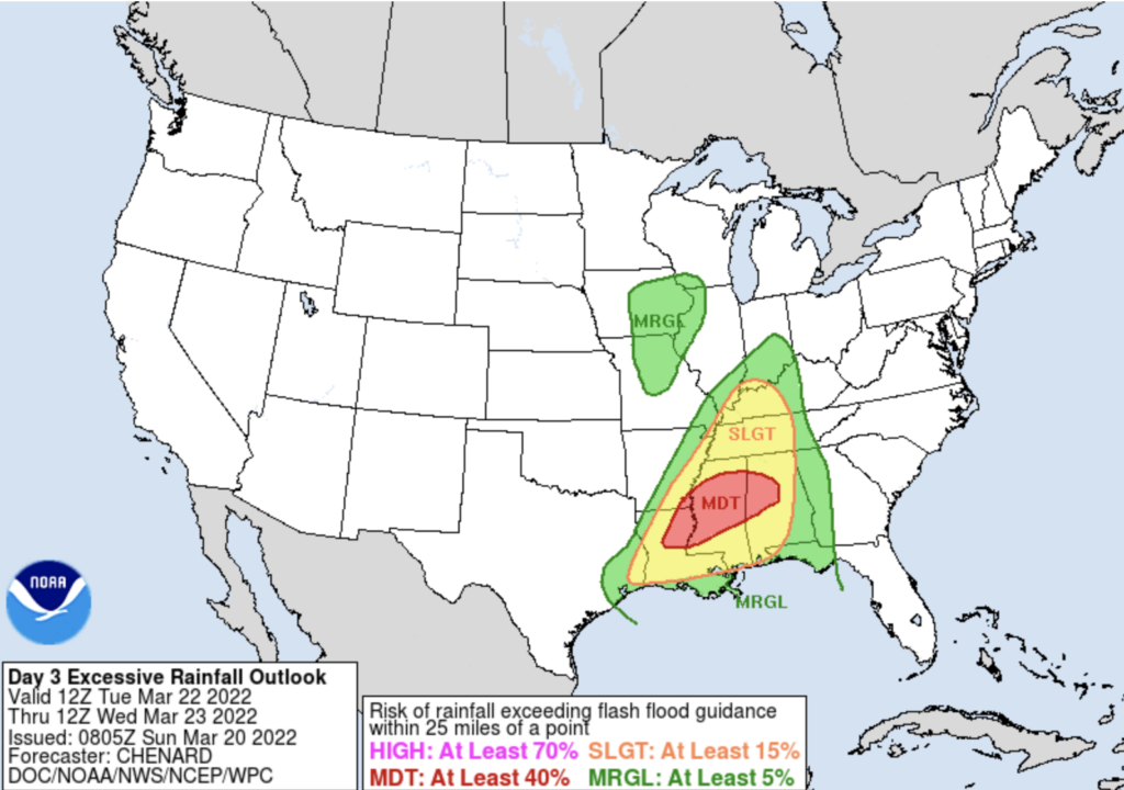
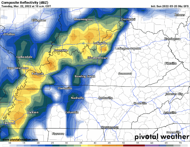
The timing on this event appears to be early afternoon Tuesday through the evening. Washout day, yay! See the GFS current ETA below:
The good news: severe stuff should be well to our south. This doesn’t mean you won’t see lightning or hear thunder, but it does mean you can tell your storm anxiety to chillax.
If the system tracks more north this changes things, but for now there is no need to worry about severe weather. Models have consistently kept the severe worries south.
We’ll keep you updated as we get closer to this event!
Cold mornings are not over. Cold fronts often follow big rain/storm events.

Quick References:
Weather changes constantly.
Follow @NashSevereWx on Twitter for any changes to this forecast.
Live coverage during tornado and severe thunderstorm warnings:
Look good.
Support the mission.
We are 100% community supported. No ads. No subscription fees. Keep it free for everyone.
Categories: Forecast Blogs (Legacy)
You must be logged in to post a comment.