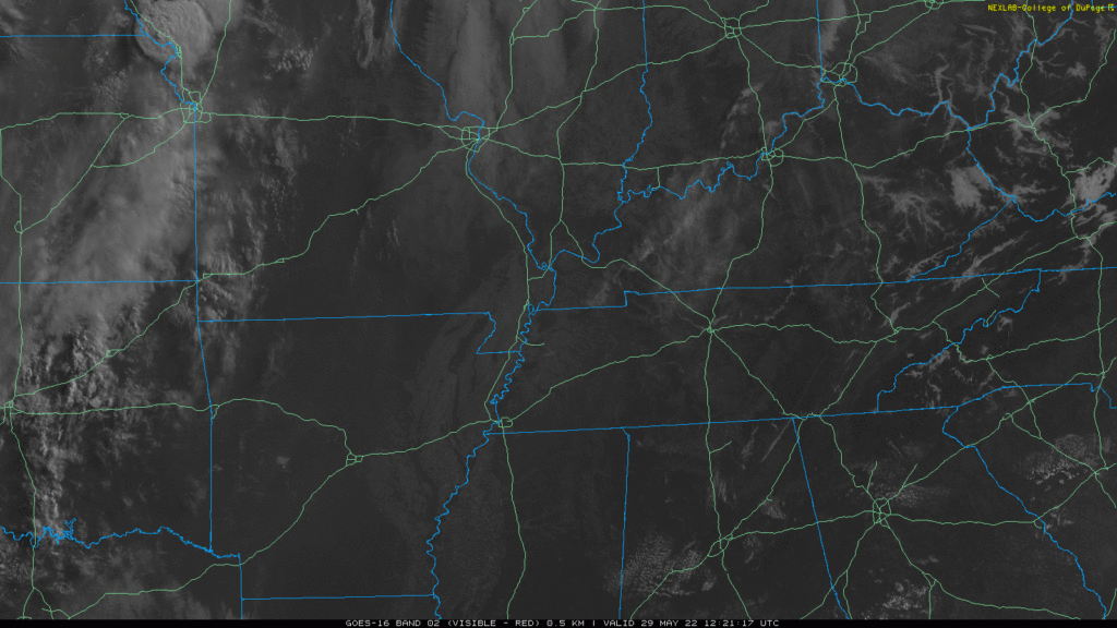
No sunblocking local clouds anywhere on satellite as I write this.
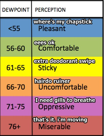
Dewpoints will top off in the low 60°s this week until a cold front comes through sometime Thursday and cuts it into the upper 50°s by Friday.

No sunblocking local clouds anywhere on satellite as I write this.
Dewpoints will top off in the low 60°s this week until a cold front comes through sometime Thursday and cuts it into the upper 50°s by Friday.
Clouds lingering this morning will determine the high temp.
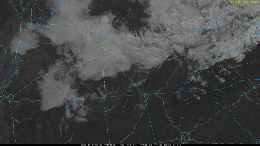
NWS-Nashville thinks they’ll hang around long enough to keep the high temp at 78°. We’re even getting sprinkles out of them. They should dissipate this afternoon. If clouds mix out sooner than that we should have no trouble getting into the 80°s.

A few light showers may streak through today, no big deal.
Today and Saturday we get relatively cool temps, low humidity. Then Sunday the oven is turned on and we start to bake.
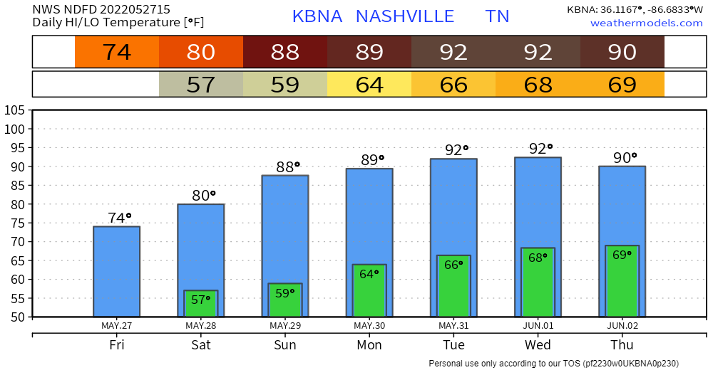
Memorial Day weekend pretty much ideal. No rain in the forecast anywhere. Dewpoints at or under 60°.
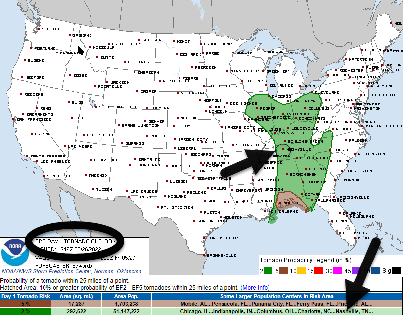
The probability of a tornado within 25 miles of us today is 2% per the SPC tornado outlook:
The damaging straight line wind probability is 5%. We are not outlooked for 1″ hail. For flash flooding it’s 5% to 15%.
Flash flooding is a low probability threat today (5% to 15%).
→MRMS radar estimates 1.5″ to almost 2″ fell over the past 24 hours in parts of Will Co and Nashville. CoCoRahs data shows measured precip, it shows around 0.5″ to 1.5″:

→ No reliable information tells anyone exactly when or where (Halsey concert, baseball games, whatever) it is going to rain or storm tonight. It may not storm at any one location.
→ You should be prepared for rain and storms. Most of us will be probably be fine, or slightly inconvenienced by weather. No data suggests a total washout/stormout for us tonight.
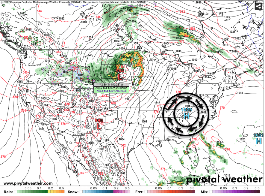
Much cooler today. Tuesday, a warm front lifts in making things warmer and more humid.
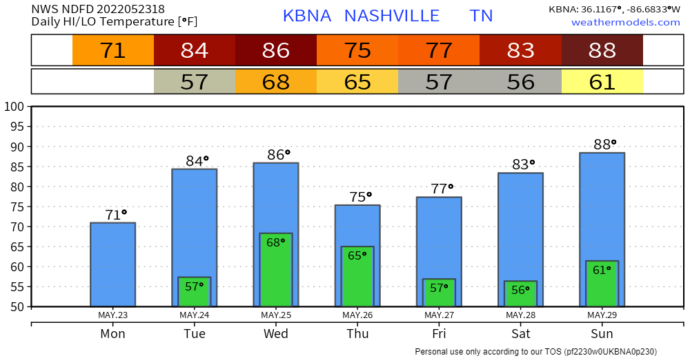
Next rain and/or storm event is Wednesday – Thursday.
Timing. A few models put in rain/storms here Weds morning. But I think the most likely ETA for rain is Weds afternoon and night. ETD Thursday after lunch or so, tho we may see drizzlers linger into Thu late afternoon/evening.

NWS Nashville said in their morning AFD.
This is a true "cold" front for early summer
and afternoon high temperatures today will be noticeable cooler
as only in the 70s to around 80.
This is a good thing. It’s been super hot lately. This cool change will do us some good. From hot and dust to cool and musty.

Highest heat and humidity combo of the spring expected today. High temps in the shade 93° with dewpoints 66° to 68°.
The May 21 record high is 94° (1941). We may tie it.
Rain/Storms are unlikely. A few model runs had storms popping up late this afternoon / early tonight, but most models think not. It’s totally possible tho so keep an eye on it.
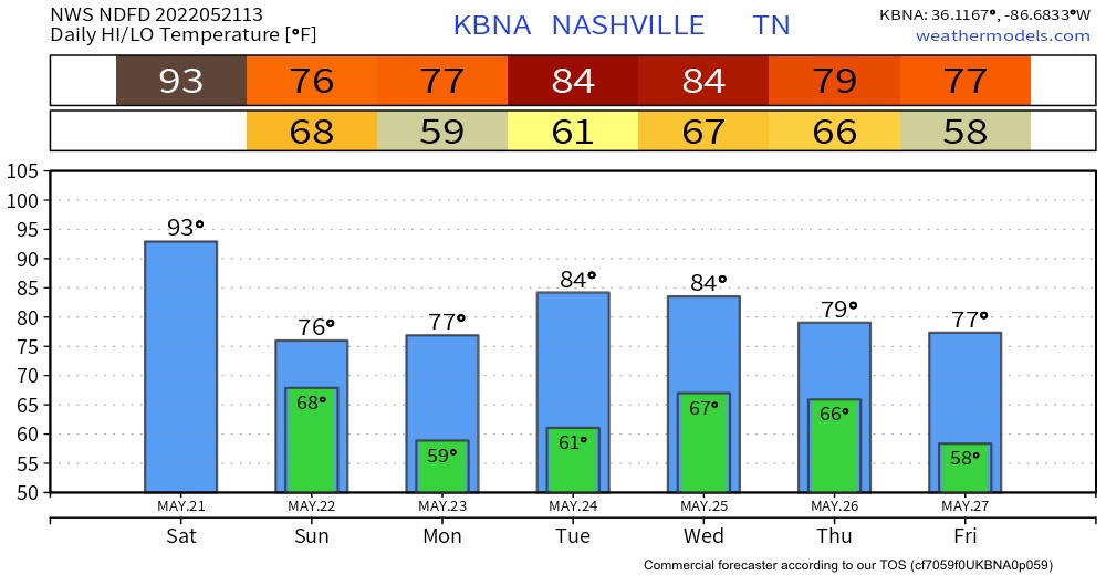
Today is going to be a muggy one. The high today is going to be 93. The record high was set back in 1941 with a high of 94 degrees. I don’t believe that we are going reach 94 today but there is still a chance.
You must be logged in to post a comment.