
The probability of a tornado within 25 miles of us today is 2% per the SPC tornado outlook:
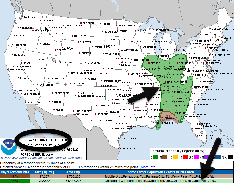
The damaging straight line wind probability is 5%. We are not outlooked for 1″ hail. For flash flooding it’s 5% to 15%.
This risk occurs this afternoon. Showers this morning will be off and on and nonthreatening. Models think a line of strong storms with the above low-probability severe potential will develop to our west and move east through our area between lunch and the evening rush hour. “Lunch” and “evening rush hour” are intentionally vague terms because of ETA and ETD differences in the models.
The HRRR model thinks storms will form to our west around noon and move through between 1 PM and 3 PM.
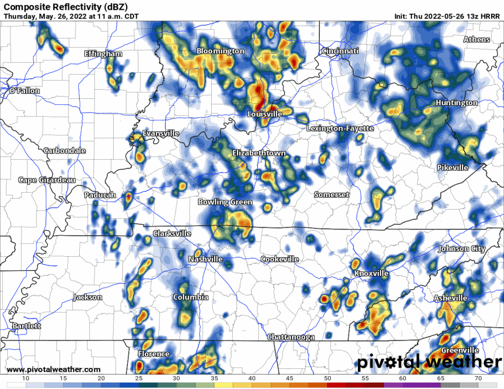
We think the timing may be off so we are using lunch to evening rush hour as the risk window.
This afternoon wave is the main event.
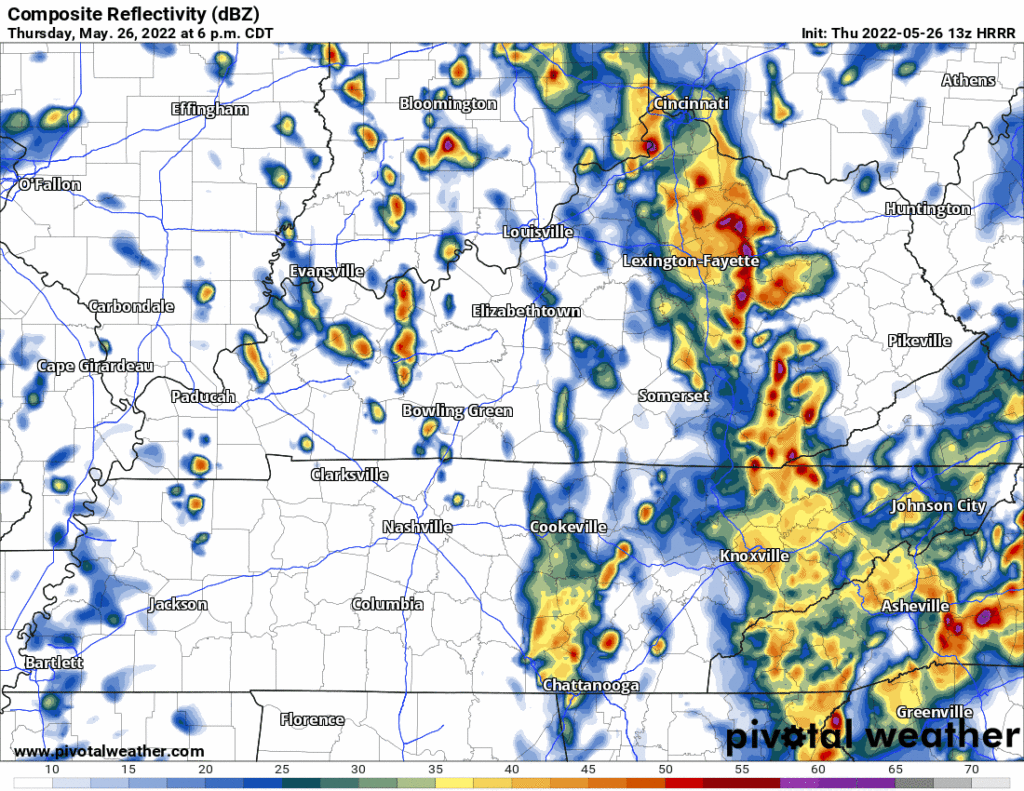
Rain and storms should be clearing out during/after the evening rush hour. Light rain may break off and rain on a few locals but think most will probably be rain-free tonight. The HRRR model shows the clear-out:
Stay connected on Twitter for changes to timing and storm hazards today.
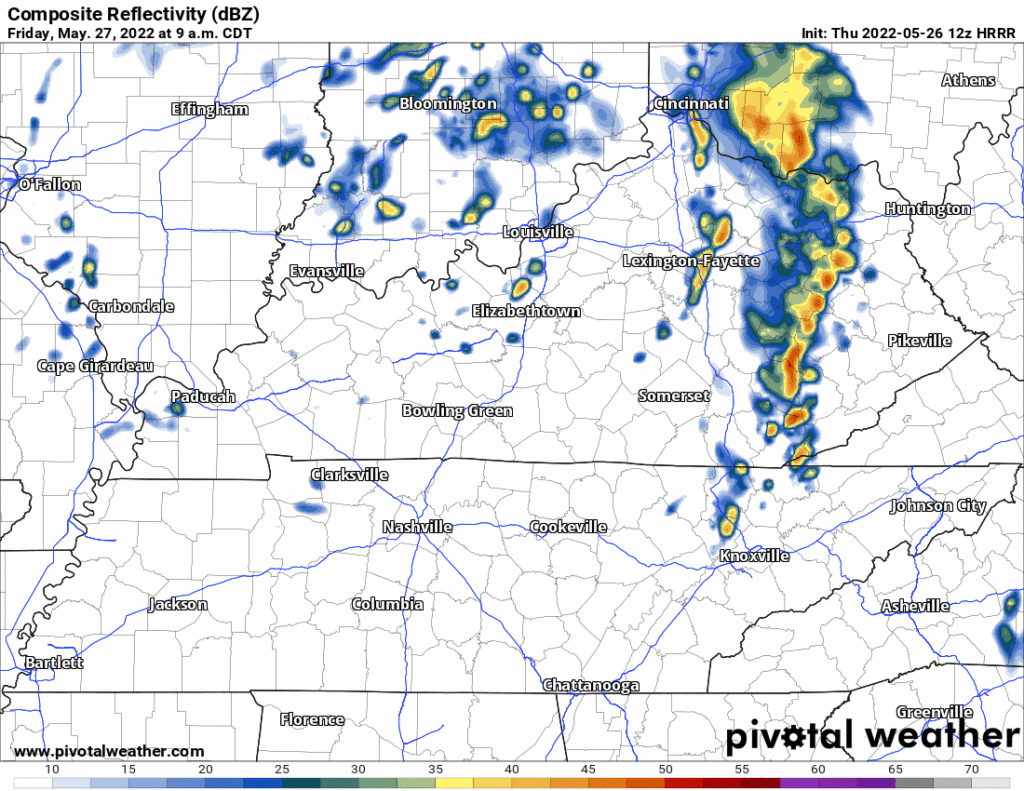
→Friday the upper low that’s causing Thursday’s problems will move north and east of us. Once it does, it’ll spin in a few hit or miss rain showers. Nothing severe.
→This weekend we clear out and heat up.
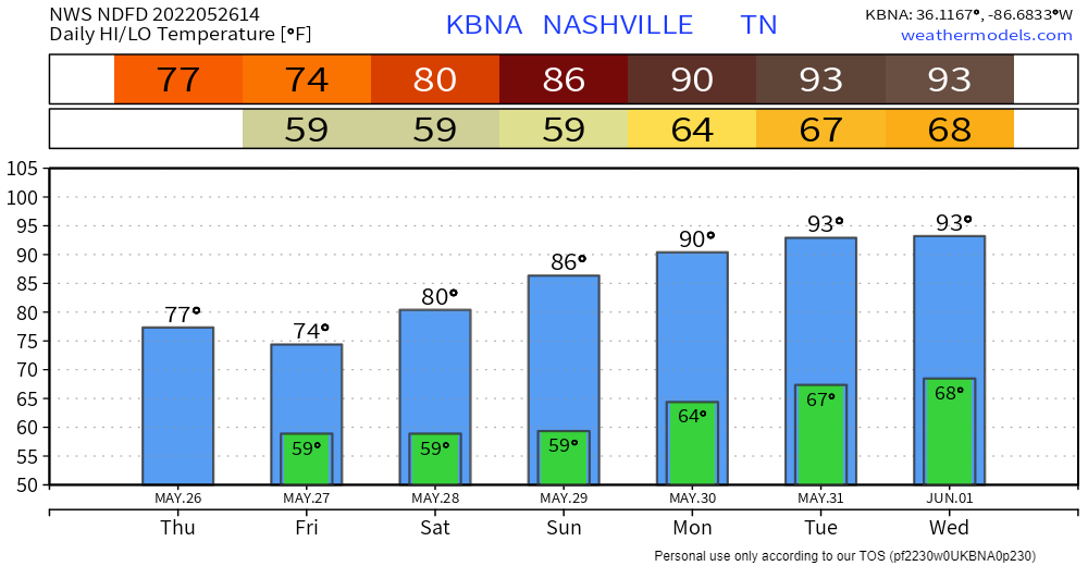
→Next potential rainmaker: middle of next week, June 1.
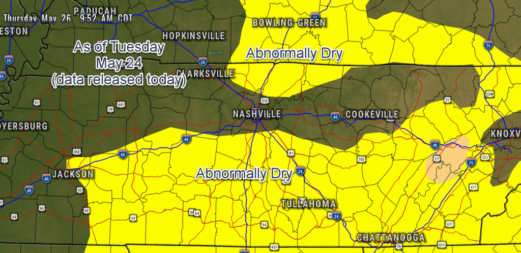
→Drought data runs Tuesday to Tuesday, and is released each Thursday. New data is in. The “abnormally dry” area crept into almost all of Will Co and the northern tip of Davidson Co. I expect this will change next week given the rain we’ve seen since Tuesday.
Quick References:
Weather changes constantly.
Follow @NashSevereWx on Twitter for any changes to this forecast.
Live coverage during tornado and severe thunderstorm warnings:
Look good.
Support the mission.
We are 100% community supported. No ads. No subscription fees. Keep it free for everyone.
Categories: Forecast Blogs (Legacy)
You must be logged in to post a comment.