

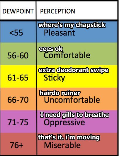
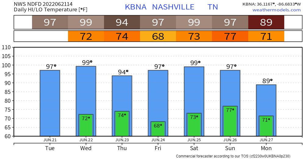
Comfortable humidity and temps Monday and Tuesday, let’s goooo.
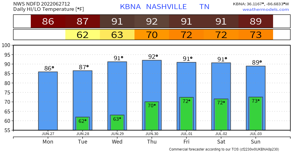
Humid, summertime airmass arrives Thursday morning and sets up camp. Temps right around and slightly above normal for late June with humidity increasing from Comfortable to Sticky. Humidity will be Uncomfortable Friday through the weekend.


You must be logged in to post a comment.