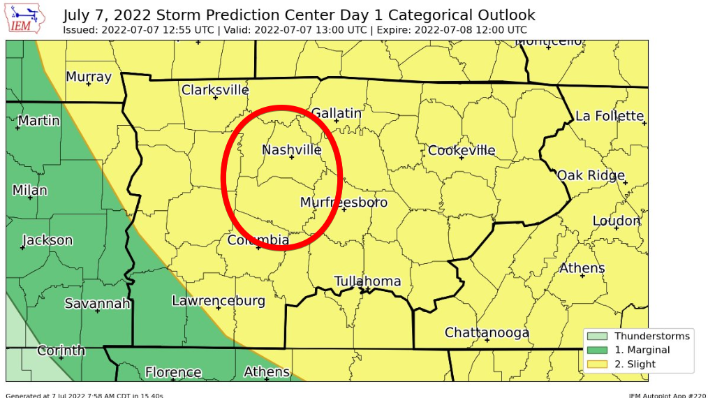
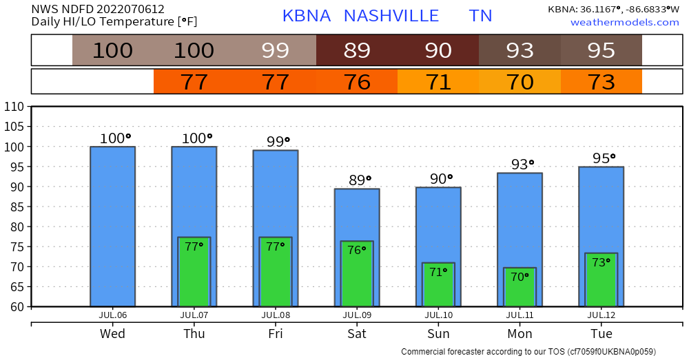
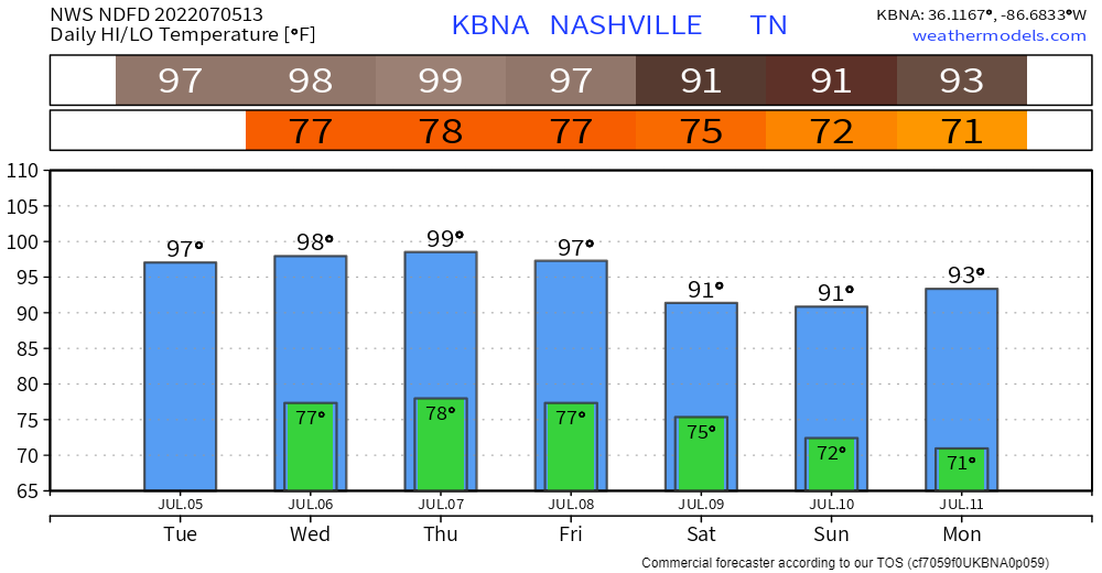
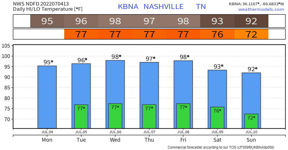
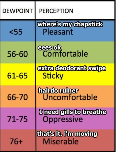
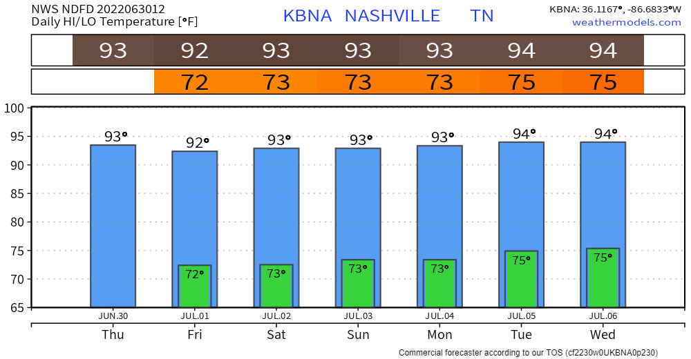
We’re staying dry and getting up into the low 50’s today. The sun stays until Friday. Temps heat back up to the low 70’s by the end of the work week.
Severe Storms Possible Saturday Morning
A cold front is forecast to come through Saturday morning that has the potential to bring some severe storms our way as it pushes through. The SPC has everyone west of the Cumberland Plateau in a severe weather outlook for Friday. Our counties are in a slight risk (2/5 scale) for severe weather. This translates to a 15% chance of severe weather occurring within a 25 mile radius of us. Main threats are damaging winds along the front as it comes through (60+ mph) and isolated tornadoes.