
The dewpoint jumped from 58° at 5 AM to 68° at 9 AM.
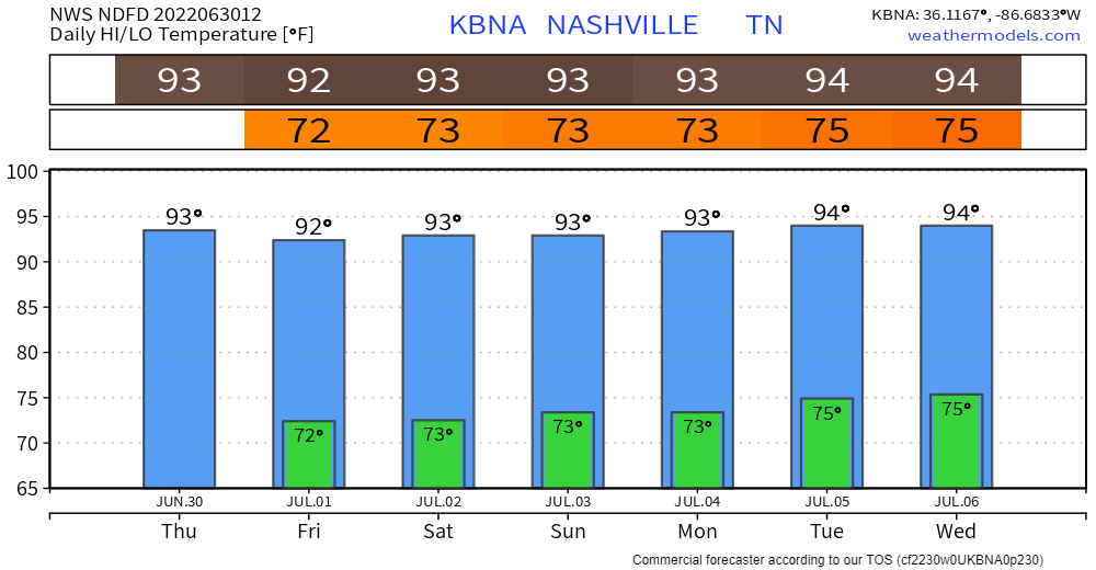
Foreseeable future afternoon highs are now stuck in the low/mid 90°s.
Storms may pop up this afternoon. High pressure will fight storm formation but a few cells may push through. Don’t know exactly whether, when, or where it’ll happen.
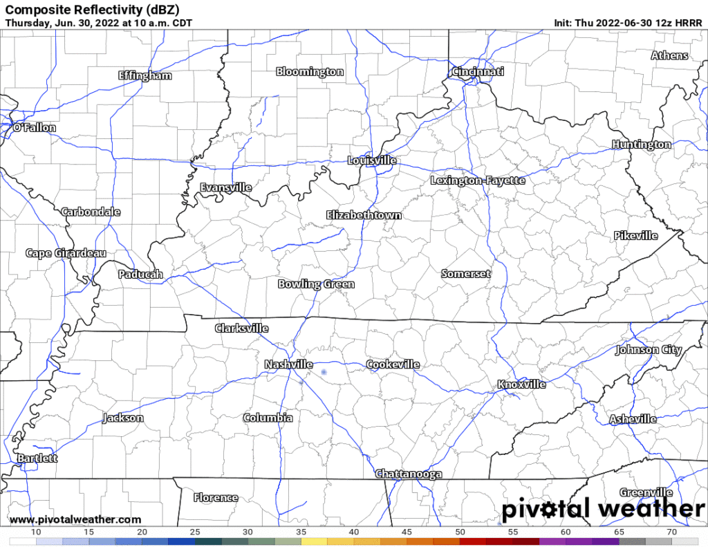
HRRR model (below) has a few downpours today capable of producing lightning mid-afternoon in random spots. Doubt this model has the location/times exactly right — conditions are favorable for some of us to see something pop up. Be near enclosed shelter quickly in case of a lightning strike. Storms today will move north, so if outside today, look overhead and south of you for threats.
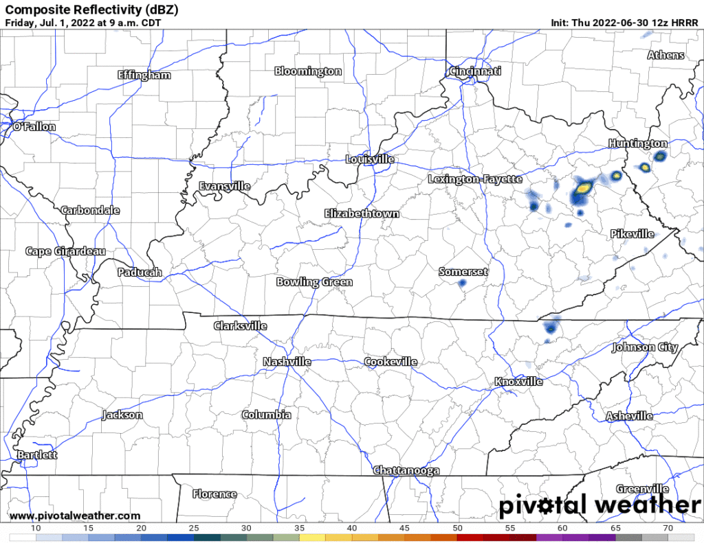
More storms in our region Friday, but maybe not locally. Afternoon/early evening storm chances increase a bit, but are unlikely for any one spot. HRRR model illustrates:
Same through the weekend and the Fourth: Afternoon/Early Evening pop ups, unevenly distributed, with any one spot unlikely to get rain each day. Plan activities with quick access to nearby enclosed shelter. Severe weather not expected, but lightning is a hazard so keep an eye out. Can’t completely rule out potential for damaging straight line winds spreading out of a large collapsing thunderstorm. Oh — one other thing — precipitable water values will be very high: some of us may see a lot of rain very quickly this weekend. Classic summertime pop up storm szn is here.
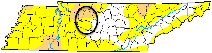
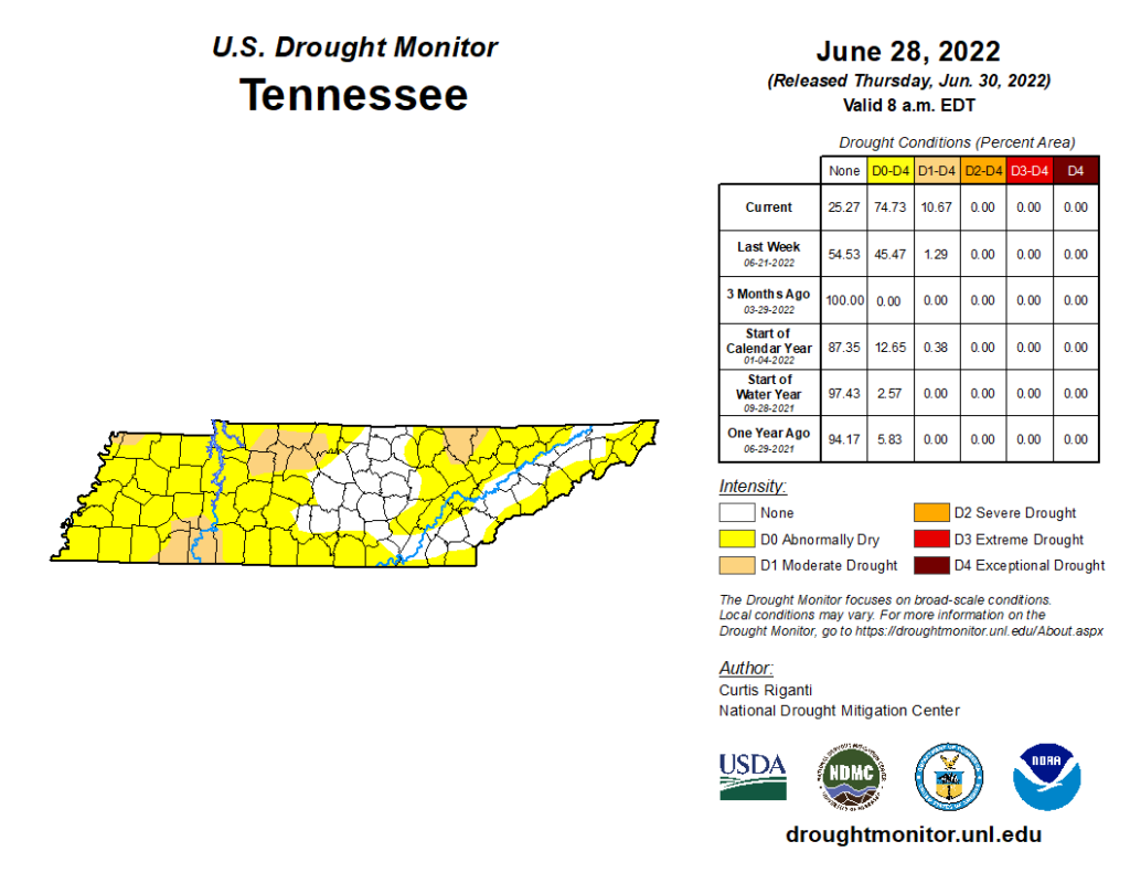
We need the rain. Nashville along and north of I-40 is in a Moderate Drought, everyone else (except SE Davidson Co.) is predrought “abnormally dry.”
Quick References:
Weather changes constantly.
Follow @NashSevereWx on Twitter for any changes to this forecast.
Live coverage during tornado and severe thunderstorm warnings.

Look good.
Support the mission.

We are 100% community supported. No ads. No subscription fees. Keep it free for everyone.


Categories: Forecast Blogs (Legacy)
You must be logged in to post a comment.