
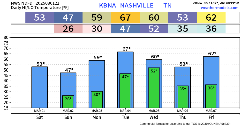
Really nice Spring-like work week lies ahead of us.
Highs quickly climbing into the mid 70s by Tuesday, staying close to that for the rest of the week.
Doesn’t look like we’ll have any record-breaking heat, but highs will be ~15° above average.

Really nice Spring-like work week lies ahead of us.
Highs quickly climbing into the mid 70s by Tuesday, staying close to that for the rest of the week.
Doesn’t look like we’ll have any record-breaking heat, but highs will be ~15° above average.

Sunset tonight: 5:48p
Sunset tomorrow: 6:49p
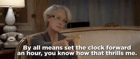
We’ll lose an hour of sleep tonight – don’t forget to set your clocks forward an hour!
We may see a few sprinkles Sunday morning, “highest” chances in southern WillCo., but chances are relatively low everywhere.

Few sprinkles possible throughout the evening, but most of us will probably stay dry. Maybe bring a rain jacket just in case; or don’t if you’re feeling dangerous.

Rest of the weekend will be dry besides a few sprinkles possible Sunday morning, NBD.

Friday will be the exception to “cool” with highs in the mid 60s. Not half bad.
A [mostly] dry cold front will sweep thru Friday night, letting in cooler temps for the rest of the weekend.
Spring-like temperatures return Monday and look to stay with us for most, if not all of next week.

Our Wind Advisory will expire at 6p tonight, when the winds finally chillax. Until then, gusts up to 35 mph will have the cool day feel even cooler.
If you hear anything about accumulating snow – that only applies to the Cumberland Plateau. Can’t totally rule out seeing a few sprinkles, or even a few flurries this evening, but no accumulation is expected here.

A Wind Advisory is now in effect until 6p Wednesday. Sustained winds in the 20-30 mph range are expected, with gusts up to 50 mph not out of the question.
With the winds coming out of the S/SE, travel (especially for high-profile vehicles) may be a little tricky on W-E oriented roads such as 40 and 840.

Headlines:
A Wind Advisory will be in effect from noon Tuesday to 6p Wednesday for wind gusts up to 45 mph expected.
While thunderstorms are likely Tuesday PM, most should stay below severe criteria.
Let’s dive into the details.
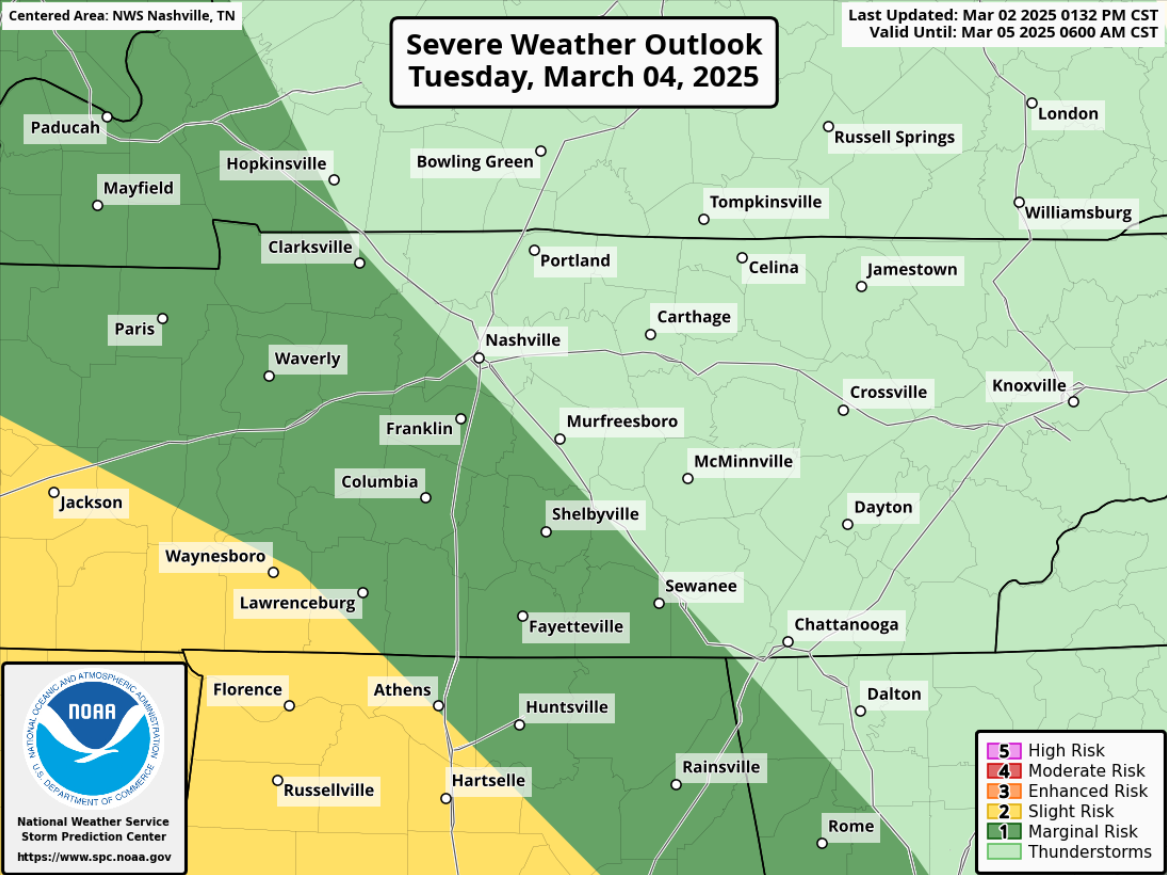
Still watching Tuesday for severe storm potential – but the overall chances have come down.
The Storm Prediction Center has outlooked areas S and W of I-24 with a 5% chance of severe weather within 25 miles. This could (probably will) change between now and then.
Outdoor burning continues to be discouraged, with gusty winds and low relative humidity values expected thru this evening.
Skipping ahead to Tuesday.
Not much has changed. We continue to be outlooked with a 15% chance of severe weather within 25 miles.
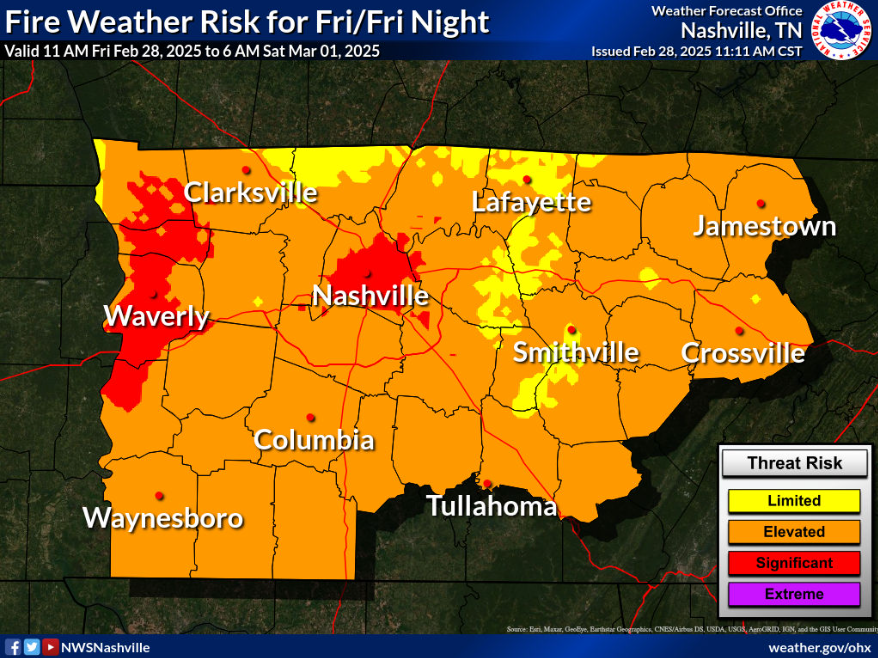
With warm temps, low relative humidity, and gusty winds today – some elevated fire danger will exist. Under these conditions, fire can spread quickly. Outdoor burning is discouraged.
Jumping ahead to Tuesday.
You must be logged in to post a comment.