
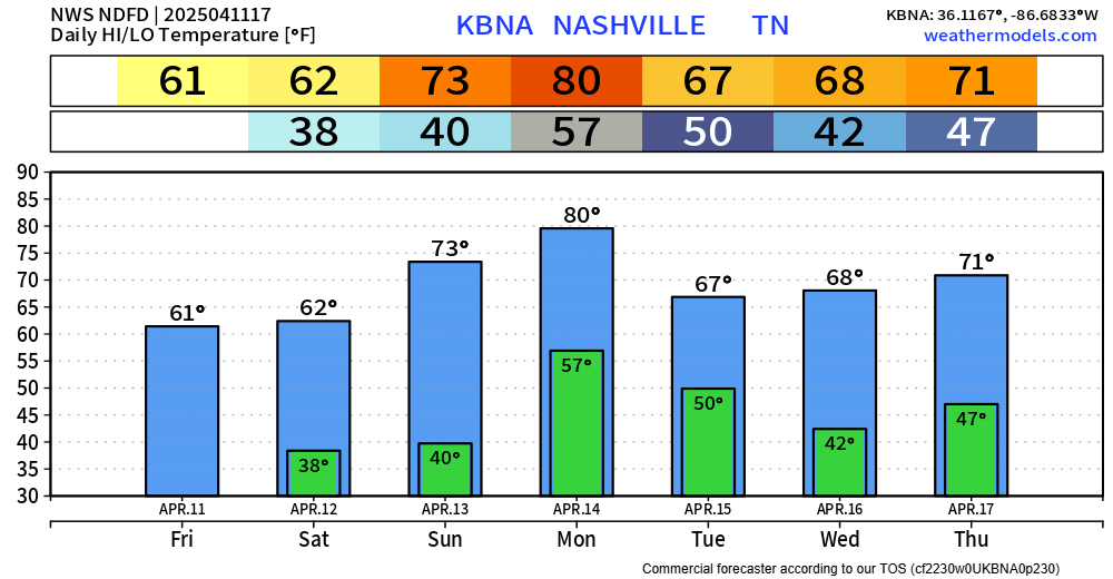
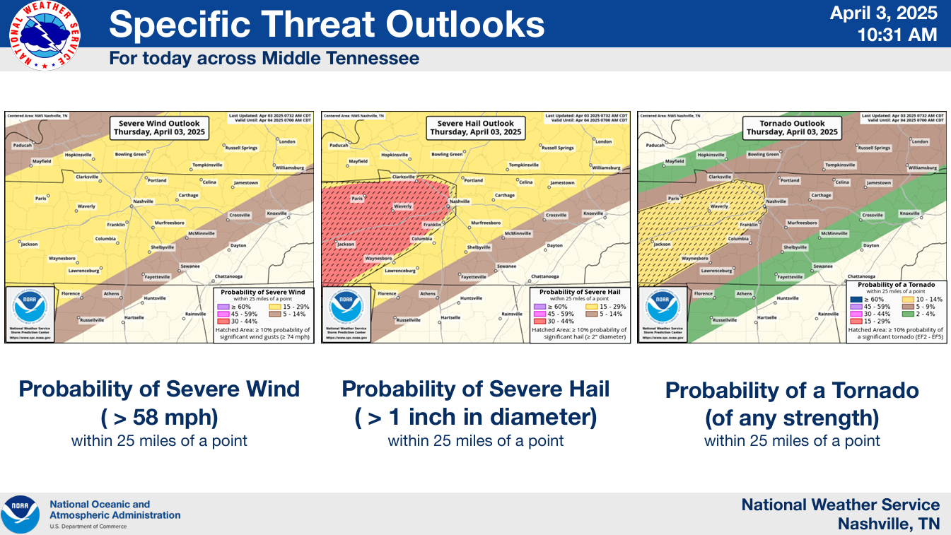
Winds could be a little gusty Monday afternoon, up to 25 mph.
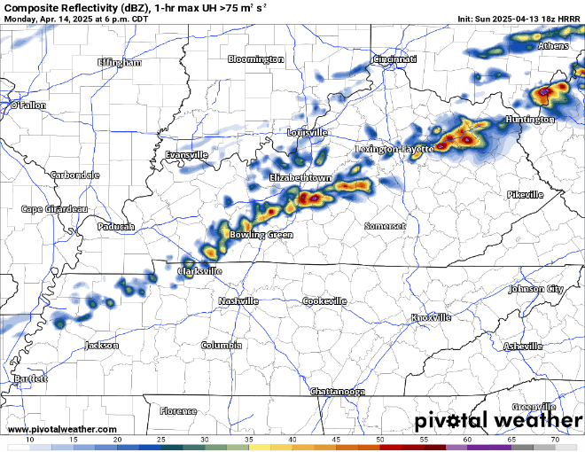
Also, some showers and storms look possible Monday PM, probably closer towards the evening/night. Ball practices may be OK.
Currently not expecting any severe weather, but some rumbles of thunder not out of the question.


You must be logged in to post a comment.