
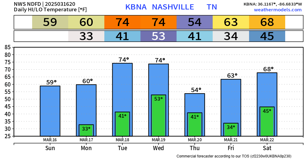
We’ll wake up with temps in the upper 30s/low 40s on Tuesday but quickly get up into the mid 70s by the afternoon.
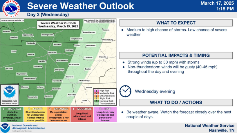
Similar temps for Wednesday, but with chances for some showers/storms as a cold front pushes thru sometime in the afternoon/evening. Before, the rain, wind gusts up to 40 – 45 mph will be possible throughout the day – a Wind Advisory may be needed.


You must be logged in to post a comment.