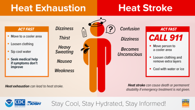
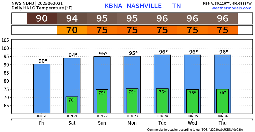
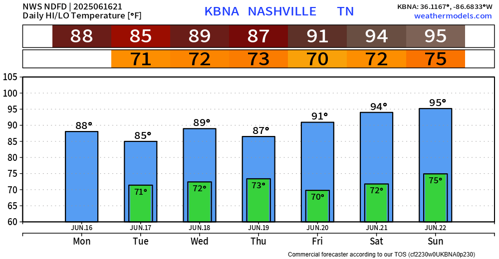
As suspected, NWS Nashville has gone ahead and extended our Heat Advisory until 7p Friday.
Why? Heat index values will reach up to 107° daily.

Take precautions if you have to be outdoors for prolonged periods of time.

As suspected, NWS Nashville has gone ahead and extended our Heat Advisory until 7p Friday.
Why? Heat index values will reach up to 107° daily.
Take precautions if you have to be outdoors for prolonged periods of time.
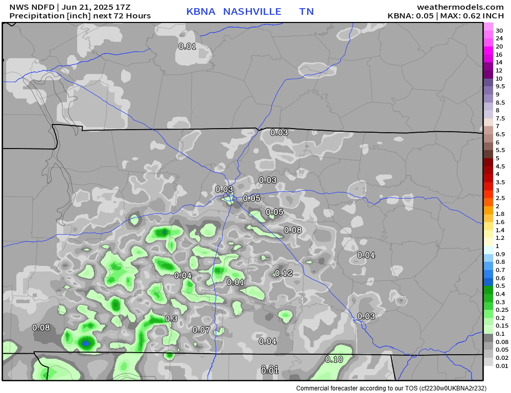
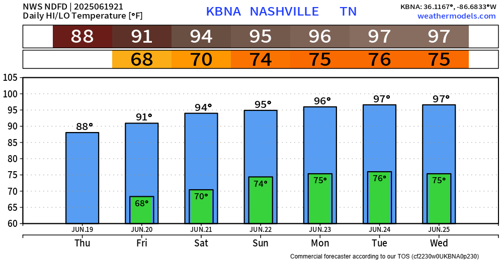
Showers and storms have helped cooled things off – which has been welcomed, prior to storms heat index values were in the low 100s.
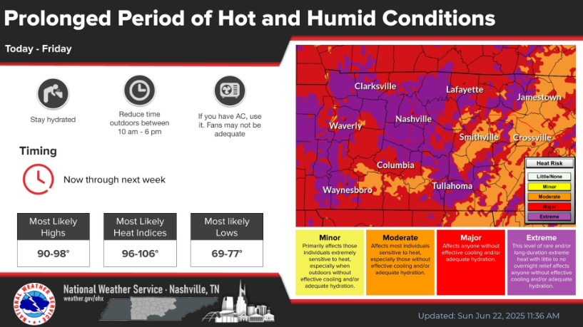
Heat index values will continue to be in the 100 – 106° range thru this weekend.
As of 2p, the heat index at BNA was 103°.

This will be common each afternoon over at least the next 6 days.
High temps will easily reach the mid 90s, even upper 90s by the middle of next week.
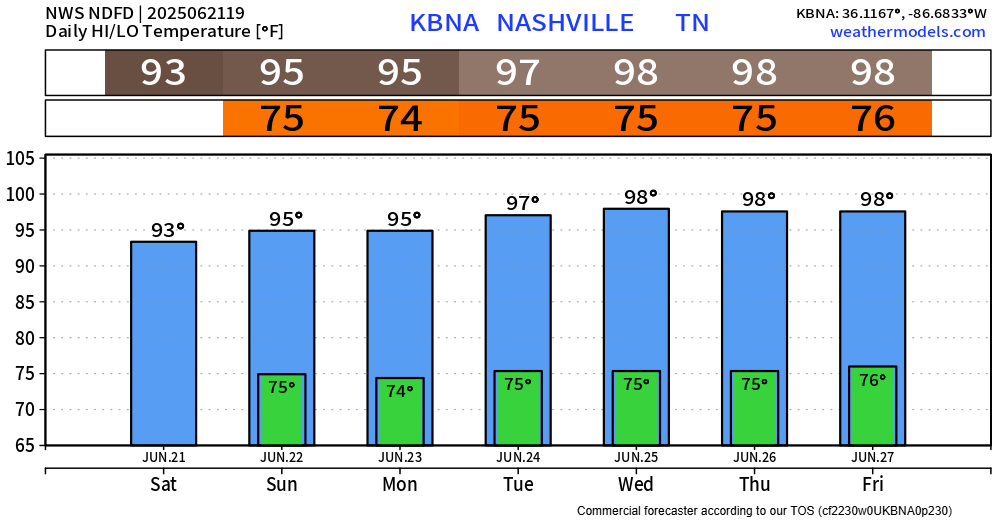
Dewpoints in the ‘I need gills to breathe’ range will keep heat index values near 105° daily.
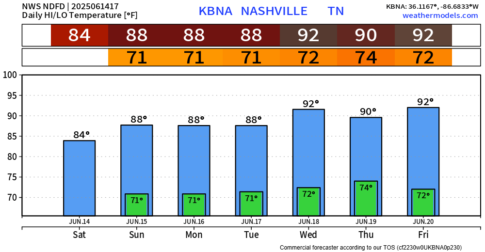
“Astronomical summer kicks off today at 942 PM CDT, and right on cue, here comes a heat wave” was the opening line to the midday area forecast discussion from our friends at NWS Nashville – which I thought was very fitting.
Side note: we could see some areas of locally dense fog early Friday morning. Take it slow in the morning if you encounter any.
We are currently sitting at the 4th wettest start to the year ever, with BNA recording 35.01″ of rain so far. Your backyard may have seen slightly more/less.
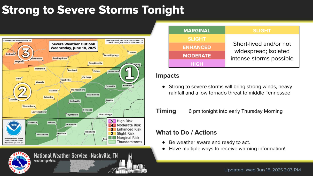
Just prior to publishing, Davidson Co. have been included in a Severe Thunderstorm Watch until midnight. This does not mean Williamson Co. is in the clear – stay connected! All info in the blog holds true.
I know you’ve heard this one before, but showers/storms continue to move thru our area this evening. Activity should diminish as we get closer to sunset. We’ve seen a ton of rain recently, so creeks will easily fill up with any heavy rainfall. Avoided flooded roadways.
Storms will continue thru this evening. Follow along with us on all of our socials, and you can always check the radar anytime on our website here: Radar | Nashville Severe Weather
Storms are expected to remain below severe limits, but heavy rain and frequent lightning may be an issue. Activity should decrease as we get closer to sunset.
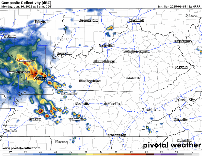
Wattery winners on this Father’s Day have mostly been confined to those in Williamson County. Still a few more showers hanging around in the vicinity, but activity will continue to decrease as we head towards sunset.
I know I sound like a broken record, but I’m not sure how else to phrase it.
Each day thru at least Thursday will consist of Wattery chances, mostly confined to the afternoon/evening hours.
Impossible to know if plan ‘x’ will be dry at ‘y’ time – just part of the Wattery.
You must be logged in to post a comment.