
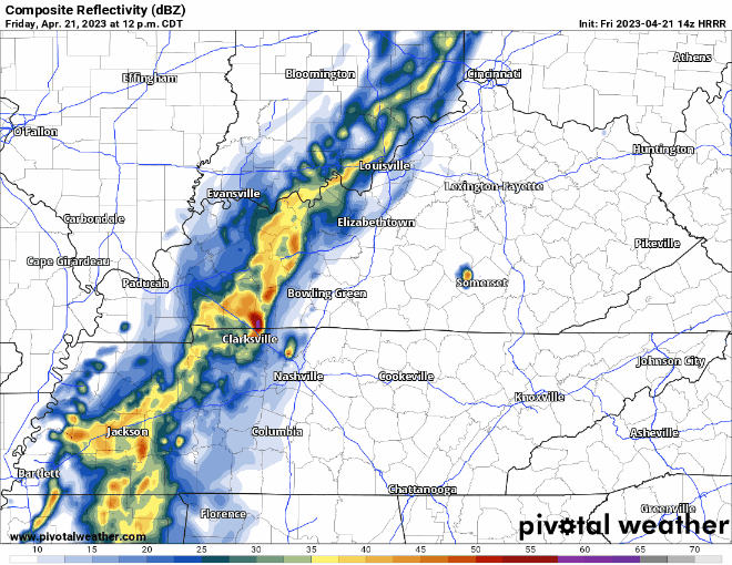
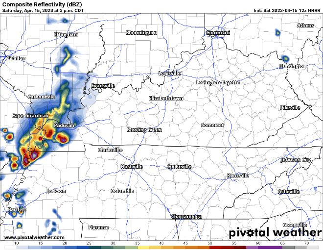
- A few models think some pop-up showers are possible this afternoon, other models disagree and think we stay totally dry. Even if they do pop-up, they would be in-n-out pretty quick.
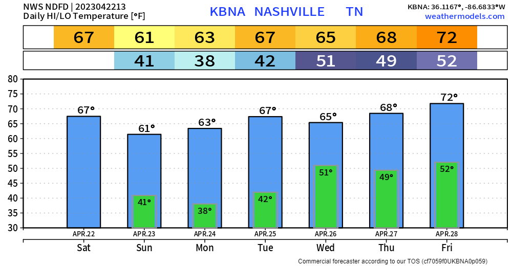
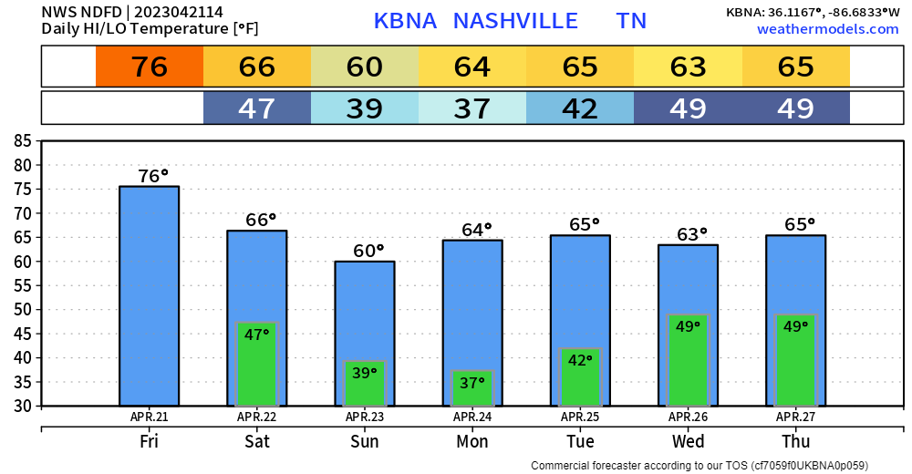
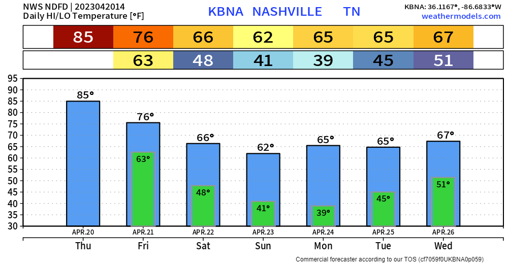
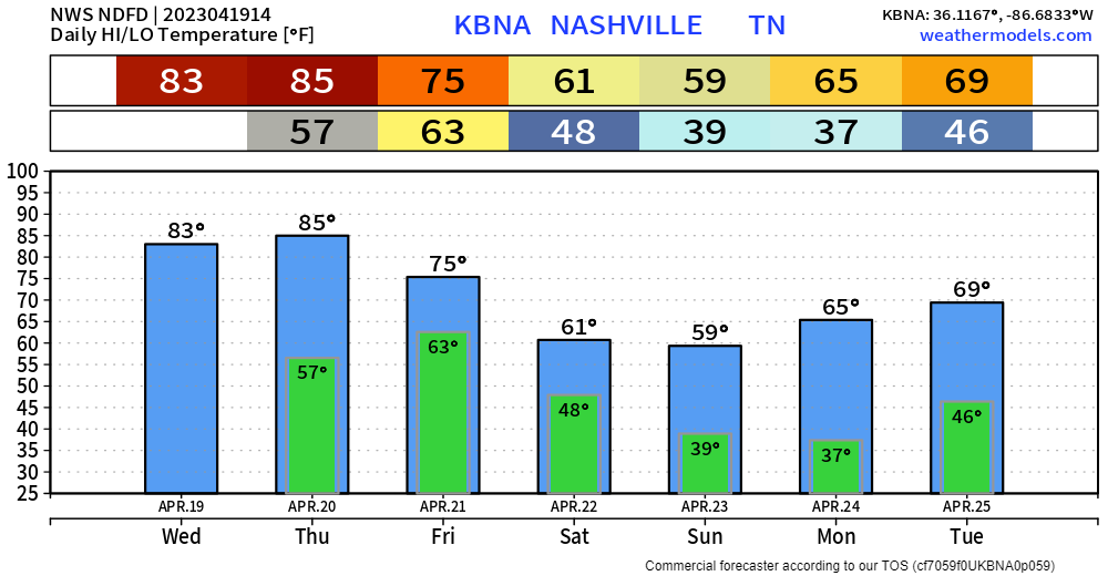
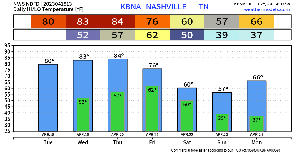
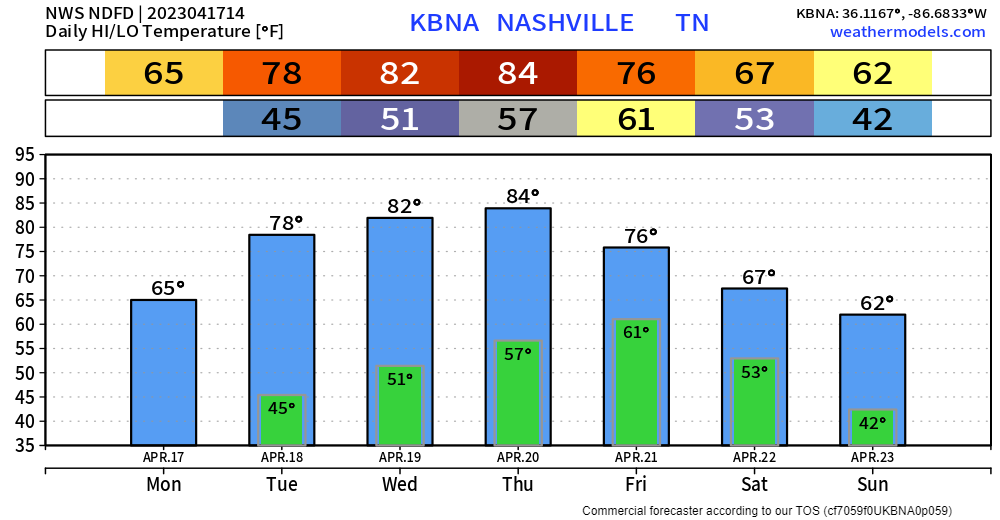
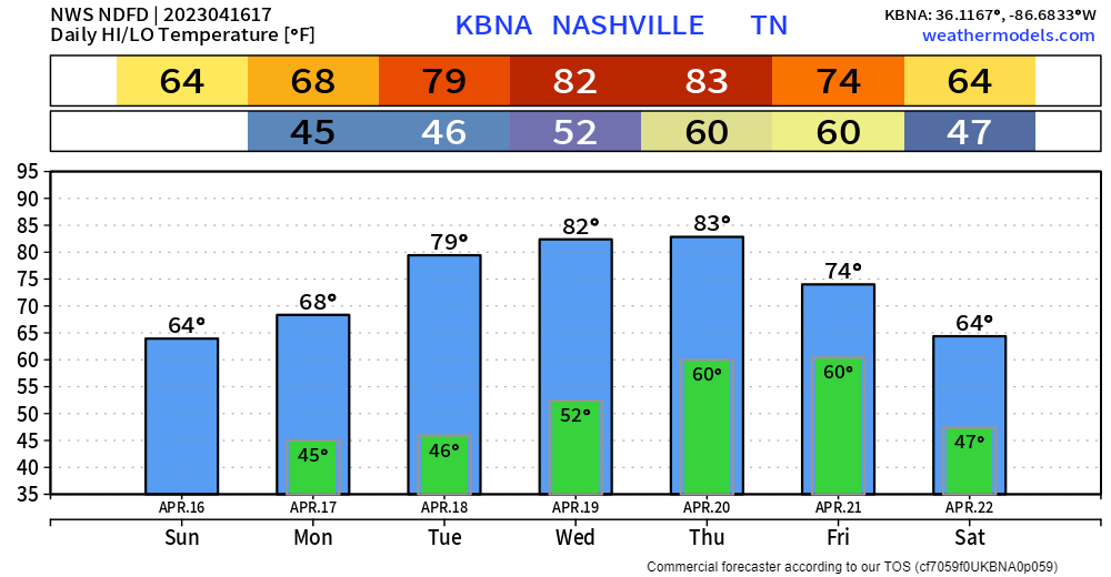
- All week (until Friday) high temps will be hanging out in the 60s. Our average for this time of the year is mid 70s. Enjoy if you like cooler weather, if you like warmer weather, just wait a little, we’ll make it to the 90s eventually, then you’ll want the 60s back.

- Frost possible the next two nights, more likely overnight Sunday into Monday. Cover up any plants that you may have planted. It is Earth Day – if that makes you feel more inclined.
- Rain returns maybe Tuesday, more likely Wednesday. Rain chances stick around for the rest of the week.
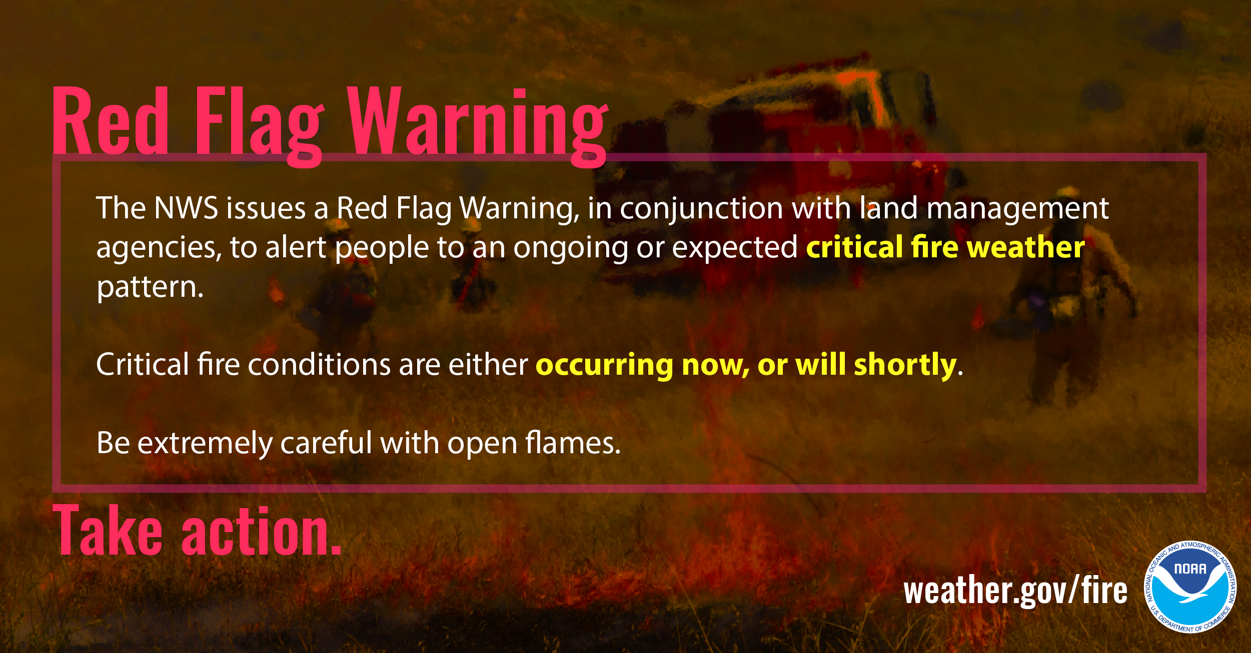
- No severe weather in the forecast for the next 7 days.

Quick References:
Weather changes constantly.
Follow @NashSevereWx on Twitter for any changes to this forecast.
Live coverage during tornado and severe thunderstorm warnings:

Look good.
Support the mission.
You must be logged in to post a comment.