
With wind gusts up to 20-25mph today, and relative humidity values around 20-25%, we’ll have an elevated fire danger today. Outdoor burning and anything that could cause an open spark/flame is discouraged.
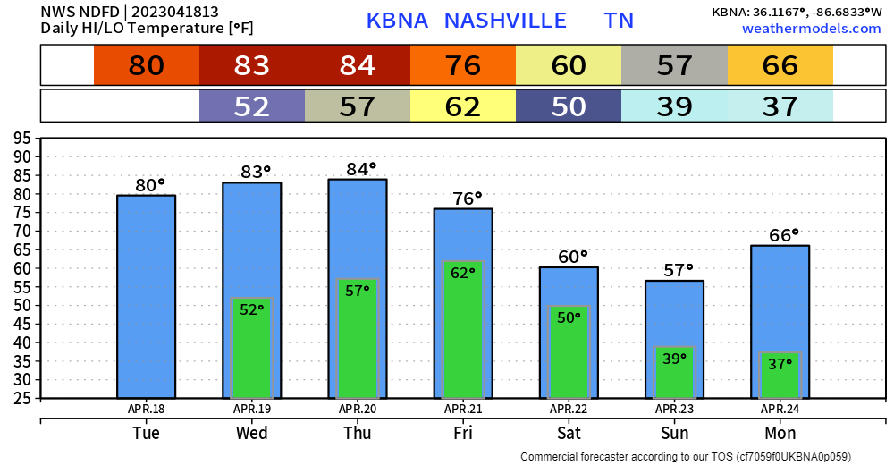
Next few days will be warm, making our way into the mid 80’s by Thursday.
The GFS and Euro models both continue to show the rain holding off until Friday. As of right now, the best rain chances look to be Friday AM and Friday evening/night, with maybe a little bit of a break in-between. Still not looking ideal for any outdoor activities you have Friday night. Good news is no severe weather is expected. Rainfall totals will be around one inch.
Rain should be moving out as the marathon is kicking off. Temps look to stay in the 50’s during the marathon. Dry rest of the Saturday, will be on the cooler side tho.

Sunday and Monday morning will come with a chance of frost as low temps dip down into the 30’s. Prepare to cover up loved plants.
Quick References:
Weather changes constantly.
Follow @NashSevereWx on Twitter for any changes to this forecast.
Live coverage during tornado and severe thunderstorm warnings:

Look good.
Support the mission.

We are 100% community supported. No ads. No subscription fees. Keep it free for everyone.


Categories: Forecast Blogs (Legacy)
You must be logged in to post a comment.