
Now through the afternoon looks great, lots of sun, will feel like spring outside.
Then some question marks start to arise.
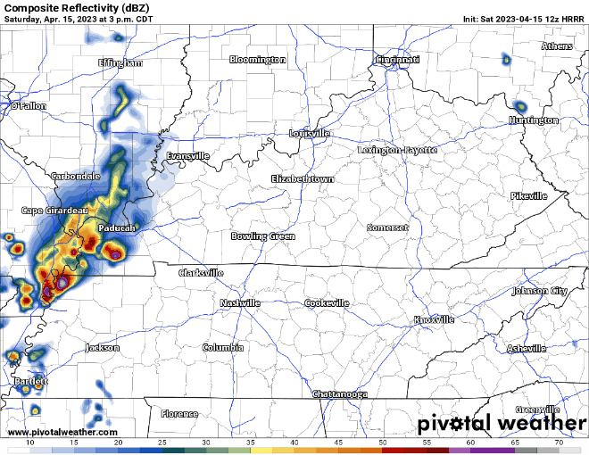
The HRRR model shows some pop-up showers forming to our west during the early evening hours. This particular run of the HRRR thinks these don’t really make it here or they miss us to our north. Other models agree, and think we miss out on rain/storms, giving green lights for outdoor activities tonight (until midnight but this will be later addressed). This is all positive news. However, models are not right all the time. I see no reason to not go forth with your plan A but have an indoor plan B justtt in case. Don’t let rain break your heart.

Then a second, more certain line of showers/non-severe thunderstorms will head this way.

ETA looks to be a little after midnight. This line should include some heavy rain, lightning, and maybe some gusty wind, but again, not worried about severe weather. Being outside in this would be less than ideal, when thunder roars, go indoors.
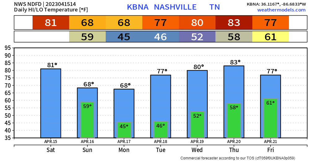
Rain should clear out for the most part before Sunday AM. Sunday will be the start of a dry first half of the week. Temps warming up a little more everyday. And what a surprise, rain chances return Thursday and Friday. Sounds familiar.
Quick References:
Weather changes constantly.
Follow @NashSevereWx on Twitter for any changes to this forecast.
Live coverage during tornado and severe thunderstorm warnings:

Look good.
Support the mission.

We are 100% community supported. No ads. No subscription fees. Keep it free for everyone.


Categories: Forecast Blogs (Legacy)
You must be logged in to post a comment.