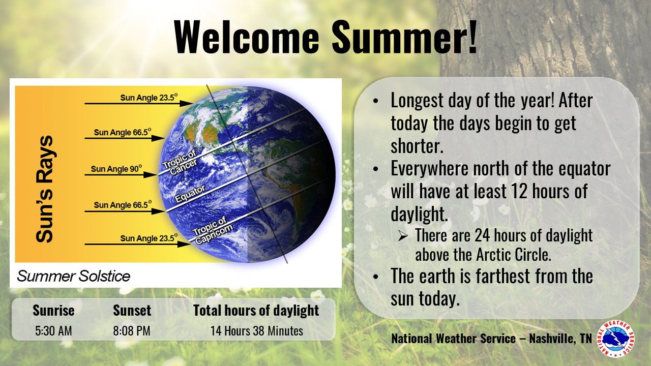
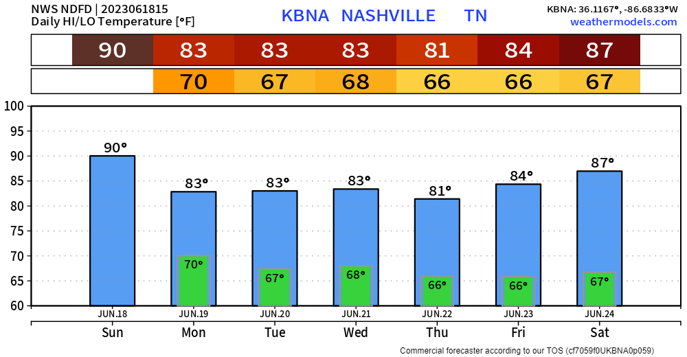
Happy Summer That Doesn’t Feel Like Summer! Summer officially began at 9:58am. Today thru Friday will not feel like summer at all. Barely making it into the 80’s, however this will be accompanied by some Wattery chances.

Happy Summer That Doesn’t Feel Like Summer! Summer officially began at 9:58am. Today thru Friday will not feel like summer at all. Barely making it into the 80’s, however this will be accompanied by some Wattery chances.
Crazy Ivan and Wattery are special phrases.
Crazy Ivan: a storm that moves from east to west, instead of the usual west to east. The full reference can be found by clicking here.
Wattery:
Neither of these are official terms, you won’t find them in the dictionary. We’ve coined these phrases over the years. We think they are cool.
Playing the Wattery this week will not be like buying a ticket for the Mega Millions. You’re more likely to see a good bit of rain this week than not, which your crunchy, getting brown grass will appreciate. NWS Nashville puts it perfectly.
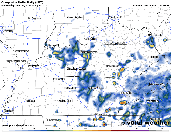
Currently a band of light rain around the TN River. It’ll slowly move toward us, unsure if it will make it. If it does, we could see some light rain around noon – 3p. No big deal.
Hot off the press, the Storm Prediction Center has outlooked our counites with a
Air Quality Alert will be in effect all day today. “Ground level ozone concentrations within the region may approach or exceed unhealthy standards. The general public is not likely to be affect. Active children and adults, and people with a respiratory disease such as Asthma, should limit prolonged outdoor exertion.”
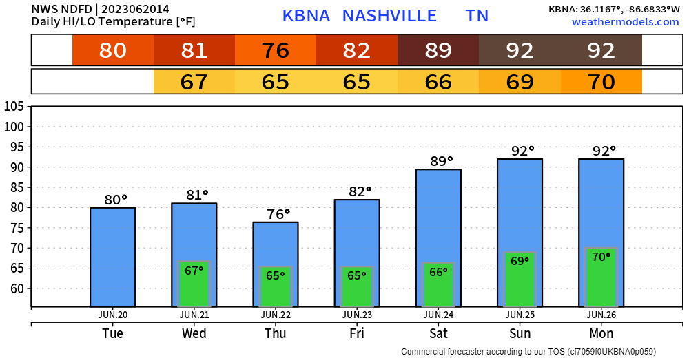
Today and tomorrow look dry. If we were to see any rain, it’d be today, but those chances are very low. Sun will dominate, thankfully dewpoints will be tame so heat index values will not differ greatly from the actual temp.
Typical middle of June day, the same can be said for Friday and Saturday. Wattery and hot. Sunday is a little different, we’ll touch on that later.
Refresher on the term “Wattery”. It’s complex but tell your friends and they’ll be sooo impressed. A four-sided pun? Who wouldn’t just be flabbergasted about your vast knowledge.
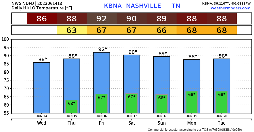
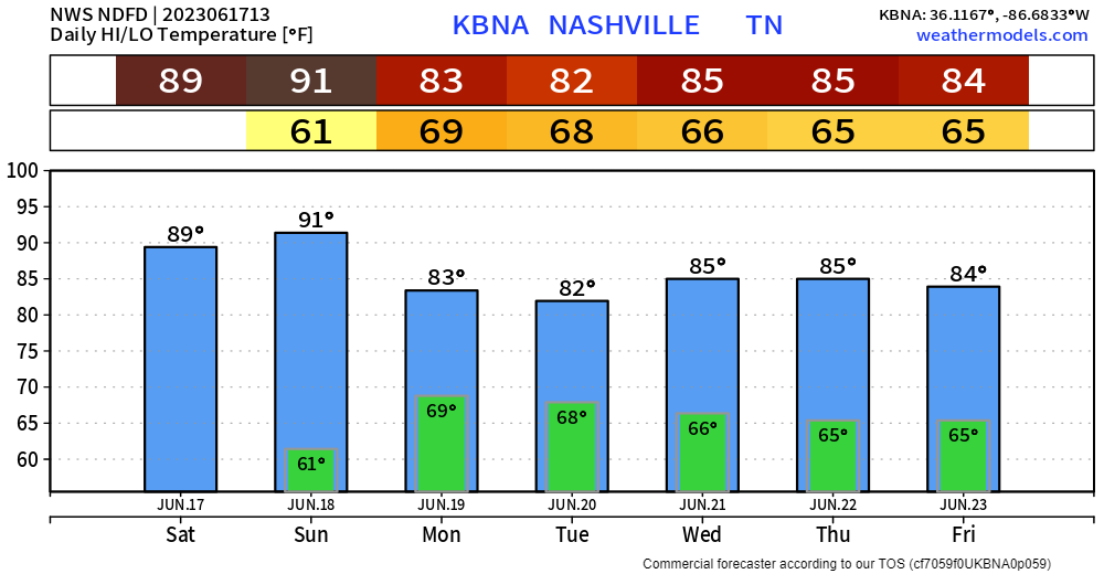
The dry streak can only last so long, and it looks to come to an end today.
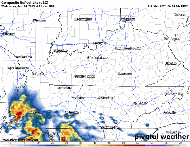
HRRR model (above) thinks our best chance of seeing rain/a storm will be this afternoon and evening. Additional showers/storms are possible around sunset. No severe weather expected, but lightning, gusty winds, and heavy downpours all possible.

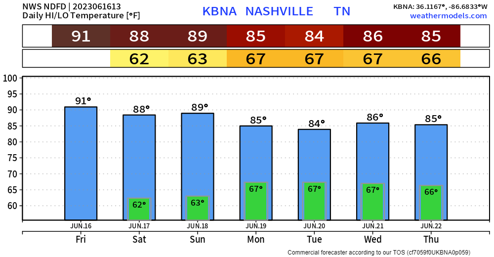
June 13, 2022 the high got to 97°, which was a record for June 13. Today our high is 80° and dry. I’ll take today.
Tomorrow temps will return to where they ought to be for this time of the year, accompanied by Wattery chances.
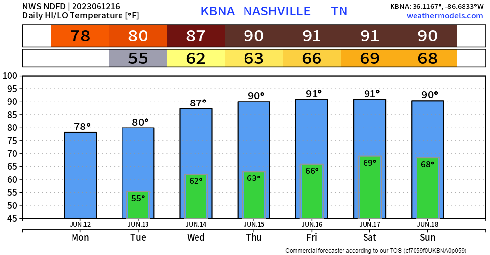
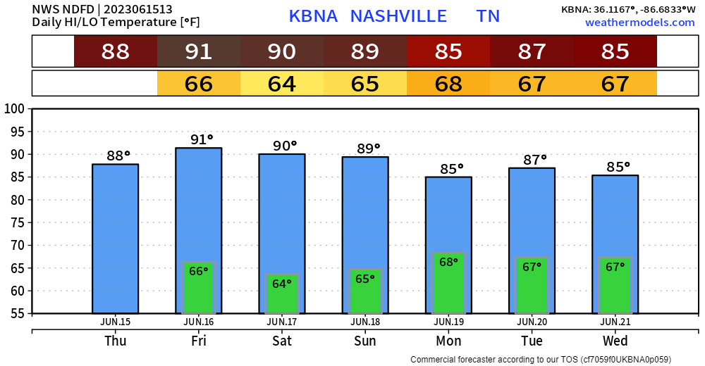
Today will be a lovely June day as high temps may not even reach 80° thanks to abundant cloud cover.
Today and Tuesday look dry for the most part, Wattery chances exist Tuesday but a majority of it looks to stay to our south.
You must be logged in to post a comment.