
Today and tomorrow, we’ll have dry conditions, relative humidity values from 20-25% + gusty winds = elevated fire danger. Outdoor burning and anything that could start a spark or flame are going to be no no’s. No training exercises.

Friday rain chances re-enter the forecast, but models are holding the chances back ’til more the PM hours. Friday PM outdoor activities look highly questionable. See EURO model below.
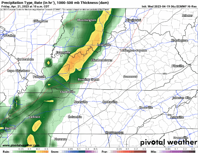
While it won’t be raining the entire afternoon and evening, it looks like it’ll be more on than off. No severe weather is expected, but a rumble of thunder cannot be ruled out. Rainfall totals look to be around an inch, no flooding concerns.
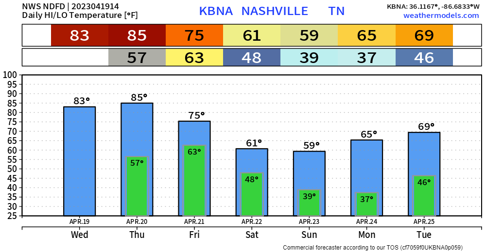
No matter what distance you are running/walking Saturday morning 1) you’ll be doing more than what I do Saturday morning, so props to you and 2) it’ll be mostly dry, and temps will be on the cooler side. A stray shower can’t totally be ruled out Saturday morning, but I think the vast majority will be off to our east. Temps look to be in the 50’s and a good amount of cloud coverage. Sounds ideal, if I were to be participating, which I am not.
Rest of Saturday and Sunday will be dry with temps on the cooler side.
This cooler trend looks to continue as we head into next week. Sunday and Monday morning bring chances of frost.

Quick References:
Weather changes constantly.
Follow @NashSevereWx on Twitter for any changes to this forecast.
Live coverage during tornado and severe thunderstorm warnings:

Look good.
Support the mission.

We are 100% community supported. No ads. No subscription fees. Keep it free for everyone.


Categories: Forecast Blogs (Legacy)
You must be logged in to post a comment.