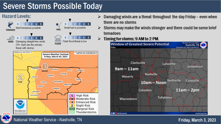
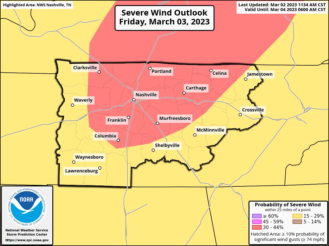
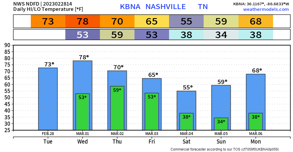
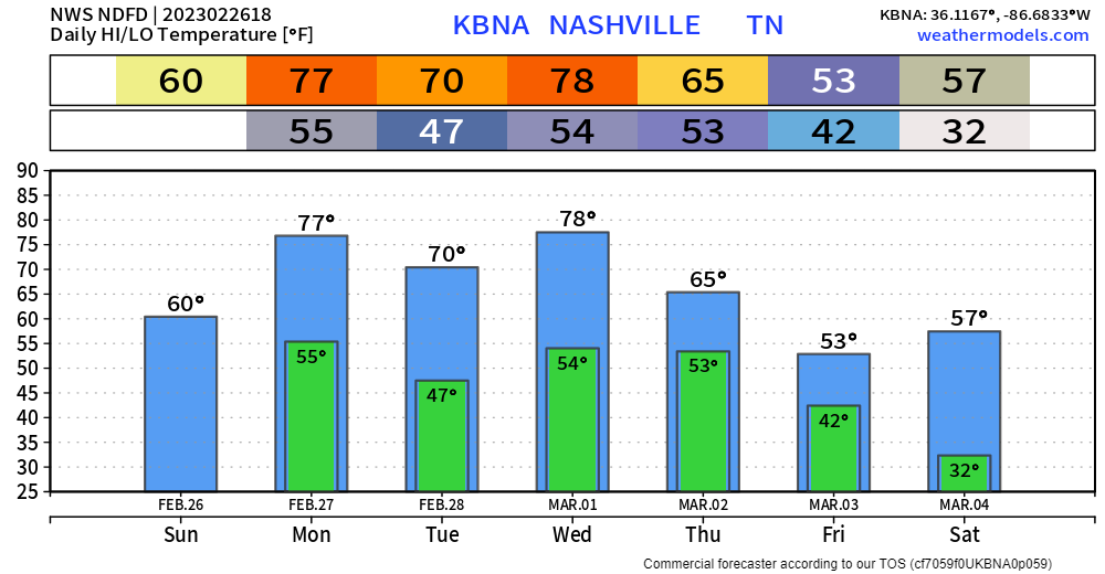
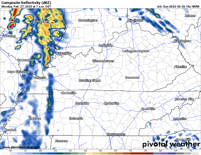
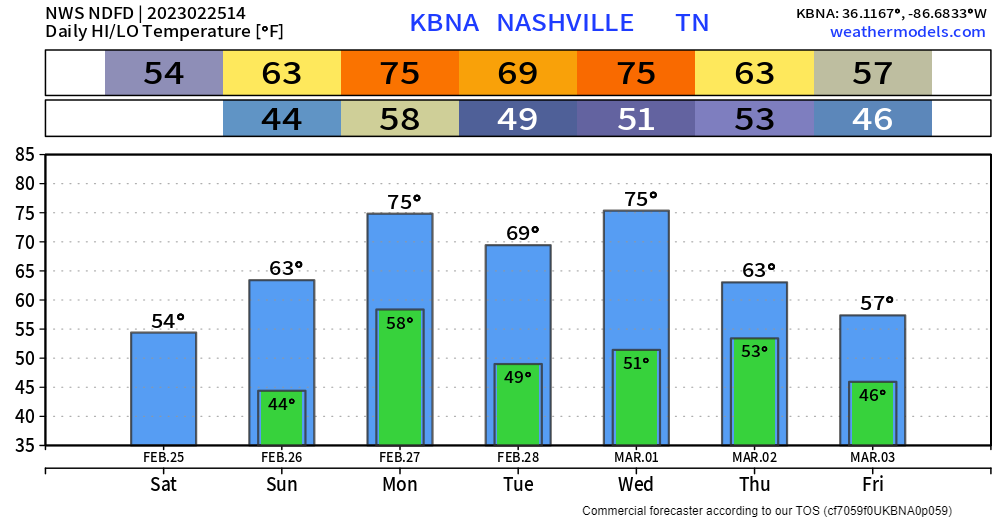
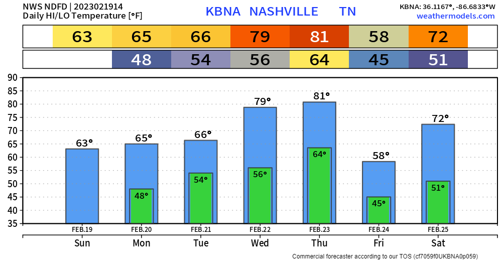
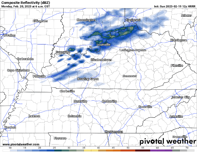
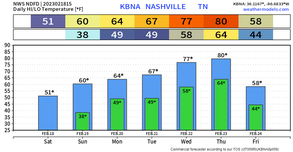
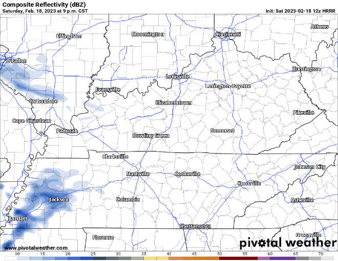
It’s been a while since we’ve had rain chances so close to each other, but don’t get your hopes up, this next chance doesn’t look to be much.

🌧️The Euro model above shows rain chances Saturday thru Sunday.
It’s been a while since we’ve had rain chances so close to each other, but don’t get your hopes up, this next chance doesn’t look to be much.

🌧️The Euro model above shows rain chances Saturday thru Sunday.
Some light showers this morning – no worries with these.
🕜 General ETA for main line of storms is 4-7 PM –> HRRR model thinks 5-6 PM (This could very easily change, stay connected!)

🕜 NAM3k model thinks storms in front of the line arrive 6-7 PM, while the main line gets here around 10-11 PM. (Majority of models lean toward the HRRR solution, ETA of 4-7PM is more likely, but it is unwise to discount any model).
⚠️Updated from earlier today.
This morning we thought the storms would come in around 9 PM to 10 PM Wednesday night. Now we think that’s earlier.
⌚ HRRR model ETA is now 5 PM to 6 PM. Timing may change so stay informed.
I’ve forgotten what it looks like, but it may* rain from above on Wednesday. Yes, maybe, not for sure.
Two models show two different solutions. Sus.
The EURO (below) shows very little, if any. Maybe just enough to get the ground a lil’ wet.
October will live up to its name of being the driest month on average, at least for the first half of the month. No rain is expected for at least the next week. Good for fall festivities.
It’ll be a little windy today, and relative humidity will be sorta low, so today may not be the best day for a bonfire.
Ongoing showers looks to wane away at some point this afternoon, as shown by the HRRR model below.

HRRR model thinks it is possible that more showers develop this afternoon. Unsure if this will actually happen, but even if it does, they look very scattered in nature, and you may stay dry. Looks as if evening plans are good to go but having rain gear close by for the NSC game or other activities wouldn’t be a horrible idea.
Mother nature thought one day of nice weather was all we deserved, as dewpoints creep back up into the mid 60s.
Rain chances are a thing today, but the HRRR thinks most of us end up dry today. If the model is right, Friday night football looks good to go.
Today and the majority of Friday you’ll probably catch yourself saying…

Mid 80’s for high temperatures, with dewpoints in the mid 50’s will have you feeling great. By Friday dewpoints will creep back up into the mid 60’s as a developing upper low brings in moisture, raising rain chances.
Today and Thursday should be fairly nice days, as high temps only reach the mid 80’s and dewpoints gradually fall into the mid 50’s. Only a very small rain chance today, as only one or two of you may see rain.
Muggy day with dewpoints in the upper 60’s and high temps in the upper 80’s. With a soupy airmass in place, more Wattery showers/lightningstorms will be possible today, but it’s more than likely you stay dry, but maybe not.
You must be logged in to post a comment.