
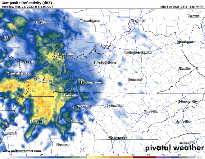
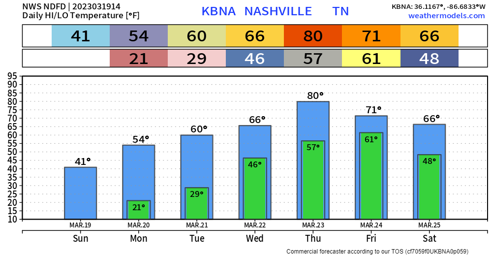
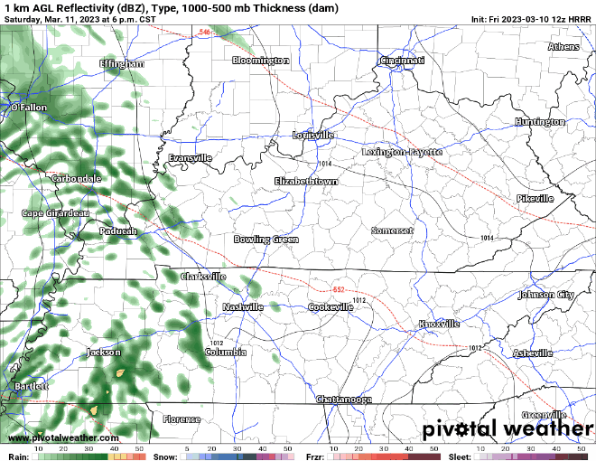
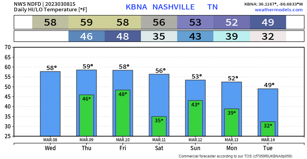
Rain should clear out in the next few hours; clouds will stick around all day to keep our temperatures somewhat down.
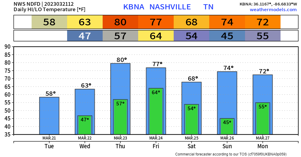
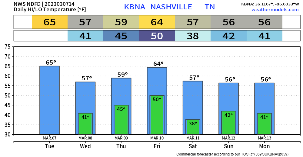
Tomorrow we get warm, some may consider it hot. High temperature pushing 80°.
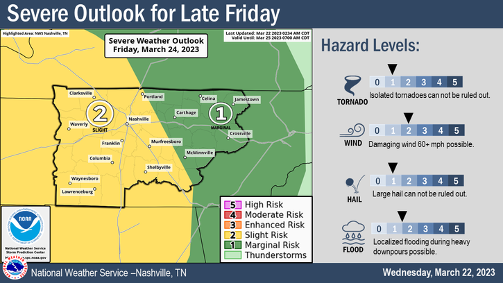
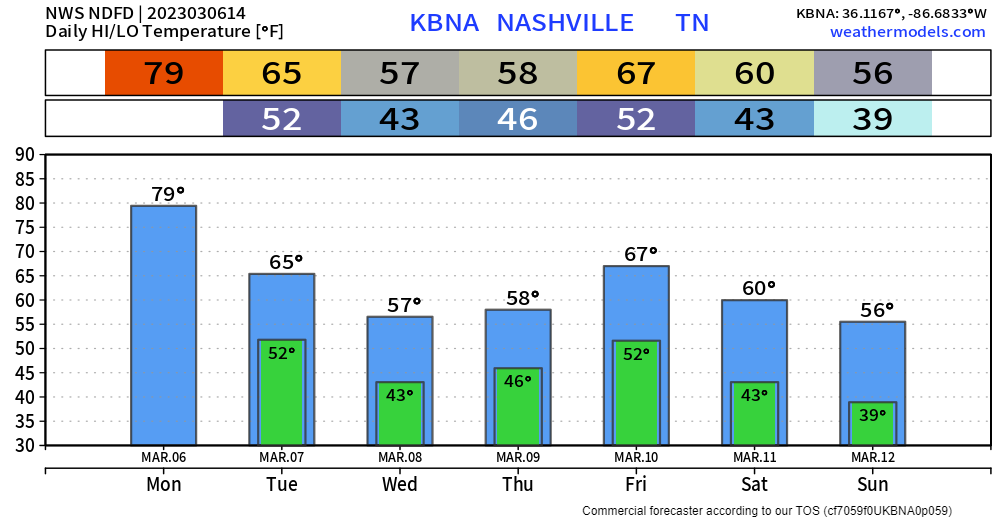
We maintain our 15% chance of severe weather within 25 miles on Friday.


You must be logged in to post a comment.