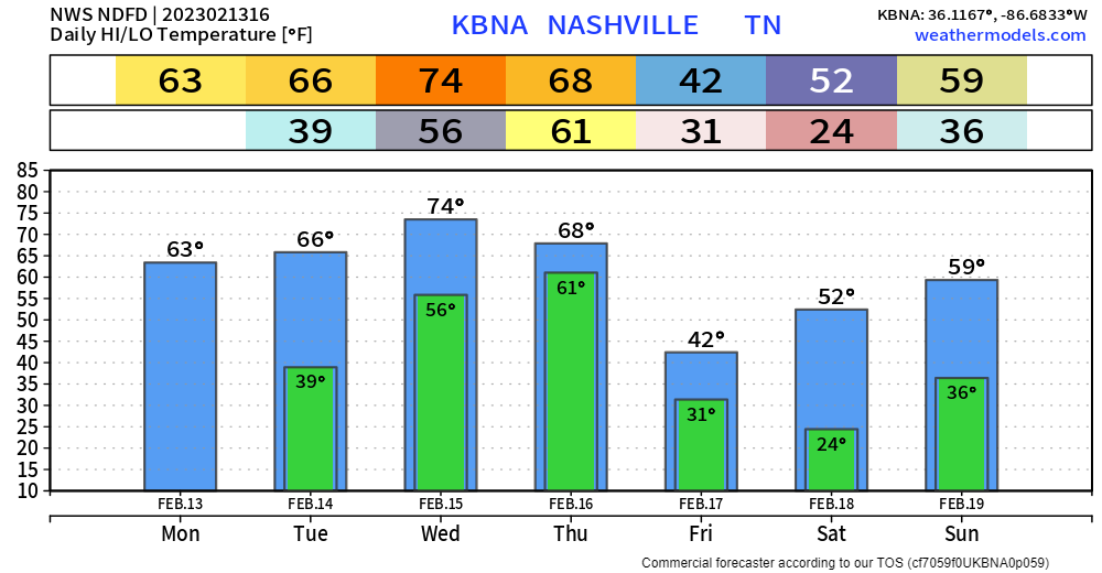
Warm day today, with the high temperature expected to get near 75°. Record high for 2/15 is 77°, we might’ve gotten there if we had some more help from the sun, but we won’t see too much of it today.

Warm day today, with the high temperature expected to get near 75°. Record high for 2/15 is 77°, we might’ve gotten there if we had some more help from the sun, but we won’t see too much of it today.
Love is in the air, but bad air quality isn’t. Crap apps were showing bad air quality yesterday, when our air was and is totally okay. Nothing from Ohio is blowing down here.
Today will be warm, but windy. A Wind Advisory will be in effect from 3pm today – 3am Wednesday. Sustained winds of 20-30mph, with gusts up to 45mph possible.
It may be Monday, but it’ll be a beautiful day. Sun, high temps in the mid 60’s.
The first half of Valentine’s Day will be nice. It’ll get windy in the afternoon/evening, sustained winds of 20-25mph, with gusts up to 40mph are possible. A Wind Advisory will be in effect from 3pm Tuesday – 6am Wednesday.
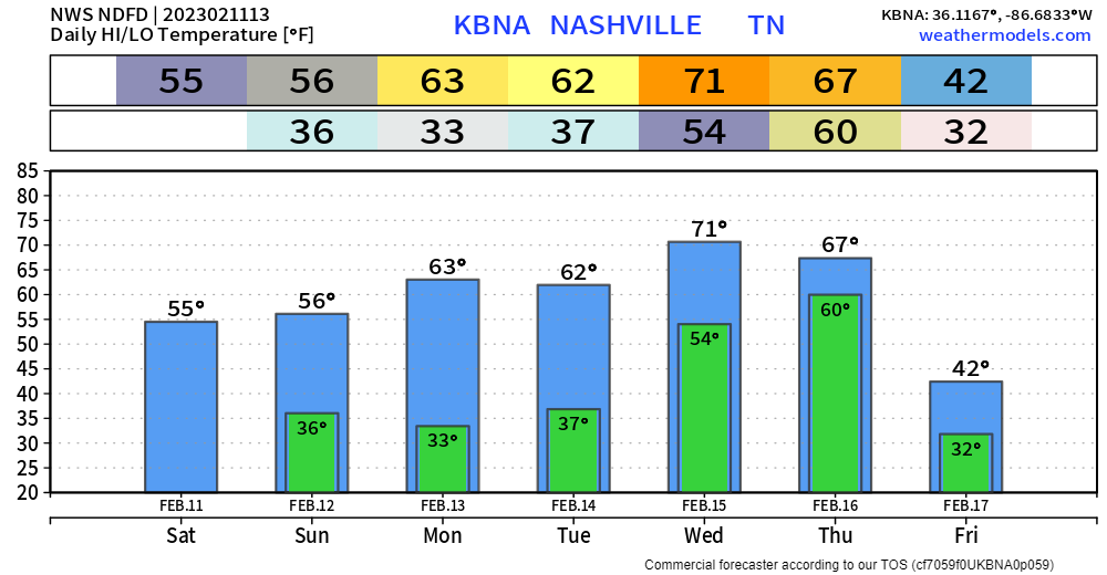
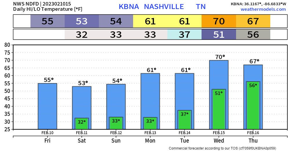
Cool, but at least a sunny and dry Super Bowl Sunday. Can’t complain too much I suppose. We’ll warm up a little by the day, making our way to the low 70’s.
We stay dry until Tuesday evening, when a band of showers roll on through. These will be quick and of little consequence.
Nice and sunny start to the day. Clouds will move in as the day goes on, along with rain chances going up.
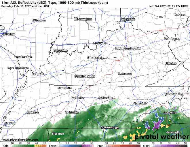
As a low pressure system spins to our SE, it may toss some showers at us. Looks like the best chance of any will be from 8pm tonight thru the wee hours of Sunday morning. Betters chances of a shower are in WillCo, you may stay dry in Davidson. And yes, they’ll just be rain showers with temperatures above freezing. Rain should move out before you head off to your Sunday morning plans.
Looks fairly nice until Saturday night. Cool temps, but we’ll be dry.
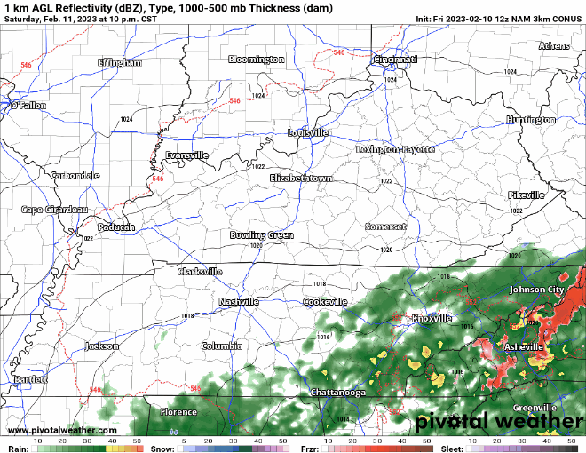
NAM3k model shows maybe some showers moving in late Saturday into Sunday morning, but nothing serious. We may see a few flurries mix in, but we are expected to stay above freezing, so no impacts are expected. Rain should move out by lunch Sunday – Super Bowl parties look to be rain free.
Cloudy, but fairly mild start to the day. Temps will make their way up into the upper 60’s. Maybe a shower or two as we go throughout the day but won’t be much.
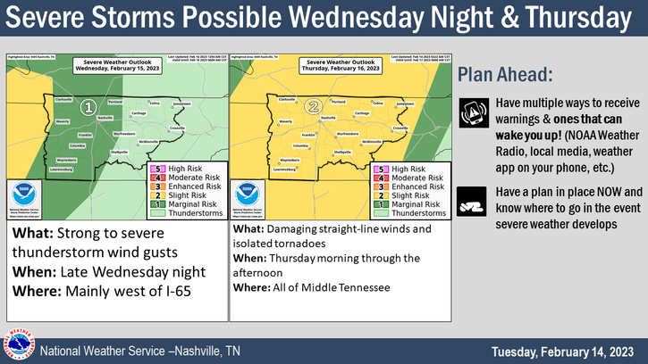
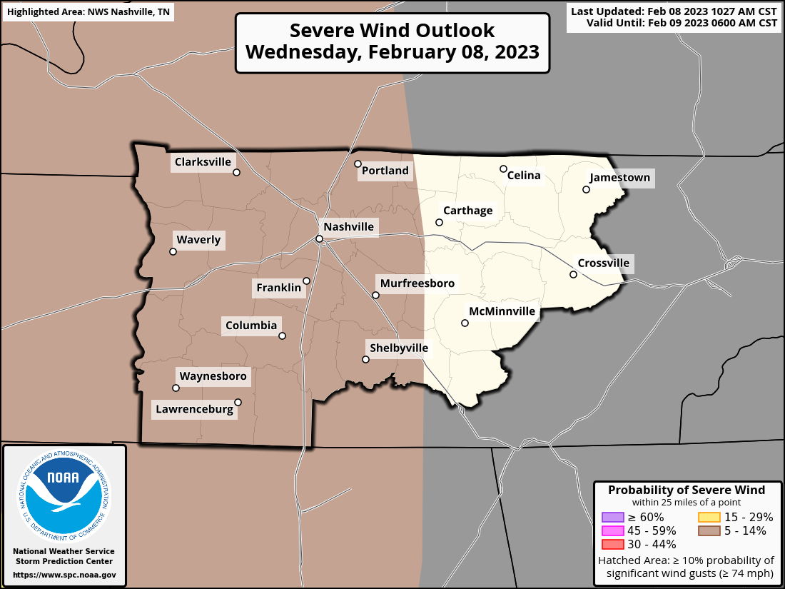
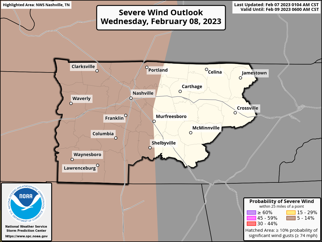
The Storm Prediction Center has maintained our 5% chance of damaging straight-line winds within 25 miles tonight.
Today will be real nice, with highs in the upper 60’s. Lots of sun streaming through the thin layer of clouds.
Wednesday, (very low) storm chances move in. The Storm Prediction Center has outlooked our two counties with a 5% chance of damaging winds within 25 miles. We are NOT included in the tornado, hail, or flash flooding outlook.
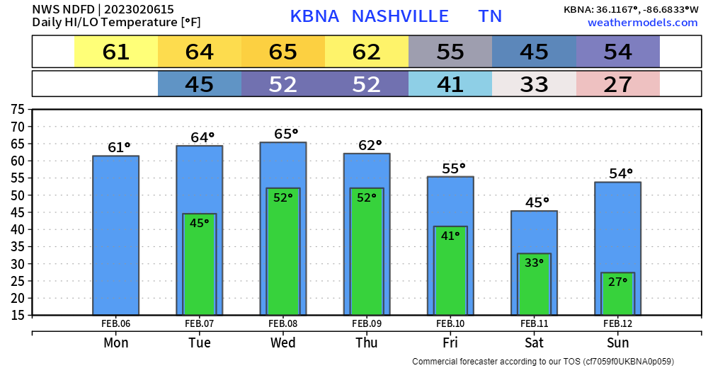
Today and Tuesday will be absolutely gorgeous – sun, highs in the mid 60’s. Can’t ask for too much better for this time of the year.
Unfortunately, this lovely weather will only last two days before the rain returns on Wednesday. A cold front will push into our area bringing some rain, maybe a few rumbles of thunder, but no severe weather is expected at this time. Timing is still fuzzy, but it looks likely that the front will arrive sometime Wednesday evening/overnight.


The groundhog who pretends he knows the future thinks we’ll get six more weeks of winter. Little does he know we just got three straight days of it and we are all tired of it. I’m more of a prairie dog fan myself, they don’t act like they know the weather.
You must be logged in to post a comment.