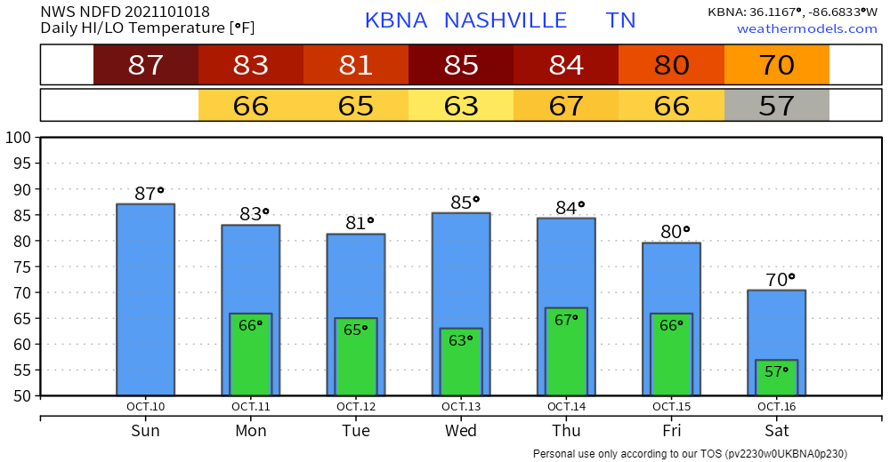
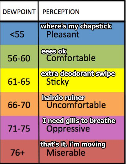
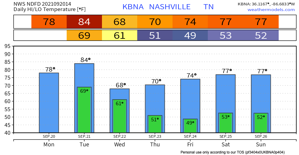
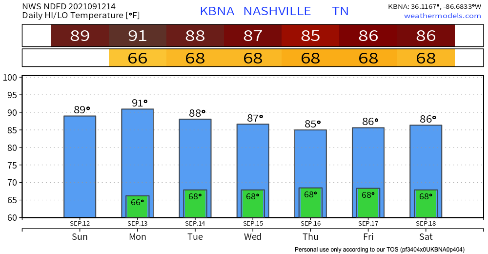
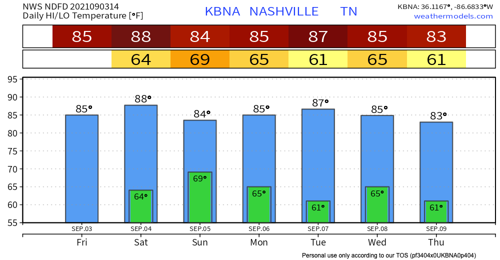
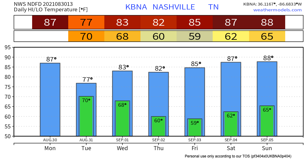
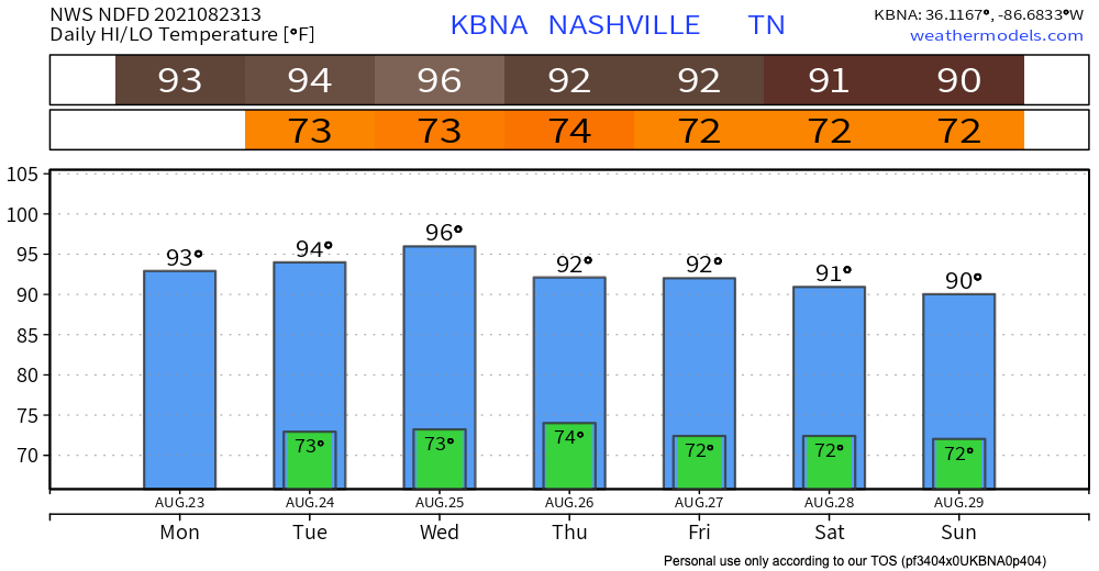
I hate to be the bearer of bad news, but it still isn’t sweater weather yet. Temps today in the mid to high 80s, and dewpoints hanging on at the high 60s. A bit sticky but definitely could be worse. Temps today are falling right below the record high for today.
Author: Emily Merz
Mild-ish Day Today, Possible Afternoon Showers
Temps and humidity are sticking to the trend today – temps in the high 70s and dewpoints in the high 60s (so sticky, but not unbearable).

The NWS said that some afternoon pop ups are possible, but HRRR shows most of the fun weather happening to our east. In their words, “Don’t think it’ll be widespread, but we’ll probably see some pavement wetters prior to sunset this evening.”
Comfy But Warmer, Slightly Sticky
Flash Flooding Possible Today
Another Warm Day, Pop-ups Possible but Not Likely
Temps Rise, but Still a Beautiful Sunday
Dry and Pleasant Today, Rain Chance Sunday
Today, there is no rain in sight. Temperatures will be in the low 80’s, and dewpoints in the 60’s. It’ll be a great day for outdoor activities.

Next Rain Chance
Eyes are on Sunday as the next day for rain. A low pressure trough will start pushing south, and with it comes some rain chances. The HRRR, as of now, thinks this will enter our area early in the morning Sunday, but this timing is uncertain. Other models think it’ll be later.
Remnants of Ida Approach Today
Let’s jump right in. Ida made landfall yesterday as a category 4 hurricane. It has since weakened down to a tropical storm, and is expected to be a tropical depression when it comes through our area, far weaker than what we’ve seen in Louisiana. Our impacts will be somewhat dependent on the exact track Ida takes as it turns our direction. We’ll be publishing a special blog this afternoon/evening with all of the details that become evident throughout the day.
The Heat Is Back; No Rain For a Few Days
Today, a high pressure system overhead keeps us rain-free.

It will definitely feel like summer today, with mid 90s temps and dewpoints in the 70s. Here’s what the heat index looks like on the NWS Blend of Models. Pro tip: on the model, red means hot, white means really hot. Heat indices look to get right up near 100°.