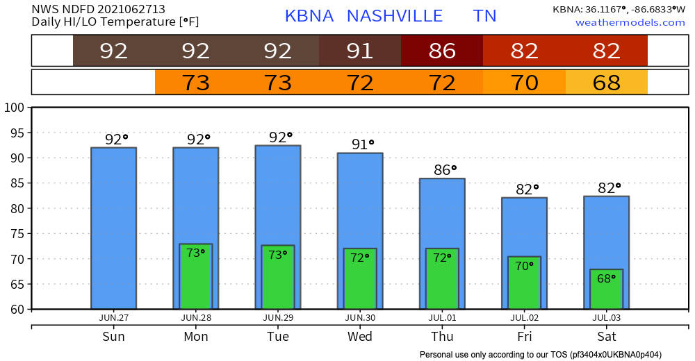
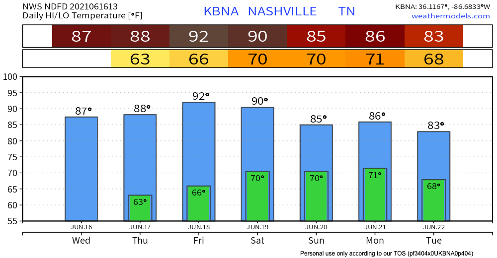
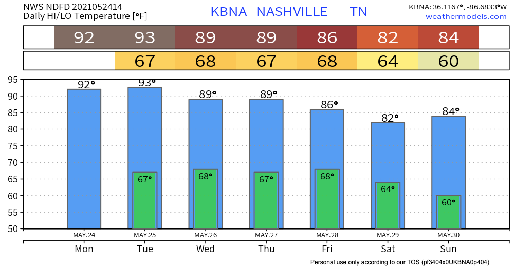
Dewpoints approaching 70° this week. A cold front (ETA Saturday-ish) will rescue us. Until then, sorry hair.
Isolated afternoon showers may be somewhere in Middle Tennessee today. It’s unlikely one will isolate on you.

I am a junior broadcast meteorology major with a communications minor at Mississippi State University.
Dewpoints approaching 70° this week. A cold front (ETA Saturday-ish) will rescue us. Until then, sorry hair.
Isolated afternoon showers may be somewhere in Middle Tennessee today. It’s unlikely one will isolate on you.
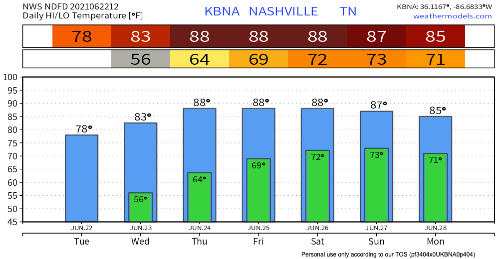
Today will be the same as yesterday – slightly higher but not sweltering temps, low dewps, light wind. You can thank the low pressure trough spinning in east winds.

Unfortunately, the trough will head east Thursday and our winds will turn south. That means temps and dewps will rise.
The rain and storms have made their way to our East, and what’s left is some mild temperatures and low dewpoints.

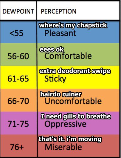
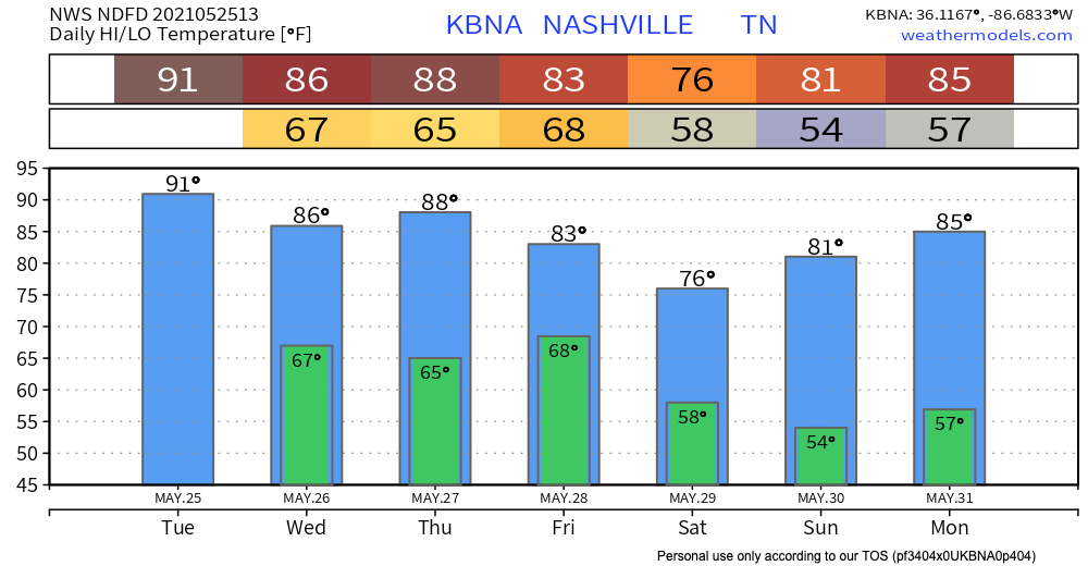
Two days. The surface high that’s providing these awesome temps will be here through Wednesday, but then a low pressure system moves in to raise humidity into extra deodorant swipe/hair probs levels.
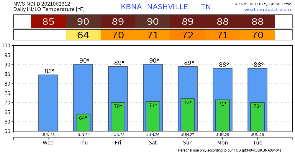
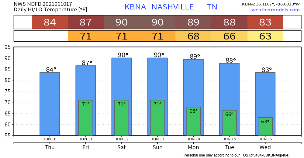
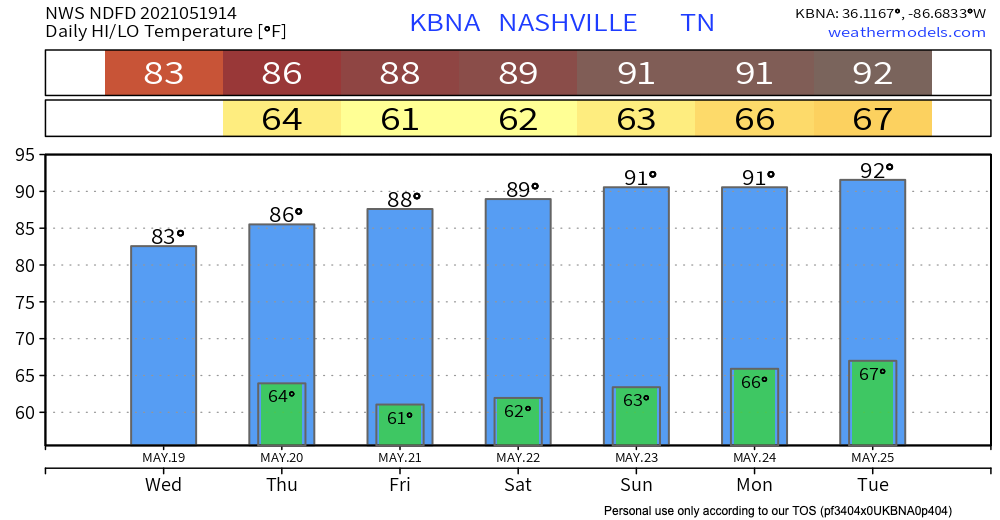
The cold front that passed through yesterday has left us some dry and cool air, which continues until the weekend.

Friday, the cold front that brought us this cool and dry weather will have moved well off the east coast. Two things will happen after this. 1, we will warm up significantly (dewpoints and temperatures). 2, we’ll be watching the Gulf Coast to see when/if a tropical system will make landfall.

The low pressure trough is finally leaving our area, and starting to take the rain with it. Key word “starting.”
The HRRR shows scattered storms mostly in the afternoon and evening, but they look significantly more scattered than in previous days. This means there should be some gaps in the rain, if you wanted to run some errands or go for an actual run. You’re probably sick of hearing this by now, but precise timing of when it will and will not be raining is hard to say.
Low pressure will hang around two more days, causing a “will it or won’t it” downpour risk. Today should look like the past few days – scattered showers and storms — some dry, others getting a show. NWS doesn’t expect anything too intense out of these storms, other than some heavy rain and wind, maybe lightning.
Small chance of some isolated showers today as we heat up. The HRRR shows some little rainy spots around the area. Bet against rain, plan on sweating instead.
Downpours, likely containing lightning, show up on the HRRR model around lunchtime Wednesday continuing through early afternoon.
Today is going to be, if the title didn’t give it away, hot. And also dry.
We’re currently under an advisory until midnight for the ozone levels at the surface. High concentrations of ozone can be unhealthy. The code orange means that although the general public probably won’t be affected, people with respiratory diseases like asthma, or people who spend a lot of time outdoors, such as marathon runners or construction workers, should try to limit their outdoor physical activity, especially during the middle of the day when the sun is the strongest.
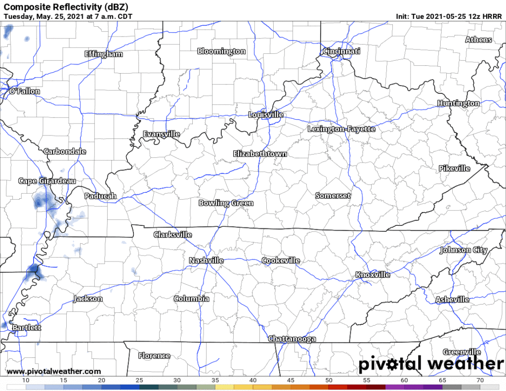
Summer is definitely on its way this week, but today will be a mostly cloudy day. The HRRR through midnight tonight shows a mostly dry day, but a light shower could pop up this morning. Nothing concerning, but maybe keep a small umbrella in your car if you’re wearing a nice outfit.
You must be logged in to post a comment.