The snow target time is Friday morning.
The below NWS Nashville graf has good information for Middle Tennessee:
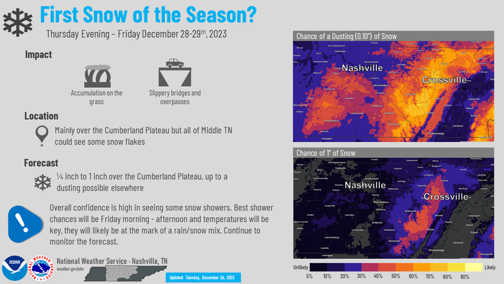
Takeaways for us in Davidson and Williamson Counties:

The snow target time is Friday morning.
The below NWS Nashville graf has good information for Middle Tennessee:
Takeaways for us in Davidson and Williamson Counties:

Morning rain will end during lunch. A few hit/miss showers may drive by your place this afternoon, otherwise cloudy with a few breaks of sunshine for some. HRRR model through 7 PM today below:
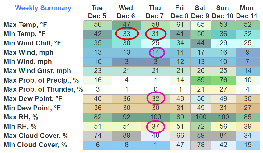
Colder air later this week, wind chills near freezing Weds morning with colder mornings after that.
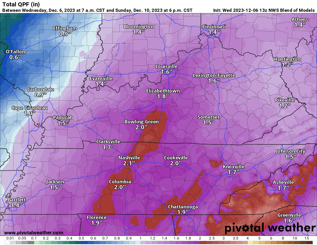
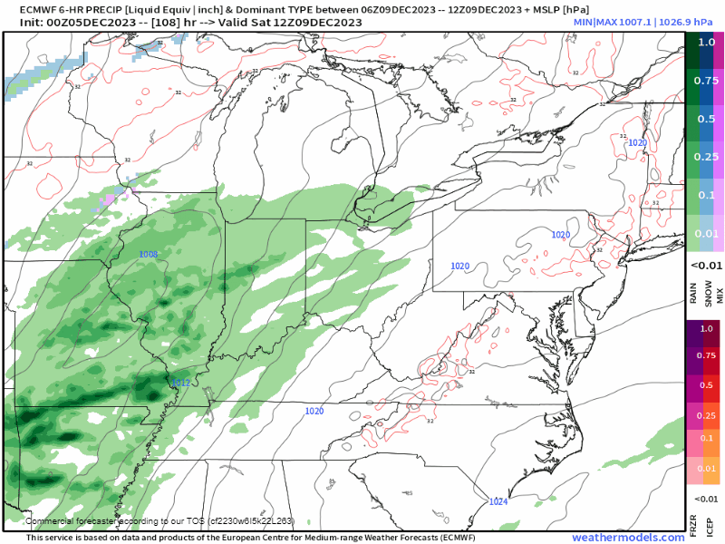
National Blend of Models predicts 2″ of rain this weekend.

BEST GUESS TIMING. Most likely start time between 6 PM to midnight Saturday night. Ending around lunch Sunday. It’s possible rain could arrive as early as noon Saturday and end earlier Sunday morning -or- start later Saturday night and linger into Sunday afternoon.

Rain showers later today/tonight.
Near/Freezing Morning Temps & Thursday’s Marginal Fire Danger
Big Rainmaker Coming This Weekend
Quick References:
Weather changes constantly.
Follow @NashSevereWx on Twitter for any changes to this forecast.

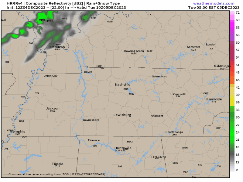
A Great Lakes snowstorm may spin a little rain into Middle Tennessee Tuesday – no biggie here – HRRR model below:
Mild days, cold mid week mornings – near freezing – ahead:
A big system will plow through this weekend. Here it is:
Skies clearing today. Looks pretty good.
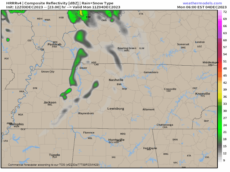
2. Tuesday morning. Cold brief rain if the HRRR is right (model cuts off before arrival):


3. Weekend rain. Timing and “accuracy” iffy at this range. A soaker is best bet. Not sure if Saturday or Sunday or both. May involve thunderstorms but no current severe concerns. Notice those pinks and blues as the system moves away – common false flag for wintry precip. More about this system tomorrow.

Plan for off and on light showers this afternoon into tonight.
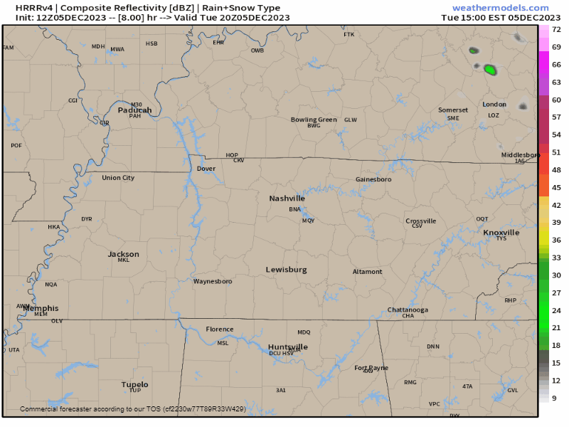
Reasoning. This was the radar as of 2:02 PM:
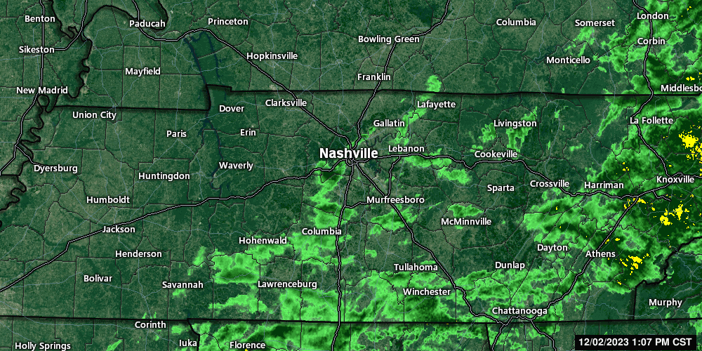
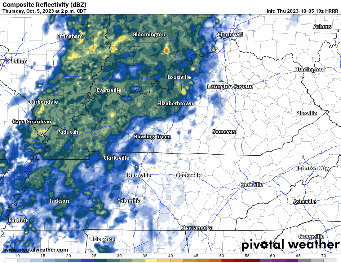
Rain between Savannah – Hohenwald – Lawrenceburg will get to us later today and tonight according to the HRRR model:
The Intern is on Finals Haitus until 12/8 – so like Fortnite, you get the OG for a while –

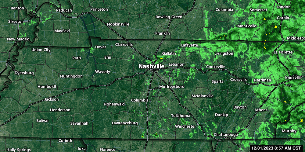
Most of the morning rain is gone — below is the radar before 10 AM this morning – we may squeeze out a few more showers this afternoon which would be NBD:

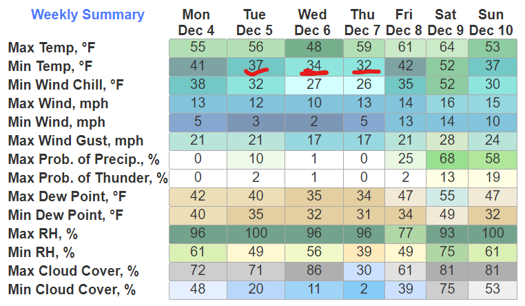
Subfreezing mornings Tue & Weds – hard freeze both mornings – many of us will be colder than that – coldest temps around sunrise – redboxed below are the 24° and 26° lows – then a warmup rest of the week.
I’m writing because the fearless intern bugged out claiming it’s a “test day/travel day for me” but I hacked his Life 360 and apparently he’s been at some lampshade and garden gnome emporium since 11 AM so yeah, we’ll have to take that up with him offline.
You must be logged in to post a comment.