

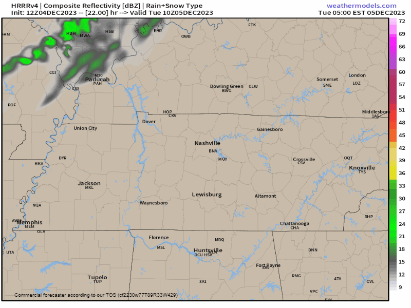
A Great Lakes snowstorm may spin a little rain into Middle Tennessee Tuesday – no biggie here – HRRR model below:
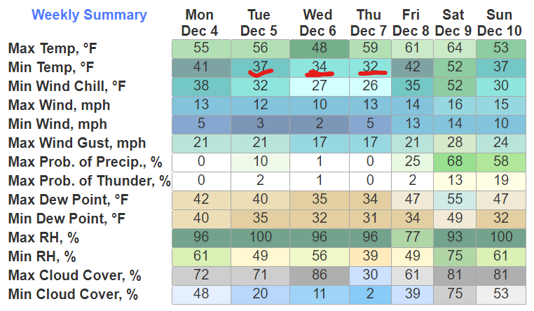
Mild days, cold mid week mornings – near freezing – ahead:
A big system will plow through this weekend. Here it is:
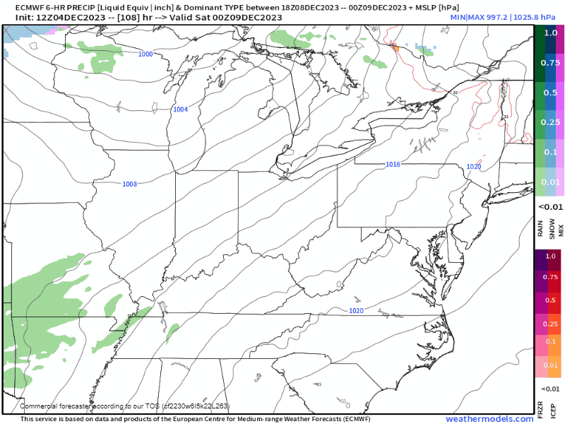
- Severe threat Saturday will be in the Tex-Ark-La-Miss area.
- Rain is likely here late Saturday through Sunday, with a conditional severe threat. Meaning, a few conditions will have to be met to develop severe thunderstorms for us late Saturday into Sunday. Timing may change. Data not super reliable.
- “Although [storm-powering] instability is forecast to be relatively weak on Sunday due to a cooler and drier airmass over parts of the Southeast, isolated severe storms could occur if a line of strong storms can become organized.” Storm Prediction Center (SPC), 12/4/23.
- “Predictability too low” for severe weather for Sunday, says SPC.
- Rain is likely. WPC rainfall estimates for the weekend range from 1″ to 1.5″, with pockets of 2″ around Middle Tennessee.
- Euro model above shows blues and pinks indicating frozen precip after the cold front passes. This is a common false flag for accumulating snow:
- Models struggle with precip type at this range.
- Usually it’s just rain – as the subfreezing air approaches, dry air overcomes the back edge of the departing system, eliminating the precip – or – the precip pulls away before subfreezing air can catch up. Early December Ohio Valley lows rarely if ever cause us wintry precip problems.
- The ground will be too warm to hold falling snow or ice.
- Nothing to see, so far, in the data.
Quick References:
Weather changes constantly.
Follow @NashSevereWx on Twitter for any changes to this forecast.
Live coverage during tornado and severe thunderstorm warnings:

Look good.
Support the mission.

We are 100% community supported. No ads. No subscription fees. Keep it free for everyone.


Categories: Forecast Blogs (Legacy)
You must be logged in to post a comment.