South winds gusting to 40 MPH thru Weds AM. High today 77°, record for 2/27 is 80° set last year.
Weak storm line ETA 6-7 AM Weds. Severe unlikely.
Temps crash cold after that line. Dress for winter Weds.

South winds gusting to 40 MPH thru Weds AM. High today 77°, record for 2/27 is 80° set last year.
Weak storm line ETA 6-7 AM Weds. Severe unlikely.
Temps crash cold after that line. Dress for winter Weds.
Few thunderstorms not a concern this early morning / 438 AM
New Wind Advisory. South winds around 20 mph with gusts up to 40 mph expected. Advisory begins noon Tuesday and ends 6 AM CST Wednesday.
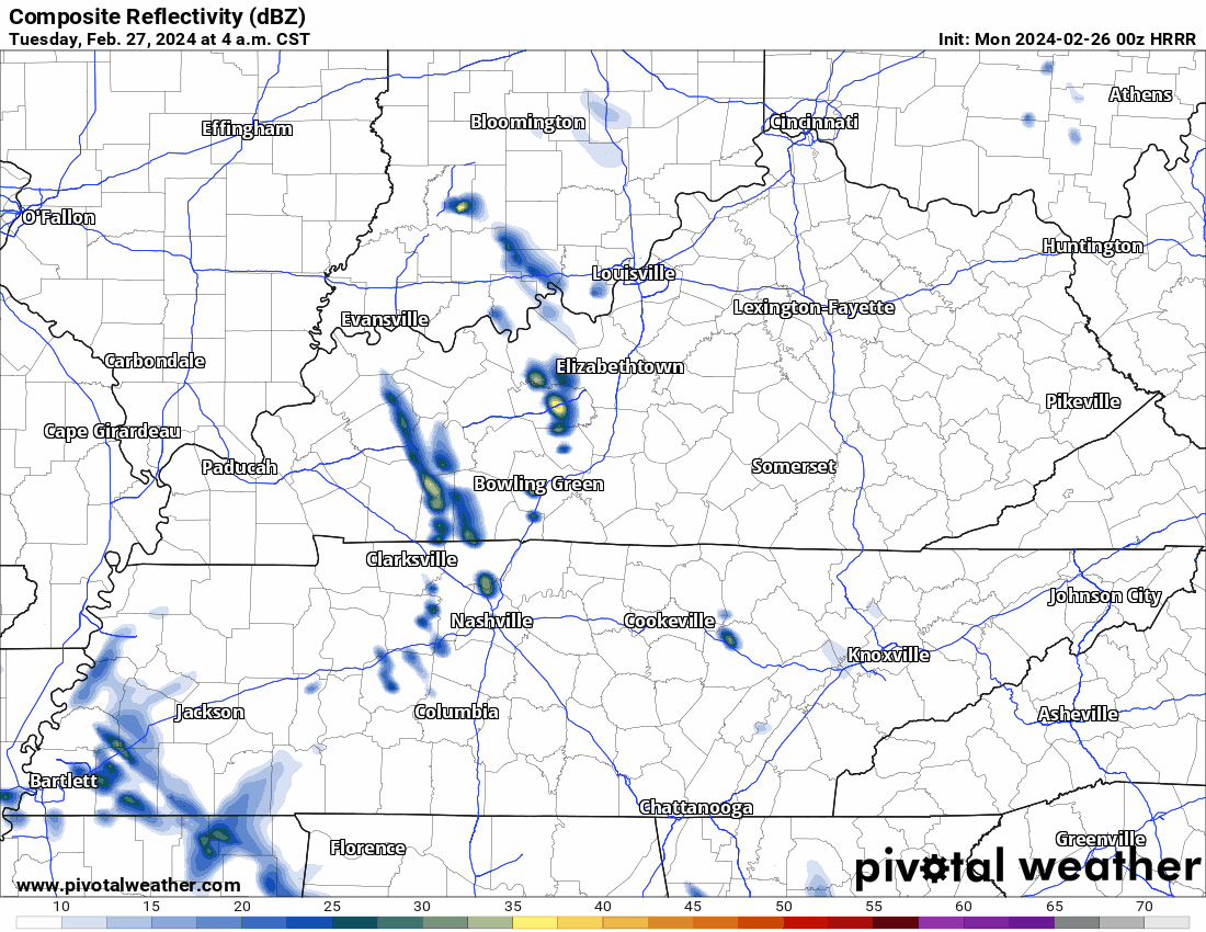
Rainouts now possible for unluckly local fields Tuesday. New (0z) HRRR model delivers narrow area of rainout-level rains (never rely on one model run). This morning didn’t think we’d see rainouts. Now, we might.
We good fam ⚽️ . Looks not great for NYRB tho.


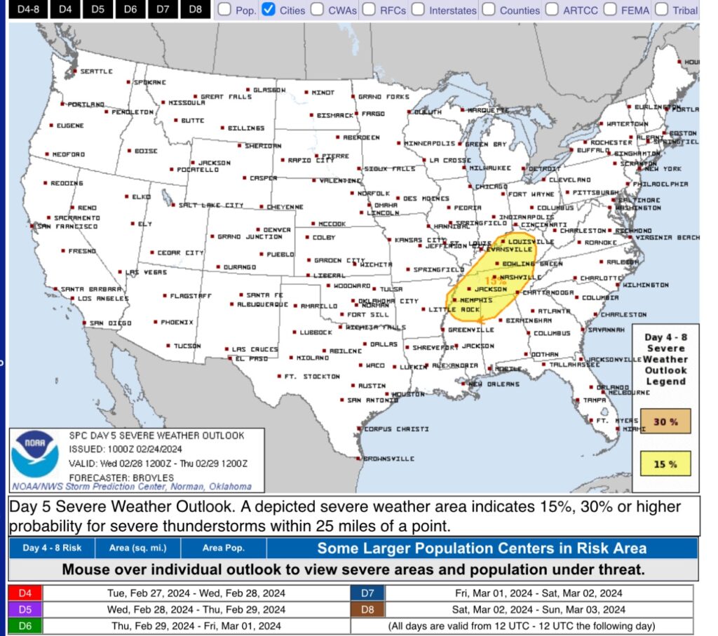
Removed: the 15% probability of severe weather for Wednesday. Rain Tues and thunderstorms Weds, but severe weather now appears less likely.
What changed: recent model runs show a dry airmass Monday thru Weds. When Weds’ troublemaking cold front arrives, storm-fueling moisture and instability will be low. Bad storms need moisture and instability. Without them, meh.

We remain outlooked for severe thunderstorm potential Wednesday. Expect an update after SWAD (ongoing now at Trevecca).
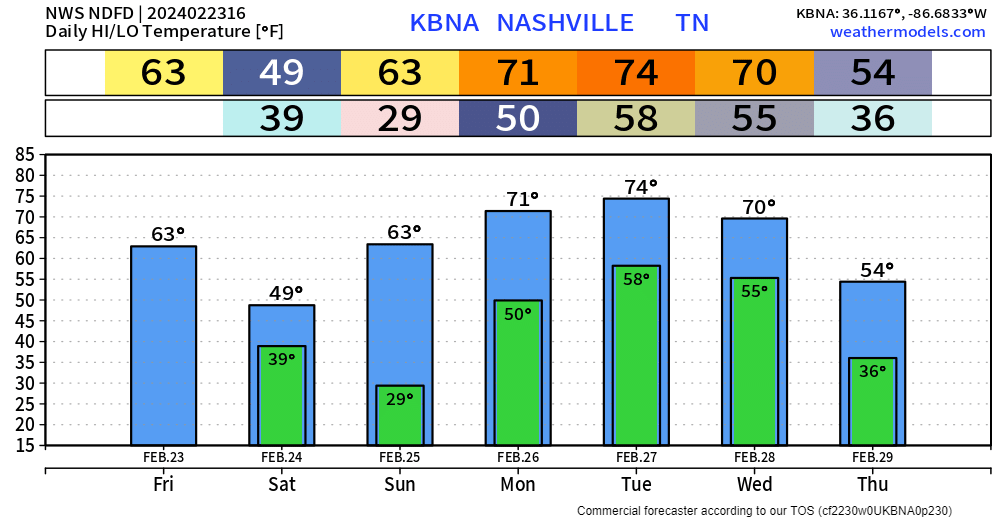
Temps 👇🏽. Want to get right in to severe potential Weds 2/28/24.
SPC outlooked Wednesday, Feb 28, 2024, for severe weather potential.
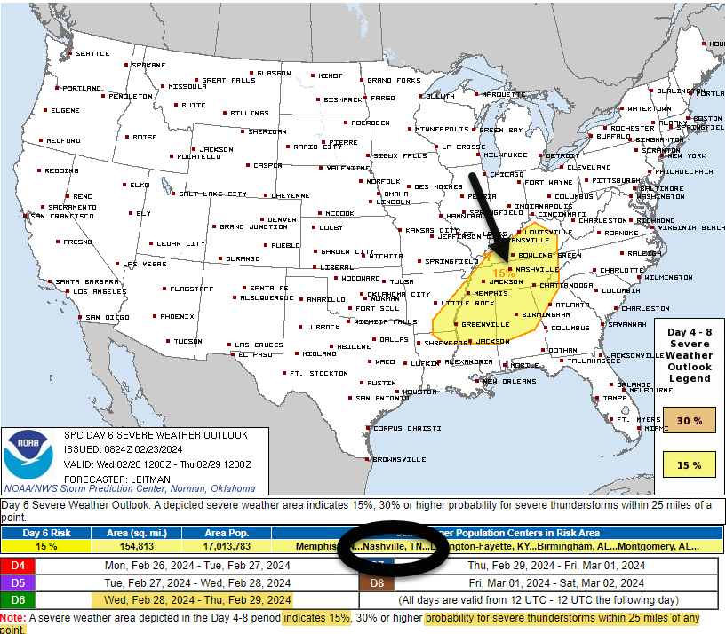
This outlook means 15% probability of a severe thunderstorm (defined: hail, and/or damaging straight line winds, and/or tornado) within 25 miles of you.

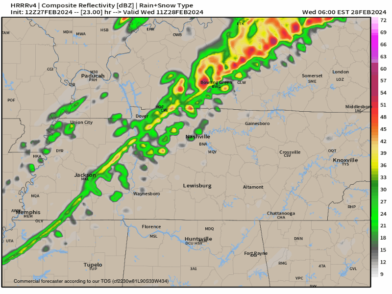
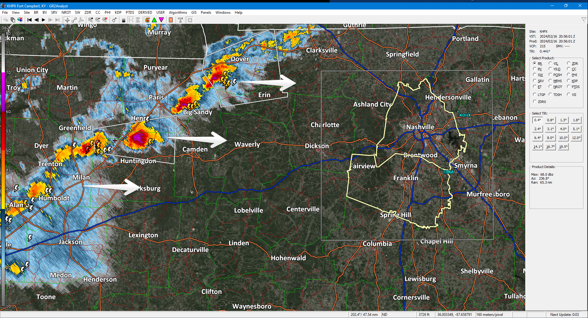
Approaching storm line healthy. Producing frequent lightning. Even rotating at mid levels. Expect here heavy rain, lightning, gusty winds, maybe small hail 5-6 PM, give or take an hour or so.
Brace yourself for a drastic temp change. 60°s this afternoon. 30°s before midnight with subfreezing wind chills lasting until late Sunday AM.
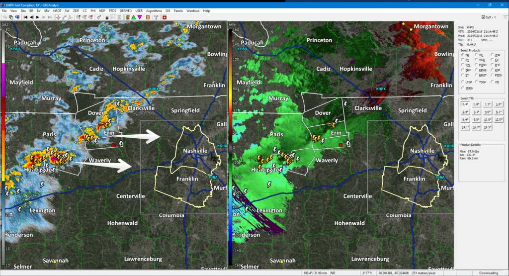
At 3 PM a strong thunderstorm line formed in West TN moving our way. Lightning, small hail, gusty winds, brief heavy downpours. 5-6 PM ETA per HRRR model. Very cold air behind it, bundle up if going out.
You must be logged in to post a comment.