
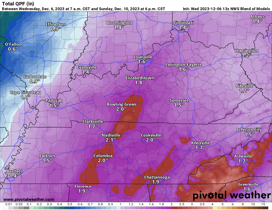
National Blend of Models predicts 2″ of rain this weekend.

BEST GUESS TIMING. Most likely start time between 6 PM to midnight Saturday night. Ending around lunch Sunday. It’s possible rain could arrive as early as noon Saturday and end earlier Sunday morning -or- start later Saturday night and linger into Sunday afternoon.
FLOODING? Unlikely. Some ponding and usual heavy rain stuff Saturday night – overnight – Sunday morning. 2″ is unlikely to cause significant problems except maybe briefly in your normal low/floody spots.
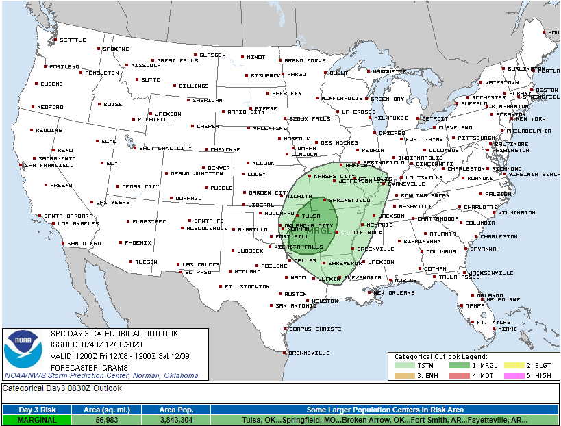
STORMS? Probably not. SPC has the severe risk to our west on Friday …
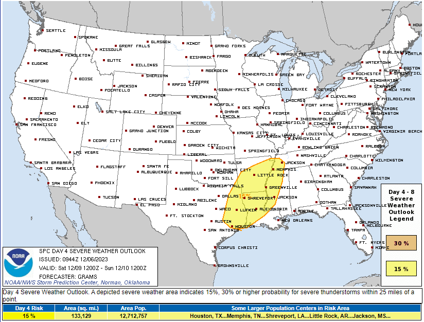
… with a higher severe probability to our west and southwest Saturday …
… but locally the predictability is too low. This looks like a line of heavy rain and strong straight line winds. Data is too confused/jumbled to draw conclusions.
Some severe weather ingredients will be in place, but other essential ingredients appear to be missing. Example: max dewpoint is 49, too low for severe! Good news! But we’ll have to update this forecast again tomorrow hoping this trend against local severe weather continues. It may not.
SNOW: You may hear local mets discuss snow – they cover the plateau, too, so they have to mention it – there’s no compelling evidence for this system to bring us snow as the system departs Sunday.
Quick References:
Weather changes constantly.
Follow @NashSevereWx on Twitter for any changes to this forecast.
Live coverage during tornado and severe thunderstorm warnings:

Look good.
Support the mission.

We are 100% community supported. No ads. No subscription fees. Keep it free for everyone.


Categories: Forecast Blogs (Legacy)
You must be logged in to post a comment.